oldham OL15 Postcodes
Spending a fortune on conveyancing?

Compare instant, low-cost online quotes from trusted conveyancing solicitors.
Backed by experts, our no-obligation service searches through the best conveyancing quotes on the market to save you time and money.
Oldham (OL15)
The OL15 postcode area is located in the Oldham postcode town region, within the county of Greater Manchester, and contains a total of 615 individual postcodes.
There are 13 electoral wards in the OL15 postcode area, including Ashton-Under-Lyne, Bacup, Heywood, Littleborough, Oldham, Rochdale, Todmorden which come under the local authority of the Rochdale Council.
Combining the whole postcode region, 18% of people in OL15 are classed as having an AB social grade, (i.e. 'white-collar' middle-upper class), compared to 27% across the UK.
This does not mean that the people of OL15 are poorer than other areas, but it may give an indication that there are areas of deprivation.
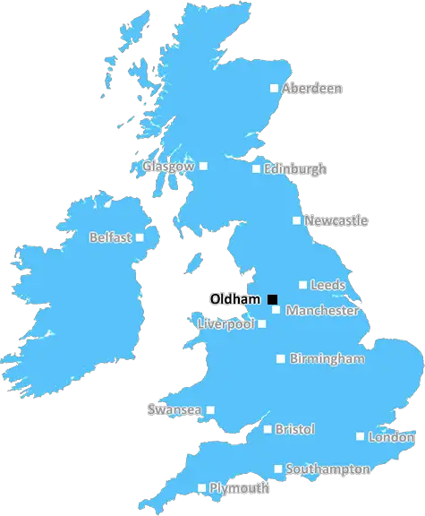
The OL15 postcode is in the Oldham district of Greater Manchester, in the North West of England. It is part of the Oldham post town and covers several areas of the town including Moorside and Greenacres. It is bounded by the OL13 postcode to the east, the OL16 postcode to the south, and the OL9 postcode to the west.
The population of the OL15 postcode area is around 13,150 and the area is home to a large number of industry and manufacturing businesses. The majority of these businesses are located in the parts of Oldham enclosed by OL15, such as Moorside, and many are family owned.
The area is served well by public transport, with Cedar Park Metrolink station providing quick and easy access into Manchester city centre. The Oldham loop of the M60 is also close by, providing quick access into Manchester, Stockport and further afield.
Though historically a centre for industry, there has been more recent investment into the OL15 area, resulting in new housing developments, business parks and leisure facilities, making it an attractive residential area for those commuting into Manchester. The area is also well linked with nearby towns and cities due to the presence of the M60 and its good public transport links.
The area is home to numerous places of worship, including St Paul's Church and the Guru Har Rai Gurdwara, as well as a number of schools, including Broughton CE Primary School, Carr Hill Primary School and Oldham Hulme Grammar School.
The area is surrounded by picturesque countryside and there is a range of leisure amenities and outdoor activities to be enjoyed in the area, with a wealth of green space, parks and cycle routes around the OL15 postcode. There are also a number of shops, pubs and restaurants scattered around the area to enjoy.

Demographics
Greater Manchester

OL15 is located in the county of Greater Manchester, in England.
Greater Manchester has a total population of 2,782,100, making it the 3rd largest county in the UK.
Greater Manchester has a total area of 492 square miles, and a population density of 2180 people per square kilometre. For comparison, Greater London has a density of 5,618 people/km2.
| Outward Code | OL15 |
| Postal Town | Oldham |
| MSOA Name | Rochdale 014 |
| LSOA Name | Rochdale 014A |
| County | Greater Manchester |
| Region | Greater Manchester |
| Country | England |
| Local Authority | Rochdale |
| Area Classification | Urban with Major Conurbation |
OL15 Electoral Wards
The postal region of OL15, includes the local towns, villages, electoral wards and stations of:
Dig even deeper into the OL15 postcode by clicking on a postcode below:
Click on an outward postal code below for more information about the area. Each 'outward' postcode give you a comprehensive list of all postcodes within the outward code area (OL) and estimated address.
Click on an 'outward' code for more information. For example, the outward postcode page 'EC2M' will give you an alphabetical list covering all postcodes located in the region, from 'EC2M 1BB' through to 'EC2M 7YA'.
Chris H
Wednesday, April 10, 2024
We don't have any views of OL15 right now. If you live in OL15 or have visited it, please help us to help others by telling others what you think of this neighbourhood.
Add your view of OL15
People need your local expertise. If you live in OL15 or have first-hand knowledge of the neighbourhood, please consider sharing your views. It's completely anonymous - all we ask is for your initials.
Please tell us what you like about the OL15 postcode area, what you don't like, and what it's like to live or work here.
| LOCAL AMENITIES | |
| FAMILY FRIENDLY | |
| PARKING | |
| GREEN SPACES |
Local News Lancashire
When are the May local elections, and who can vote?
Voters in parts of England and Wales will elect councillors, mayors and police commissioners in May.
BBC NewsAttempted murder arrest over street fight - police
Police say an e-bike rider in his 20s was deliberately knocked down after an "altercation".
BBC NewsPreston win to raise Huddersfield drop fears
Preston North End dent Huddersfield Town's Championship survival hopes with a victory that keeps them in the hunt for the play-offs.
BBC NewsPharmacy robots speed up prescription picking
The robots are "like giant vending machines" that find medicines faster than humans, a Trust says.
BBC NewsPool where deadly bacteria found to be demolished
The leisure complex is set to be knocked down, despite pleas from the community.
BBC NewsMorecambe 0-1 Crewe Alexandra
Crewe's League Two play-off hopes are given a boost as they beat Morecambe.
BBC NewsCouncil-run children's homes could double
There are concerns children in care in Lancashire are being placed far away from their communities.
BBC NewsUniversity cuts 165 jobs amid financial concerns
The Preston-based university is "facing unprecedented financial challenges", its vice-chancellor says.
BBC NewsFrom the Postcode Area blog

Deciphering Crime Rates - a Deep Dive Into UK Postcode Analysis
Ever wondered about the crime rate in your UK postcode? You're not alone. We've dug deep into the data, uncovering trends and patterns that'll make your head spin.

Death of the High Street?
The BBC reports that despite councils' attempts to kurb them, the UK's high streets have seen a huge growth in fast food outlets. Could this mark the death knell for the Great British high street, and what can we do about it to halt its decline?

Discrimination by Postcode
You really couldn't make it up, could you? Some of the country's most vulnerable people are missing out on their weekly £25 Cold Weather Payment, just because the system that's in operation is discriminating against them because payments are based on postcode, rather than geographic location.

The Redesign is Underway
Well, the current website was absolutely in dire need of a good redesign - from the ground up. So I set out to pull it all apart and get it up and running again to become the most comprehensive guide to every postcode in the UK. And it's been a long, tough job from start to finish - and quite possibly the biggest project I've ever undertaken.
SOCIAL GRADES
According to census records, 18% of people here have a social grade of AB (highest), compared to the national average of 27%.