oldham OL13 Postcodes
Spending a fortune on conveyancing?

Compare instant, low-cost online quotes from trusted conveyancing solicitors.
Backed by experts, our no-obligation service searches through the best conveyancing quotes on the market to save you time and money.
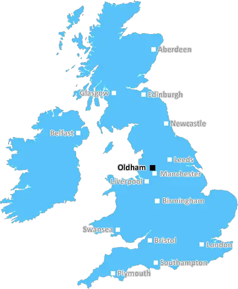
Oldham (OL13)
The OL13 postcode area is located in the Oldham postcode town region, within the county of Lancashire, and contains a total of 821 individual postcodes.
There are 17 electoral wards in the OL13 postcode area, including Ashton-Under-Lyne, Bacup, Heywood, Littleborough, Oldham, Rochdale, Todmorden which come under the local authority of the Rossendale Council.
Combining the whole postcode region, 15% of people in OL13 are classed as having an AB social grade, (i.e. 'white-collar' middle-upper class), compared to 27% across the UK.
This does not mean that the people of OL13 are poorer than other areas, but it may give an indication that there are areas of deprivation.
The OL13 postcode is located in the Oldham district of Greater Manchester, UK. The suburb of Springhead is within the postcode district, which also includes the townships of Delph and Denshaw, as well as parts of Diggle. The M60 motorway is in close proximity to the postcode, providing good transport links.
The area is known for its pleasant countryside and idyllic views of the Pennines. As such, it is attractive to many people who enjoy outdoor activities such as walking and cycling. The area also boasts some of the best and most challenging running tracks in the North West. The well-known Denshaw Moor running loop is located in this postcode district.
The area is well served by local amenities such as shops, cafes and pubs. There are a number of small business parks, industrial estates and commercial centres located here, providing employment opportunities. Education is provided by a variety of primary and secondary schools in the local area. There is also a college which caters to the needs of the local population.
The postcode is just over 55 miles from Manchester city centre and 20 miles from Rochdale. The area is also just twenty minutes' drive from the iconic Saddleworth villages, home to some of Oldham's best-known landmarks, such as the White Hart Inn.
The postcode district is home to some lovely countryside walks, including a route along the Rochdale fringe. With its charming fountains and public squares, there is plenty to explore. The area is also served by a regular bus service, which connects it to most of the surrounding towns and villages. It is also home to the UK's first Green Flag Park, which provides excellent parkland for outdoor leisure activities.
The OL13 postcode is a pleasant and picturesque area, which is home to a diverse range of people and offers plenty of things to do. This postcode district is an ideal place to live and work for those who appreciate the beautiful countryside and the many amenities that the area has to offer.

Demographics
Lancashire

OL13 is located in the county of Lancashire, in England.
Lancashire has a total population of 1,485,000, making it the 8th largest county in the UK.
Lancashire has a total area of 1187 square miles, and a population density of 482 people per square kilometre. For comparison, Greater London has a density of 5,618 people/km2.
| Outward Code | OL13 |
| Postal Town | Oldham |
| MSOA Name | Rossendale 003 |
| LSOA Name | Rossendale 003C |
| County | Lancashire |
| Region | Lancashire |
| Country | England |
| Local Authority | Rossendale |
| Area Classification | Urban with City and Town |
OL13 Electoral Wards
The postal region of OL13, includes the local towns, villages, electoral wards and stations of:
Dig even deeper into the OL13 postcode by clicking on a postcode below:
Click on an outward postal code below for more information about the area. Each 'outward' postcode give you a comprehensive list of all postcodes within the outward code area (OL) and estimated address.
Click on an 'outward' code for more information. For example, the outward postcode page 'EC2M' will give you an alphabetical list covering all postcodes located in the region, from 'EC2M 1BB' through to 'EC2M 7YA'.
Chris H
Monday, April 8, 2024
We don't have any views of OL13 right now. If you live in OL13 or have visited it, please help us to help others by telling others what you think of this neighbourhood.
Add your view of OL13
People need your local expertise. If you live in OL13 or have first-hand knowledge of the neighbourhood, please consider sharing your views. It's completely anonymous - all we ask is for your initials.
Please tell us what you like about the OL13 postcode area, what you don't like, and what it's like to live or work here.
| LOCAL AMENITIES | |
| FAMILY FRIENDLY | |
| PARKING | |
| GREEN SPACES |
Local News Lancashire
Council-run children's homes could double
There are concerns children in care in Lancashire are being placed far away from their communities.
BBC NewsBoy held after police officer struck by stolen car
A stolen mobility car was "deliberately driven" at an officer as he approached it, police say.
BBC NewsSurrey only face 21 balls on rain-affected day
Openers Rory Burns and Dom Sibley are only able to add four runs as rain ruins Surrey's reply to Lancashire's 202.
BBC NewsManhunt after mum pushing baby in pram stabbed
Habibur Masum, who has links to Burnley, is wanted by police after a woman was stabbed in Bradford.
BBC NewsMan 'put through hell' after losing home to DWP
George Henderson said he made an "honest mistake" in claiming too much Carer's Allowance.
BBC NewsG4 superfan changes her name in honour of singers
Christine Christie Ansell Duncan Jai Martin changed her name in tribute to the X Factor finalists.
BBC NewsMan arrested after mosque break-in
A man ran away after he was challenged by some men already inside the building, police say.
BBC NewsGhostbusters superfan lands role in latest film
Simon Gray has been collecting toys and merchandise for 30 years.
BBC NewsFrom the Postcode Area blog

Deciphering Crime Rates - a Deep Dive Into UK Postcode Analysis
Ever wondered about the crime rate in your UK postcode? You're not alone. We've dug deep into the data, uncovering trends and patterns that'll make your head spin.

Death of the High Street?
The BBC reports that despite councils' attempts to kurb them, the UK's high streets have seen a huge growth in fast food outlets. Could this mark the death knell for the Great British high street, and what can we do about it to halt its decline?

Discrimination by Postcode
You really couldn't make it up, could you? Some of the country's most vulnerable people are missing out on their weekly £25 Cold Weather Payment, just because the system that's in operation is discriminating against them because payments are based on postcode, rather than geographic location.

The Redesign is Underway
Well, the current website was absolutely in dire need of a good redesign - from the ground up. So I set out to pull it all apart and get it up and running again to become the most comprehensive guide to every postcode in the UK. And it's been a long, tough job from start to finish - and quite possibly the biggest project I've ever undertaken.
SOCIAL GRADES
According to census records, 15% of people here have a social grade of AB (highest), compared to the national average of 27%.