norwich NR3 Postcodes
Spending a fortune on conveyancing?

Compare instant, low-cost online quotes from trusted conveyancing solicitors.
Backed by experts, our no-obligation service searches through the best conveyancing quotes on the market to save you time and money.
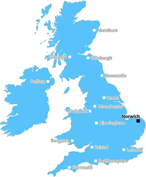
Norwich (NR3)
The NR3 postcode area is located in the Norwich postcode town region, within the county of Norfolk, and contains a total of 1104 individual postcodes.
There are 4 electoral wards in the NR3 postcode area, including Attleborough, Beccles, Bungay, Cromer, Dereham, Fakenham, Great Yarmouth, Holt, Lowestoft, Melton Constable, North Walsham, Norwich, Sheringham, Walsingham, Wells-Next-The-Sea, Wymondham which come under the local authority of the Norwich Council.
Combining the whole postcode region, 15% of people in NR3 are classed as having an AB social grade, (i.e. 'white-collar' middle-upper class), compared to 27% across the UK.
This does not mean that the people of NR3 are poorer than other areas, but it may give an indication that there are areas of deprivation.
The NR3 postcode is used to cover the North-East of Norwich, mostly the areas surrounding the River Wensum and in the vicinity of the University of East Anglia (UEA). This part of Norwich includes the city centre and most of the nearby suburbs including Eaton, South Earlham, Bowthorpe, Old Catton and Mile Cross.
NR3 areas such as Silver Road, Earlham Road, Dereham Road and Newmarket Road are relatively densely populated, with a combination of a mixture of housing types from university halls of residence, to traditional terraced houses, to modern flats. As with the rest of Norwich, NR3 benefits from a large, vibrant student population.
NR3 offers a variety of shops and independent businesses, stores, caf�s, bars and restaurants, giving the area a great selection of convenient amenities. There are also plenty of parks and outdoor spaces including the popular Earlham Park, providing a tranquil contrast to the city centre.
The city centre of Norwich, despite being only around two miles away from NR3, is easily accessible from the area. Frequent buses depart from NR3, including the X1/A express which provides a direct and fast connection to the city centre, taking around 10 minutes. In addition, the area is served by two railway stations - Norwich and Wensum Park - providing easy access to other parts of the city and the East of England.
Living in NR3 comes with its fair share of advantages. The area is served by Norwich City Football Club's Carrow Road, providing convenient access to the popular football games and various other sporting and cultural events. In addition, the train station at Norwich connects the city with other destinations in the United Kingdom, making NR3 a good starting point for anyone looking to explore the UK.
Lastly, families looking to live in the area can take advantage of NR3's proximity to the University of East Anglia's schools. This means parents can take their children to the best universities in the country in the same locality.

Demographics
Norfolk

NR3 is located in the county of Norfolk, in England.
Norfolk has a total population of 892,900, making it the 25th largest county in the UK.
Norfolk has a total area of 2080 square miles, and a population density of 165 people per square kilometre. For comparison, Greater London has a density of 5,618 people/km2.
| Outward Code | NR3 |
| Postal Town | Norwich |
| MSOA Name | Norwich 007 |
| LSOA Name | Norwich 007B |
| County | Norfolk |
| Region | Norfolk |
| Country | England |
| Local Authority | Norwich |
| Area Classification | Urban with City and Town |
NR3 Electoral Wards
The postal region of NR3, includes the local towns, villages, electoral wards and stations of:
Dig even deeper into the NR3 postcode by clicking on a postcode below:
Click on an outward postal code below for more information about the area. Each 'outward' postcode give you a comprehensive list of all postcodes within the outward code area (NR) and estimated address.
Click on an 'outward' code for more information. For example, the outward postcode page 'EC2M' will give you an alphabetical list covering all postcodes located in the region, from 'EC2M 1BB' through to 'EC2M 7YA'.
Chris H
Sunday, April 7, 2024
We don't have any views of NR3 right now. If you live in NR3 or have visited it, please help us to help others by telling others what you think of this neighbourhood.
Add your view of NR3
People need your local expertise. If you live in NR3 or have first-hand knowledge of the neighbourhood, please consider sharing your views. It's completely anonymous - all we ask is for your initials.
Please tell us what you like about the NR3 postcode area, what you don't like, and what it's like to live or work here.
| LOCAL AMENITIES | |
| FAMILY FRIENDLY | |
| PARKING | |
| GREEN SPACES |
Local News Norfolk
Seven arrested after protest at pork factory
Police deal with an ongoing incident, which the company describes as "criminal".
BBC NewsFans urged to check train times before derby match
Ipswich fans going to Norwich could be affected by timetable changes due to strike action.
BBC NewsAccess to NHS dentists 'still a concern' in county
A patient group finds practices have waiting lists of up to 6,000 people.
BBC NewsTenth-generation circus act thrilled by crowds
"My friends think it's cool to travel around the country and perform," says 17-year-old Luke Austin.
BBC NewsIpswich legends beat rivals on the golf course
Former footballers swap their boots for golf clubs as they battle it out ahead of Saturday's clash.
BBC NewsCarers' support charity saved from closure
The charity, which had announced its impending closure, is saved by a partnership with an NHS trust.
BBC NewsPolice investigate death of man found on beach
While the man's death is unexplained, police do not believe it to be suspicious.
BBC NewsCouncil adapts plans for Grade I listed building
A councillor says the authority is in the process of changing the designs to reflect local desires.
BBC NewsFrom the Postcode Area blog

Deciphering Crime Rates - a Deep Dive Into UK Postcode Analysis
Ever wondered about the crime rate in your UK postcode? You're not alone. We've dug deep into the data, uncovering trends and patterns that'll make your head spin.

Death of the High Street?
The BBC reports that despite councils' attempts to kurb them, the UK's high streets have seen a huge growth in fast food outlets. Could this mark the death knell for the Great British high street, and what can we do about it to halt its decline?

Discrimination by Postcode
You really couldn't make it up, could you? Some of the country's most vulnerable people are missing out on their weekly £25 Cold Weather Payment, just because the system that's in operation is discriminating against them because payments are based on postcode, rather than geographic location.

The Redesign is Underway
Well, the current website was absolutely in dire need of a good redesign - from the ground up. So I set out to pull it all apart and get it up and running again to become the most comprehensive guide to every postcode in the UK. And it's been a long, tough job from start to finish - and quite possibly the biggest project I've ever undertaken.
SOCIAL GRADES
According to census records, 15% of people here have a social grade of AB (highest), compared to the national average of 27%.