norwich NR2 Postcodes
Spending a fortune on conveyancing?

Compare instant, low-cost online quotes from trusted conveyancing solicitors.
Backed by experts, our no-obligation service searches through the best conveyancing quotes on the market to save you time and money.
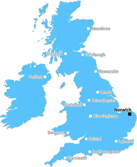
Norwich (NR2)
The NR2 postcode area is located in the Norwich postcode town region, within the county of Norfolk, and contains a total of 1058 individual postcodes.
There are 2 electoral wards in the NR2 postcode area, including Attleborough, Beccles, Bungay, Cromer, Dereham, Fakenham, Great Yarmouth, Holt, Lowestoft, Melton Constable, North Walsham, Norwich, Sheringham, Walsingham, Wells-Next-The-Sea, Wymondham which come under the local authority of the Norwich Council.
Combining the whole postcode region, 29% of people in NR2 are classed as having an AB social grade, (i.e. 'white-collar' middle-upper class), compared to 27% across the UK.
This does not mean that the people of NR2 are wealthier - or higher class - than average, but it can be an indication that the area may be prospering and desirable to live in.
The NR2 postcode refers to an area in Norwich, or the wider Norwich district in Norfolk, UK. It is an amalgamation of two former postal towns: Earlham and the Cathedral Close.
The area covers several contemporary neighbourhoods, including pockthorpe, the Golden Triangle, the Riverside & Eaton Centres, the Avenues and the Marriots. Within these neighbourhoods there are various local attractions, such as the University of East Anglia, Norwich Research Park, Norfolk and Norwich University Hospital, Intu Chapelfield, and the popular Riverside & Eaton Centres.
The NR2 area is the second most densely populated postcode in Norwich, with a population of approximately 20,200 people - mostly young professionals and students. Along with the University, many of the residents are employed in the FinTech industry, which has been rapidly growing in this district.
The NR2 postcode has a vibrant and diverse atmosphere, and is full of facilities and activities suitable for all demographics. There is a large green space within Calvert Park - perfect for long walks and outdoor picnics - and a variety of cafes, restaurants, shops, and entertainment venues.
Benedict Street and St Stephens Street are both full of indie and vintage shops, including the popular Ghost & Co. Further down St Stephens Street, shoppers can find an independent cinema, art galleries, and speciality stores. The NR2 postcode also holds several food markets, which attract visitors from all corners of the city.
In terms of transport, the NR2 postcode is conveniently located close to two train stations: Norwich Train Station and Norwich Bus Station. The bus station has frequent services to other neighbouring cities and towns, including Great Yarmouth, Cromer, and King's Lynn. Furthermore, the NR2 postcode is in close proximity to the Northern Distributor Road, providing further transport connections out of Norwich.

Demographics
Norfolk

NR2 is located in the county of Norfolk, in England.
Norfolk has a total population of 892,900, making it the 25th largest county in the UK.
Norfolk has a total area of 2080 square miles, and a population density of 165 people per square kilometre. For comparison, Greater London has a density of 5,618 people/km2.
| Outward Code | NR2 |
| Postal Town | Norwich |
| MSOA Name | Norwich 007 |
| LSOA Name | Norwich 007A |
| County | Norfolk |
| Region | Norfolk |
| Country | England |
| Local Authority | Norwich |
| Area Classification | Urban with City and Town |
NR2 Electoral Wards
The postal region of NR2, includes the local towns, villages, electoral wards and stations of:
Dig even deeper into the NR2 postcode by clicking on a postcode below:
Click on an outward postal code below for more information about the area. Each 'outward' postcode give you a comprehensive list of all postcodes within the outward code area (NR) and estimated address.
Click on an 'outward' code for more information. For example, the outward postcode page 'EC2M' will give you an alphabetical list covering all postcodes located in the region, from 'EC2M 1BB' through to 'EC2M 7YA'.
Chris H
Saturday, April 6, 2024
We don't have any views of NR2 right now. If you live in NR2 or have visited it, please help us to help others by telling others what you think of this neighbourhood.
Add your view of NR2
People need your local expertise. If you live in NR2 or have first-hand knowledge of the neighbourhood, please consider sharing your views. It's completely anonymous - all we ask is for your initials.
Please tell us what you like about the NR2 postcode area, what you don't like, and what it's like to live or work here.
| LOCAL AMENITIES | |
| FAMILY FRIENDLY | |
| PARKING | |
| GREEN SPACES |
Local News Norfolk
Christians complete 120-mile Holy Week pilgrimage
Pilgrims set off from across the country and walk up to 20 miles a day to gather for Easter.
BBC News'A good time to launch a pub,' say new owners
A pub that closed in 2022 amid claims of anti-social behaviour has a new name and ownership.
BBC NewsPolice reassure fans ahead of East Anglian derby
Industrial action on the trains is expected to disrupt travel for some fans heading to Carrow Road.
BBC NewsAccess to NHS dentists 'still a concern' in county
A patient group finds practices have waiting lists of up to 6,000 people.
BBC NewsWarning ahead of fresh round of train strikes
Passengers told to plan ahead as rail and underground services to be hit by weekend walkouts.
BBC NewsIpswich legends beat rivals on the golf course
Former footballers swap their boots for golf clubs as they battle it out ahead of Saturday's clash.
BBC NewsFarmhouse hangs over cliff edge after landslide
Demolition works are to begin "as soon as is practicably possible", a council spokesman says.
BBC NewsAccess to NHS dentists 'still a concern' in county
A patient group finds practices have waiting lists of up to 6,000 people.
BBC NewsFrom the Postcode Area blog

Deciphering Crime Rates - a Deep Dive Into UK Postcode Analysis
Ever wondered about the crime rate in your UK postcode? You're not alone. We've dug deep into the data, uncovering trends and patterns that'll make your head spin.

Death of the High Street?
The BBC reports that despite councils' attempts to kurb them, the UK's high streets have seen a huge growth in fast food outlets. Could this mark the death knell for the Great British high street, and what can we do about it to halt its decline?

Discrimination by Postcode
You really couldn't make it up, could you? Some of the country's most vulnerable people are missing out on their weekly £25 Cold Weather Payment, just because the system that's in operation is discriminating against them because payments are based on postcode, rather than geographic location.

The Redesign is Underway
Well, the current website was absolutely in dire need of a good redesign - from the ground up. So I set out to pull it all apart and get it up and running again to become the most comprehensive guide to every postcode in the UK. And it's been a long, tough job from start to finish - and quite possibly the biggest project I've ever undertaken.
SOCIAL GRADES
According to census records, 29% of people here have a social grade of AB (highest), compared to the national average of 27%.