newcastle-upon-tyne NE7 Postcodes
Spending a fortune on conveyancing?

Compare instant, low-cost online quotes from trusted conveyancing solicitors.
Backed by experts, our no-obligation service searches through the best conveyancing quotes on the market to save you time and money.
Newcastle Upon Tyne (NE7)
The NE7 postcode area is located in the Newcastle Upon Tyne postcode town region, within the county of Tyne and Wear, and contains a total of 373 individual postcodes.
There are 1 electoral wards in the NE7 postcode area, including Alnwick, Ashington, Bamburgh, Bedlington, Belford, Blaydon-On-Tyne, Blyth, Boldon Colliery, Chathill, Choppington, Corbridge, Cramlington, East Boldon, Gateshead, Haltwhistle, Hebburn, Hexham, Jarrow, Morpeth, Newbiggin-By-The-Sea, Newcastle Upon Tyne, North Shields, Prudhoe, Riding Mill, Rowlands Gill, Ryton, Seahouses, South Shields, Stocksfield, Wallsend, Washington, Whitley Bay, Wooler, Wylam which come under the local authority of the Newcastle upon Tyne Council.
Combining the whole postcode region, 32% of people in NE7 are classed as having an AB social grade, (i.e. 'white-collar' middle-upper class), compared to 27% across the UK.
This does not mean that the people of NE7 are wealthier - or higher class - than average, but it can be an indication that the area may be prospering and desirable to live in.
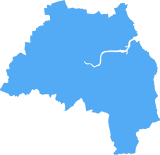
The NE7 postcode covers a large area in the North East of England. It is the largest postcode area in the entire Newcastle upon Tyne district. The area it covers sits mainly to the northern and western part of the district, stretching from the coast to the outskirts of the city.
The area is mainly residential, with a lot of the housing in the area being terraced properties built between the 1880s and 1920s. There are a number of retail outlets in the area, from small independent businesses to large chain stores. The landmark Gavinton and Northumberland Buildings are located to the East of the postcode.
The area is well connected by public transportation, with several bus routes passing through and the Metro, a service with links to the rest of Tyneside, nearby.
As the area is popular with families, there are a number of primary and secondary schools in the area, including Church High School for Girls, Walker Technology College, and West Walker Primary. There is also an abundance of green open spaces; Welbeck, Longbenton and South Gosforth Parks are all in close proximity, and each have their own lakes, games fields and recreational area for families.
The district is home to a number of sporting clubs, most notably SJP (St. James' Park) Football Club, as well as teams such as Newcastle Falcons,Blaydon and Blyth Spartans. There are also a number of churches in the area, including St. James' and St. Bartholomew's.
The main form of leisure in the area is the Northumberland Park, with its sporting facilities, theatres, and leisure centre. The area is also known for its friendly community spirit, with the annual Sunday Carnival a highlight of the calendar.
Finally, the local area is an ideal place for new businesses, with a variety of office space for rent. The area is also popular amongst young professionals, with a good selection of bars and restaurants.

Demographics

Tyne and Wear
NE7 is located in the county of Tyne and Wear, in England.
Tyne and Wear has a total population of 1,128,800, making it the 16th largest county in the UK.
Tyne and Wear has a total area of 210 square miles, and a population density of 2090 people per square kilometre. For comparison, Greater London has a density of 5,618 people/km2.

| Outward Code | NE7 |
| Postal Town | Newcastle Upon Tyne |
| MSOA Name | Newcastle upon Tyne 007 |
| LSOA Name | Newcastle upon Tyne 007A |
| County | Tyne and Wear |
| Region | Tyne and Wear |
| Country | England |
| Local Authority | Newcastle upon Tyne |
| Area Classification | Urban with Major Conurbation |
NE7 Electoral Wards
The postal region of NE7, includes the local towns, villages, electoral wards and stations of:
Dig even deeper into the NE7 postcode by clicking on a postcode below:
Click on an outward postal code below for more information about the area. Each 'outward' postcode give you a comprehensive list of all postcodes within the outward code area (NE) and estimated address.
Click on an 'outward' code for more information. For example, the outward postcode page 'EC2M' will give you an alphabetical list covering all postcodes located in the region, from 'EC2M 1BB' through to 'EC2M 7YA'.
Chris H
Saturday, April 6, 2024
We don't have any views of NE7 right now. If you live in NE7 or have visited it, please help us to help others by telling others what you think of this neighbourhood.
Add your view of NE7
People need your local expertise. If you live in NE7 or have first-hand knowledge of the neighbourhood, please consider sharing your views. It's completely anonymous - all we ask is for your initials.
Please tell us what you like about the NE7 postcode area, what you don't like, and what it's like to live or work here.
| LOCAL AMENITIES | |
| FAMILY FRIENDLY | |
| PARKING | |
| GREEN SPACES |
Local News Northumberland
Plans submitted to transform Liverpool TV and film campus for Hollywood of the North'
Developer Capital&Centric has submitted a detailed planning application for its transformation of the iconic art deco Littlewoods Building into a TV and film campus, as Liverpool aims to become the 'H&hellip
Property WeekBrewDog boss slams council and developer over delayed' Durham bar opening
The boss of brewery and pub chain BrewDog has taken aim at Durham County Council and joint venture developer The Arlington Real Estate and Richardson over delays in opening a bar, which he claims have&hellip
Property WeekInquiry clears Teesworks scheme of corruption despite lack of transparency'
No evidence of illegality found at government-backed regeneration scheme.
Property WeekCouncil calls action on 450m Sunderland film studio
FullwellCainwill begin developing the 1.7m sq site this year.
Property WeekESTAMA UK wins contracts to manage three more shopping centres
Addition of Birchwood, Weston, and Byron Place shopping centres take the number of assets the firm manages to 17.
Property WeekAvant Homes acquires Durham site for 40m resi development
Housebuilder Avant Homes has acquired a site in Willington, Durham, for the development of a 43.6m residential scheme with 200 new homes.
Property WeekDirector banned after unlawful care home scheme saw investors lose 57m
The scheme promised investors unachievable returns and put their funds at risk.
Property WeekNewcastle records steepest prime office rent growth among regions
Rents in the city have increased at twice the speed of the regional average.
Property WeekFrom the Postcode Area blog

Deciphering Crime Rates - a Deep Dive Into UK Postcode Analysis
Ever wondered about the crime rate in your UK postcode? You're not alone. We've dug deep into the data, uncovering trends and patterns that'll make your head spin.

Death of the High Street?
The BBC reports that despite councils' attempts to kurb them, the UK's high streets have seen a huge growth in fast food outlets. Could this mark the death knell for the Great British high street, and what can we do about it to halt its decline?

Discrimination by Postcode
You really couldn't make it up, could you? Some of the country's most vulnerable people are missing out on their weekly £25 Cold Weather Payment, just because the system that's in operation is discriminating against them because payments are based on postcode, rather than geographic location.

The Redesign is Underway
Well, the current website was absolutely in dire need of a good redesign - from the ground up. So I set out to pull it all apart and get it up and running again to become the most comprehensive guide to every postcode in the UK. And it's been a long, tough job from start to finish - and quite possibly the biggest project I've ever undertaken.
SOCIAL GRADES
According to census records, 32% of people here have a social grade of AB (highest), compared to the national average of 27%.