newcastle-upon-tyne NE5 Postcodes
Spending a fortune on conveyancing?

Compare instant, low-cost online quotes from trusted conveyancing solicitors.
Backed by experts, our no-obligation service searches through the best conveyancing quotes on the market to save you time and money.
Newcastle Upon Tyne (NE5)
The NE5 postcode area is located in the Newcastle Upon Tyne postcode town region, within the county of Tyne and Wear, and contains a total of 1289 individual postcodes.
There are 15 electoral wards in the NE5 postcode area, including Alnwick, Ashington, Bamburgh, Bedlington, Belford, Blaydon-On-Tyne, Blyth, Boldon Colliery, Chathill, Choppington, Corbridge, Cramlington, East Boldon, Gateshead, Haltwhistle, Hebburn, Hexham, Jarrow, Morpeth, Newbiggin-By-The-Sea, Newcastle Upon Tyne, North Shields, Prudhoe, Riding Mill, Rowlands Gill, Ryton, Seahouses, South Shields, Stocksfield, Wallsend, Washington, Whitley Bay, Wooler, Wylam which come under the local authority of the Newcastle upon Tyne Council.
Combining the whole postcode region, 12% of people in NE5 are classed as having an AB social grade, (i.e. 'white-collar' middle-upper class), compared to 27% across the UK.
This does not mean that the people of NE5 are poorer than other areas, but it may give an indication that there are areas of deprivation.
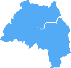
The NE5 postcode covers the area of Newcastle upon Tyne in the North East of England. It borders the NE4 and NE6 postcodes and takes in the districts of Fenham, Grange Park, Cowgate, Holeyn Hall, Wingrove, Scotswood, Benwell and Arthur's Hill.
Fenham is a residential area that has several churches and an industrial estate, while Grange Park is home to a range of housing from Victorian terraced streets to larger, detached homes. Cowgate is located close to the city centre and includes the Northern Stage theatre and the NewBridge Project art gallery. Holeyn Hall is a largely residential area with shops, pubs and a leisure centre, while Wingrove has a mixture of terraced and semi-detached houses. Scotswood, Benwell and Arthur's Hill are mainly terraced streets in the west of Newcastle.
The area of NE5 has its own shopping centre at Lobley Hill, which includes a range of stores, restaurants and a cinema. There is also a shopping area in Fenham, as well as pubs and restaurants in several districts. A number of parks and green spaces are located in and around the postcode, including Town Moor, which is one of the largest municipal parks in Europe.
This postcode is served by several bus routes, as well as the Tyne and Wear Metro, which runs from Newcastle Airport to South Hylton. Newcastle Airport is located within the postcode, along with Newcastle Racecourse and Newcastle College. In terms of sport, Newcastle United Football Club, Newcastle Falcons Rugby Club, and Newcastle Eagles Basketball Franchise are all located in this postcode area. It is also home to the Newcastle Nightline, a student help and support helpline.

Demographics

Tyne and Wear
NE5 is located in the county of Tyne and Wear, in England.
Tyne and Wear has a total population of 1,128,800, making it the 16th largest county in the UK.
Tyne and Wear has a total area of 210 square miles, and a population density of 2090 people per square kilometre. For comparison, Greater London has a density of 5,618 people/km2.

| Outward Code | NE5 |
| Postal Town | Newcastle Upon Tyne |
| MSOA Name | Newcastle upon Tyne 015 |
| LSOA Name | Newcastle upon Tyne 015C |
| County | Tyne and Wear |
| Region | Tyne and Wear |
| Country | England |
| Local Authority | Newcastle upon Tyne |
| Area Classification | Urban with Major Conurbation |
NE5 Electoral Wards
The postal region of NE5, includes the local towns, villages, electoral wards and stations of:
Dig even deeper into the NE5 postcode by clicking on a postcode below:
Click on an outward postal code below for more information about the area. Each 'outward' postcode give you a comprehensive list of all postcodes within the outward code area (NE) and estimated address.
Click on an 'outward' code for more information. For example, the outward postcode page 'EC2M' will give you an alphabetical list covering all postcodes located in the region, from 'EC2M 1BB' through to 'EC2M 7YA'.
Chris H
Sunday, April 7, 2024
We don't have any views of NE5 right now. If you live in NE5 or have visited it, please help us to help others by telling others what you think of this neighbourhood.
Add your view of NE5
People need your local expertise. If you live in NE5 or have first-hand knowledge of the neighbourhood, please consider sharing your views. It's completely anonymous - all we ask is for your initials.
Please tell us what you like about the NE5 postcode area, what you don't like, and what it's like to live or work here.
| LOCAL AMENITIES | |
| FAMILY FRIENDLY | |
| PARKING | |
| GREEN SPACES |
Local News Northumberland
Primark to significantly upsize Metrocentre store
The enlarged anchor premises will cover nearly 80,000 sq ft.
Property WeekHadrian Industrial Estates snaps up Durham portfolio for 1.28m
Hadrian Industrial Estates, part of Hadrian Land, has snapped up three multi-let industrial estates in County Durham for a combined 1.28m from commercial property investor Snowlarch.
Property WeekESTAMA UK wins contracts to manage three more shopping centres
Addition of Birchwood, Weston, and Byron Place shopping centres take the number of assets the firm manages to 17.
Property WeekEE to open 10 experiential stores in 6m investment programme
The firm unveiled the plan as it opened its Gateshead Experience store at Metrocentre shopping centre.
Property WeekDurham City Innovation District seeks JV investment partner for 250m campus
Durham County Council, Durham University and Avison Young are seeking ajoint venture investment partner to help fund a250m research and development campusat Aykley Heads, as part of their wider Du&hellip
Property WeekSignificant interest' in portfolio of 25 North East and Yorkshire pubs
Avison Young and Watling Real Estate have reported a significant level of interest.
Property WeekDirector banned after unlawful care home scheme saw investors lose 57m
The scheme promised investors unachievable returns and put their funds at risk.
Property WeekEY in talks with other interested parties' over fresh takeover of Britishvolt
The company's administrators are still chasing money from selected Australian buyer Recharge Industries.
Property WeekFrom the Postcode Area blog

Deciphering Crime Rates - a Deep Dive Into UK Postcode Analysis
Ever wondered about the crime rate in your UK postcode? You're not alone. We've dug deep into the data, uncovering trends and patterns that'll make your head spin.

Death of the High Street?
The BBC reports that despite councils' attempts to kurb them, the UK's high streets have seen a huge growth in fast food outlets. Could this mark the death knell for the Great British high street, and what can we do about it to halt its decline?

Discrimination by Postcode
You really couldn't make it up, could you? Some of the country's most vulnerable people are missing out on their weekly £25 Cold Weather Payment, just because the system that's in operation is discriminating against them because payments are based on postcode, rather than geographic location.

The Redesign is Underway
Well, the current website was absolutely in dire need of a good redesign - from the ground up. So I set out to pull it all apart and get it up and running again to become the most comprehensive guide to every postcode in the UK. And it's been a long, tough job from start to finish - and quite possibly the biggest project I've ever undertaken.
SOCIAL GRADES
According to census records, 12% of people here have a social grade of AB (highest), compared to the national average of 27%.