newcastle-upon-tyne NE39 Postcodes
Spending a fortune on conveyancing?

Compare instant, low-cost online quotes from trusted conveyancing solicitors.
Backed by experts, our no-obligation service searches through the best conveyancing quotes on the market to save you time and money.
Newcastle Upon Tyne (NE39)
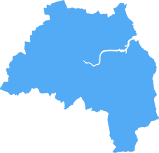
The NE39 postcode area is located in the Newcastle Upon Tyne postcode town region, within the county of Tyne and Wear, and contains a total of 362 individual postcodes.
There are 23 electoral wards in the NE39 postcode area, including Alnwick, Ashington, Bamburgh, Bedlington, Belford, Blaydon-On-Tyne, Blyth, Boldon Colliery, Chathill, Choppington, Corbridge, Cramlington, East Boldon, Gateshead, Haltwhistle, Hebburn, Hexham, Jarrow, Morpeth, Newbiggin-By-The-Sea, Newcastle Upon Tyne, North Shields, Prudhoe, Riding Mill, Rowlands Gill, Ryton, Seahouses, South Shields, Stocksfield, Wallsend, Washington, Whitley Bay, Wooler, Wylam which come under the local authority of the Gateshead Council.
Combining the whole postcode region, 25% of people in NE39 are classed as having an AB social grade, (i.e. 'white-collar' middle-upper class), compared to 27% across the UK.
This does not mean that the people of NE39 are poorer than other areas, but it may give an indication that there are areas of deprivation.
NE39 is a postcode in the North East of England covering parts of the Metropolitan Borough of Gateshead. It covers parts of the towns of Blaydon and Winlaton, as well as nearby villages such as Kibblesworth, Stella, Ryton, Crawcrook and Greenside. The area includes the Blaydon Burn and Crawcrook Burn rivers, as well as the famous Blaydon Race. It is predominantly residential and spans some of Gateshead's most popular neighbourhoods.
The local football and rugby teams are both called the Blaydon Rugby Football Club and the Blaydon Football Club, while the area is home to a number of parks and outdoor spaces, such as Stella, Shibdon and Blaydon Burn parks. It is also home to a number of listed buildings, such as Blaydon Bridge, Stella Methodist Church, St Paul's Church, and The Black Bull public house. Local amenities include a variety of shops ranging from convenience stores to larger supermarkets, and plenty of caf�s, takeaways and pubs.
Education-wise, the area is served by Winlaton West Lane Primary School, Blaydon West Primary School, Greenside Primary, and St Cuthbert's Catholic Primary. It is also home to Blaydon College, a specialist college (formerly known as Blaydon Community High School) which offers a range of qualifications and accredited courses.
The area has good transport links with regular bus services to Newcastle and Gateshead, plus a number of train stations located nearby, including Blaydon, Met-O-Light and Ryton. It is a fifteen-minute drive from Newcastle International Airport and forty-five minutes from Durham Tees Valley Airport.
NE39 is a great location to consider if you're looking for a residential area in the North East of England. It is perfect for families looking for a good quality of life with plenty of amenities and excellent transport links. Its mix of busy towns and rural villages offers something for everyone, and its array of listed buildings make it an attractive area to explore.

Demographics

Tyne and Wear
NE39 is located in the county of Tyne and Wear, in England.
Tyne and Wear has a total population of 1,128,800, making it the 16th largest county in the UK.
Tyne and Wear has a total area of 210 square miles, and a population density of 2090 people per square kilometre. For comparison, Greater London has a density of 5,618 people/km2.

| Outward Code | NE39 |
| Postal Town | Newcastle Upon Tyne |
| MSOA Name | Gateshead 022 |
| LSOA Name | Gateshead 022D |
| County | Tyne and Wear |
| Region | Tyne and Wear |
| Country | England |
| Local Authority | Gateshead |
| Area Classification | Unclassified |
NE39 Electoral Wards
The postal region of NE39, includes the local towns, villages, electoral wards and stations of:
Dig even deeper into the NE39 postcode by clicking on a postcode below:
Click on an outward postal code below for more information about the area. Each 'outward' postcode give you a comprehensive list of all postcodes within the outward code area (NE) and estimated address.
Click on an 'outward' code for more information. For example, the outward postcode page 'EC2M' will give you an alphabetical list covering all postcodes located in the region, from 'EC2M 1BB' through to 'EC2M 7YA'.
Chris H
Wednesday, April 10, 2024
We don't have any views of NE39 right now. If you live in NE39 or have visited it, please help us to help others by telling others what you think of this neighbourhood.
Add your view of NE39
People need your local expertise. If you live in NE39 or have first-hand knowledge of the neighbourhood, please consider sharing your views. It's completely anonymous - all we ask is for your initials.
Please tell us what you like about the NE39 postcode area, what you don't like, and what it's like to live or work here.
| LOCAL AMENITIES | |
| FAMILY FRIENDLY | |
| PARKING | |
| GREEN SPACES |
Local News County Durham
Rise in neighbourhood crime across County Durham and Darlington
Neighbourhood crime has increased by almost a quarter across County Durham and Darlington.
Northern EchoMove More event held in the Market Square Darlington
The Move More event hosted by Darlington Borough Council took place in the town's Market Square yesterday - take a look at some of our pictures.
Northern EchoConvicted Burnhope businessman 'in denial' over child sexual offences
A wealthy businessman who ran a successful family roofing and construction company has been jailed after being convicted of grooming and sexually assaulting a teenage girl.
Northern EchoCyclist, 15, in hospital after Gilesgate, Durham incident
A teenager has been taken to hospital following a collision on Sunderland Road, Gilesgate, in Durham
Northern EchoDarlington man armed himself with knife after he was slapped
A Darlington man who threatened a man with a knife after he was slapped across the face following a dispute outside a town centre pub has escaped custody.
Northern EchoDurham Incident LIVE: Police attend Sunderland Road in Gilesgate
Sunderland Road in Gilesgate, Durham has been closed while police attend an 'incident'
Northern EchoPutting a head on Durham's mysterious statue in Wharton Park
IN our spring special a fortnight ago, we visited Wharton Park with its spectacular views across Durham and we wondered about the headless statue which greets visitors as they enter the park from Nort&hellip
Northern EchoStanley man doused car of his 'ex's' mother before setting it alight
Vengeful arsonist Christopher Forster set fire to a parked car belonging to the mother of his ex-partner, a court was told.
Northern EchoFrom the Postcode Area blog

Deciphering Crime Rates - a Deep Dive Into UK Postcode Analysis
Ever wondered about the crime rate in your UK postcode? You're not alone. We've dug deep into the data, uncovering trends and patterns that'll make your head spin.

Death of the High Street?
The BBC reports that despite councils' attempts to kurb them, the UK's high streets have seen a huge growth in fast food outlets. Could this mark the death knell for the Great British high street, and what can we do about it to halt its decline?

Discrimination by Postcode
You really couldn't make it up, could you? Some of the country's most vulnerable people are missing out on their weekly £25 Cold Weather Payment, just because the system that's in operation is discriminating against them because payments are based on postcode, rather than geographic location.

The Redesign is Underway
Well, the current website was absolutely in dire need of a good redesign - from the ground up. So I set out to pull it all apart and get it up and running again to become the most comprehensive guide to every postcode in the UK. And it's been a long, tough job from start to finish - and quite possibly the biggest project I've ever undertaken.
SOCIAL GRADES
According to census records, 25% of people here have a social grade of AB (highest), compared to the national average of 27%.