newcastle-upon-tyne NE30 Postcodes
Spending a fortune on conveyancing?

Compare instant, low-cost online quotes from trusted conveyancing solicitors.
Backed by experts, our no-obligation service searches through the best conveyancing quotes on the market to save you time and money.
Newcastle Upon Tyne (NE30)
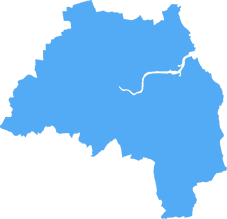
The NE30 postcode area is located in the Newcastle Upon Tyne postcode town region, within the county of Tyne and Wear, and contains a total of 858 individual postcodes.
There are 4 electoral wards in the NE30 postcode area, including Alnwick, Ashington, Bamburgh, Bedlington, Belford, Blaydon-On-Tyne, Blyth, Boldon Colliery, Chathill, Choppington, Corbridge, Cramlington, East Boldon, Gateshead, Haltwhistle, Hebburn, Hexham, Jarrow, Morpeth, Newbiggin-By-The-Sea, Newcastle Upon Tyne, North Shields, Prudhoe, Riding Mill, Rowlands Gill, Ryton, Seahouses, South Shields, Stocksfield, Wallsend, Washington, Whitley Bay, Wooler, Wylam which come under the local authority of the North Tyneside Council.
Combining the whole postcode region, 26% of people in NE30 are classed as having an AB social grade, (i.e. 'white-collar' middle-upper class), compared to 27% across the UK.
This does not mean that the people of NE30 are poorer than other areas, but it may give an indication that there are areas of deprivation.
The NE30 postcode is a postcode district located in Newcastle upon Tyne in the North East of England. The area is popular for its transport links, with Newcastle International Airport just 17 minutes away and the MetroCentre train station only 4 minutes away.
The area boasts some of Newcastle's most popular attractions, such as the Royal Quays Outlet, the popular shopping outlet offering fashion and beauty stores, and the Royal Quay Marina, with its waterfront restaurants and bars. The iconic St. James' Park stadium, home to Newcastle United Football Club, is also nearby and is a popular destination for families, sports fans, and visitors to the area.
The area has a rich history, with a variety of traditional, independent retailers and family businesses. Its high street is a great place to explore, offering a selection of souvenir shops, coffee bars, and cafes. The area also offers a range of pubs, bars, and eateries and is well-regarded for its fantastic nightlife.
The NE30 postcode is an up-and-coming area with a range of real estate options, from modern apartments to quaint period terraces. The area is becoming increasingly sought-after, due to its close proximity to the city centre, its excellent transport links, and its unique and vibrant atmosphere. Development is ongoing, with some new sites in the area, which will bring even more retail, leisure, and hospitality businesses to the area.
NE30 is a great place for young professionals and families, with excellent local schools, parks, and leisure centres nearby. There is also a range of progressive employers, including educational, creative, and IT firms. The local council strives to ensure the safety of its residents, making the area even more attractive for prospective buyers and renters.
TheNE30 postcode offers a combination of traditional values, culture, and modern advances. Its prime location, excellent transport links, and vibrant culture make it an attractive option for those wanting to live, work, and play in the area.

Demographics

Tyne and Wear
NE30 is located in the county of Tyne and Wear, in England.
Tyne and Wear has a total population of 1,128,800, making it the 16th largest county in the UK.
Tyne and Wear has a total area of 210 square miles, and a population density of 2090 people per square kilometre. For comparison, Greater London has a density of 5,618 people/km2.

| Outward Code | NE30 |
| Postal Town | Newcastle Upon Tyne |
| MSOA Name | North Tyneside 022 |
| LSOA Name | North Tyneside 022B |
| County | Tyne and Wear |
| Region | Tyne and Wear |
| Country | England |
| Local Authority | North Tyneside |
| Area Classification | Urban with Major Conurbation |
NE30 Electoral Wards
The postal region of NE30, includes the local towns, villages, electoral wards and stations of:
Dig even deeper into the NE30 postcode by clicking on a postcode below:
Click on an outward postal code below for more information about the area. Each 'outward' postcode give you a comprehensive list of all postcodes within the outward code area (NE) and estimated address.
Click on an 'outward' code for more information. For example, the outward postcode page 'EC2M' will give you an alphabetical list covering all postcodes located in the region, from 'EC2M 1BB' through to 'EC2M 7YA'.
Chris H
Tuesday, April 9, 2024
We don't have any views of NE30 right now. If you live in NE30 or have visited it, please help us to help others by telling others what you think of this neighbourhood.
Add your view of NE30
People need your local expertise. If you live in NE30 or have first-hand knowledge of the neighbourhood, please consider sharing your views. It's completely anonymous - all we ask is for your initials.
Please tell us what you like about the NE30 postcode area, what you don't like, and what it's like to live or work here.
| LOCAL AMENITIES | |
| FAMILY FRIENDLY | |
| PARKING | |
| GREEN SPACES |
Local News Northumberland
Fresh plans submitted for former Colgate-Palmolive factory
The Soapworksproposals include450 new homes and more than 145,000 sq ft ofoffice space.
Property WeekCouncil calls action on 450m Sunderland film studio
FullwellCainwill begin developing the 1.7m sq site this year.
Property WeekGateshead plans urban community' around Metrocentre
The shopping centre, the largest in the North East, has 400 stores and 2.1m sq ft of lettable space.
Property WeekMetrocentre posts 17% profit rise as recovery from pandemic continues
Footfall and occupancy are up at UK's second largest shopping destination.
Property WeekFPG acquires Washington Retail Park in Sunderland
The deal follows the firm's purchase of the Moorland Centre Retail Park in Lincoln late last year.
Property WeekBidX1 to offer more than 40 lots in March auction
The commercial and residential auction will take place on March 27.
Property WeekGo Outdoors signs new letting at former Wilko store in Metrocentre
The outdoor clothing and equipment retailer will open the new store later this year.
Property WeekPrimark to significantly upsize Metrocentre store
The enlarged anchor premises will cover nearly 80,000 sq ft.
Property WeekFrom the Postcode Area blog

Deciphering Crime Rates - a Deep Dive Into UK Postcode Analysis
Ever wondered about the crime rate in your UK postcode? You're not alone. We've dug deep into the data, uncovering trends and patterns that'll make your head spin.

Death of the High Street?
The BBC reports that despite councils' attempts to kurb them, the UK's high streets have seen a huge growth in fast food outlets. Could this mark the death knell for the Great British high street, and what can we do about it to halt its decline?

Discrimination by Postcode
You really couldn't make it up, could you? Some of the country's most vulnerable people are missing out on their weekly £25 Cold Weather Payment, just because the system that's in operation is discriminating against them because payments are based on postcode, rather than geographic location.

The Redesign is Underway
Well, the current website was absolutely in dire need of a good redesign - from the ground up. So I set out to pull it all apart and get it up and running again to become the most comprehensive guide to every postcode in the UK. And it's been a long, tough job from start to finish - and quite possibly the biggest project I've ever undertaken.
SOCIAL GRADES
According to census records, 26% of people here have a social grade of AB (highest), compared to the national average of 27%.