newcastle-upon-tyne NE29 Postcodes
Spending a fortune on conveyancing?

Compare instant, low-cost online quotes from trusted conveyancing solicitors.
Backed by experts, our no-obligation service searches through the best conveyancing quotes on the market to save you time and money.
Newcastle Upon Tyne (NE29)
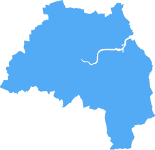
The NE29 postcode area is located in the Newcastle Upon Tyne postcode town region, within the county of Tyne and Wear, and contains a total of 1304 individual postcodes.
There are 9 electoral wards in the NE29 postcode area, including Alnwick, Ashington, Bamburgh, Bedlington, Belford, Blaydon-On-Tyne, Blyth, Boldon Colliery, Chathill, Choppington, Corbridge, Cramlington, East Boldon, Gateshead, Haltwhistle, Hebburn, Hexham, Jarrow, Morpeth, Newbiggin-By-The-Sea, Newcastle Upon Tyne, North Shields, Prudhoe, Riding Mill, Rowlands Gill, Ryton, Seahouses, South Shields, Stocksfield, Wallsend, Washington, Whitley Bay, Wooler, Wylam which come under the local authority of the North Tyneside Council.
Combining the whole postcode region, 15% of people in NE29 are classed as having an AB social grade, (i.e. 'white-collar' middle-upper class), compared to 27% across the UK.
This does not mean that the people of NE29 are poorer than other areas, but it may give an indication that there are areas of deprivation.
The NE29 postcode is in the Newcastle upon Tyne district of the United Kingdom and covers a mainly residential area of the city.The suburban neighbourhoods of Battle Hill and Preston Village form the western boundary while to the east, the postcode boundary runs close to the North Sea which is the backdrop for the attractive Northumberland coastline. Within the NE29 postcode there are numerous parks and green spaces, such as St Mary's Island, Howdon Park, Monkseaton Dene, and Whitley Bay. The area is also home to local shops, cafes and pubs, as well as a retail park, popular with residents and visitors alike.
NE29 also stretches out to the south, bordering Cullercoats and Whitley Bay. This area is the ideal spot for beach lovers; boasting some of the most beautiful beaches in the country. Home to a thriving rockpool scene, popular attractions in the area Sainte Mary's Lighthouse and Tynemouth Country Park, with the former being one of the oldest lighthouses in England. The beaches are also a great destination for outdoor activities such as swimming, fishing, and walking, both along the coastline and within the Northumberland National Park.
Heading inland, the Northumberland Coast Railway Line is located within the boundaries of the NE29 postcode, running from Newcastle to the historic town of Berwick upon Tweed, on the Scottish Borders. The line offers stunning views of the coastline, open countryside, and nearby villages.
Not too far away is the town of Whitley Bay, the seaside town located between Tynemouth and Seaton Sluice. Surrounded by shops, restaurants and pubs, Whitley Bay is a popular tourist destination, home to its legendary piers, its Nature Reserve, St. Mary's Lighthouse, and the Metro music venue. On the grounds of St Mary's Island once sat the old Spanish City Amusement Park, and nearby is the restored Spanish City dome, the only Grade II-listed building in the area.
In the NE29 postcode, there is also something for sports fans. Whitehouse Farm, located south of Whitley Bay, is a world-renowned mountain biking centre, offering trails suitable for all abilities, and for football fans, Monkseaton F.C. and Cullercoats F.C. are just a few of the local teams. For those looking to socialize and relax, the postcode also features number of pubs and premier leagues such as The Red Lion, The Free Trade, and The Raby Arms.

Demographics

Tyne and Wear
NE29 is located in the county of Tyne and Wear, in England.
Tyne and Wear has a total population of 1,128,800, making it the 16th largest county in the UK.
Tyne and Wear has a total area of 210 square miles, and a population density of 2090 people per square kilometre. For comparison, Greater London has a density of 5,618 people/km2.

| Outward Code | NE29 |
| Postal Town | Newcastle Upon Tyne |
| MSOA Name | North Tyneside 022 |
| LSOA Name | North Tyneside 022B |
| County | Tyne and Wear |
| Region | Tyne and Wear |
| Country | England |
| Local Authority | North Tyneside |
| Area Classification | Urban with Major Conurbation |
NE29 Electoral Wards
The postal region of NE29, includes the local towns, villages, electoral wards and stations of:
Dig even deeper into the NE29 postcode by clicking on a postcode below:
Click on an outward postal code below for more information about the area. Each 'outward' postcode give you a comprehensive list of all postcodes within the outward code area (NE) and estimated address.
Click on an 'outward' code for more information. For example, the outward postcode page 'EC2M' will give you an alphabetical list covering all postcodes located in the region, from 'EC2M 1BB' through to 'EC2M 7YA'.
Chris H
Saturday, April 6, 2024
We don't have any views of NE29 right now. If you live in NE29 or have visited it, please help us to help others by telling others what you think of this neighbourhood.
Add your view of NE29
People need your local expertise. If you live in NE29 or have first-hand knowledge of the neighbourhood, please consider sharing your views. It's completely anonymous - all we ask is for your initials.
Please tell us what you like about the NE29 postcode area, what you don't like, and what it's like to live or work here.
| LOCAL AMENITIES | |
| FAMILY FRIENDLY | |
| PARKING | |
| GREEN SPACES |
Local News Northumberland
Primark to significantly upsize Metrocentre store
The enlarged anchor premises will cover nearly 80,000 sq ft.
Property WeekBrewDog boss slams council and developer over delayed' Durham bar opening
The boss of brewery and pub chain BrewDog has taken aim at Durham County Council and joint venture developer The Arlington Real Estate and Richardson over delays in opening a bar, which he claims have&hellip
Property WeekScottish housebuilder Stewart Milne enters administration with loss of over 200 jobs
North-east Scotland-based housebuilder Stewart Milne Group has entered administration with the immediate loss of 217 jobs.
Property WeekMetrocentre posts 17% profit rise as recovery from pandemic continues
Footfall and occupancy are up at UK's second largest shopping destination.
Property WeekNewcastle records steepest prime office rent growth among regions
Rents in the city have increased at twice the speed of the regional average.
Property WeekDurham City Innovation District seeks JV investment partner for 250m campus
Durham County Council, Durham University and Avison Young are seeking ajoint venture investment partner to help fund a250m research and development campusat Aykley Heads, as part of their wider Du&hellip
Property WeekGateshead plans urban community' around Metrocentre
The shopping centre, the largest in the North East, has 400 stores and 2.1m sq ft of lettable space.
Property WeekCouncil calls action on 450m Sunderland film studio
FullwellCainwill begin developing the 1.7m sq site this year.
Property WeekFrom the Postcode Area blog

Deciphering Crime Rates - a Deep Dive Into UK Postcode Analysis
Ever wondered about the crime rate in your UK postcode? You're not alone. We've dug deep into the data, uncovering trends and patterns that'll make your head spin.

Death of the High Street?
The BBC reports that despite councils' attempts to kurb them, the UK's high streets have seen a huge growth in fast food outlets. Could this mark the death knell for the Great British high street, and what can we do about it to halt its decline?

Discrimination by Postcode
You really couldn't make it up, could you? Some of the country's most vulnerable people are missing out on their weekly £25 Cold Weather Payment, just because the system that's in operation is discriminating against them because payments are based on postcode, rather than geographic location.

The Redesign is Underway
Well, the current website was absolutely in dire need of a good redesign - from the ground up. So I set out to pull it all apart and get it up and running again to become the most comprehensive guide to every postcode in the UK. And it's been a long, tough job from start to finish - and quite possibly the biggest project I've ever undertaken.
SOCIAL GRADES
According to census records, 15% of people here have a social grade of AB (highest), compared to the national average of 27%.