newcastle-upon-tyne NE2 Postcodes
Spending a fortune on conveyancing?

Compare instant, low-cost online quotes from trusted conveyancing solicitors.
Backed by experts, our no-obligation service searches through the best conveyancing quotes on the market to save you time and money.
Newcastle Upon Tyne (NE2)
The NE2 postcode area is located in the Newcastle Upon Tyne postcode town region, within the county of Tyne and Wear, and contains a total of 656 individual postcodes.
There are 3 electoral wards in the NE2 postcode area, including Alnwick, Ashington, Bamburgh, Bedlington, Belford, Blaydon-On-Tyne, Blyth, Boldon Colliery, Chathill, Choppington, Corbridge, Cramlington, East Boldon, Gateshead, Haltwhistle, Hebburn, Hexham, Jarrow, Morpeth, Newbiggin-By-The-Sea, Newcastle Upon Tyne, North Shields, Prudhoe, Riding Mill, Rowlands Gill, Ryton, Seahouses, South Shields, Stocksfield, Wallsend, Washington, Whitley Bay, Wooler, Wylam which come under the local authority of the Newcastle upon Tyne Council.
Combining the whole postcode region, 34% of people in NE2 are classed as having an AB social grade, (i.e. 'white-collar' middle-upper class), compared to 27% across the UK.
This does not mean that the people of NE2 are wealthier - or higher class - than average, but it can be an indication that the area may be prospering and desirable to live in.
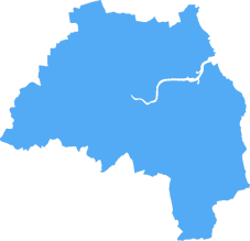
The NE2 postcode covers the Kenton and the Gosforth district in the Newcastle upon Tyne area of Tyne and Wear. The postcode district includes an area of northern Newcastle upon Tyne, stretching north from the city centre as far as the A1 motorway, and east to the A19.
Kenton and Gosforth are mainly residential suburbs, located close to Newcastle International Airport. The area is popular amongst students and young professionals, and there is plenty of local amenities within walking distance. There are several schools, a number of supermarkets, a large sports centre, and two golf clubs; plus a lively bar and restaurant scene. Good transport links via road, metro, and bus make getting around easy.
The area is well known for its green spaces; including Jesmond Dene, the Town Moor, the Arboretum, and the Heaton Park. These are excellent spots for local residents to relax and enjoy the outdoors, with plenty of child-friendly activities.
The major shopping centre in the area is the busy and vibrant Intu Eldon Square shopping centre. It boasts a huge range of shops, cafes, restaurants and entertainment venues, plus a wide range of services. There are also several independent stores and independent cafe culture.
For commuters, the A186 and A184 link the area to the city centre and the A1 links it to the motorway. There are regular buses to the nearby city centre and Metro Station Plus+ coaches into nearby towns and villages.
NE2 is a popular area, known for its great night out, its beautiful green spaces, and its great transport links. There's something for everybody in the NE2 postcode, making it a great place to live.

Demographics

Tyne and Wear
NE2 is located in the county of Tyne and Wear, in England.
Tyne and Wear has a total population of 1,128,800, making it the 16th largest county in the UK.
Tyne and Wear has a total area of 210 square miles, and a population density of 2090 people per square kilometre. For comparison, Greater London has a density of 5,618 people/km2.

| Outward Code | NE2 |
| Postal Town | Newcastle Upon Tyne |
| MSOA Name | Newcastle upon Tyne 023 |
| LSOA Name | Newcastle upon Tyne 023A |
| County | Tyne and Wear |
| Region | Tyne and Wear |
| Country | England |
| Local Authority | Newcastle upon Tyne |
| Area Classification | Urban with Major Conurbation |
NE2 Electoral Wards
The postal region of NE2, includes the local towns, villages, electoral wards and stations of:
Dig even deeper into the NE2 postcode by clicking on a postcode below:
Click on an outward postal code below for more information about the area. Each 'outward' postcode give you a comprehensive list of all postcodes within the outward code area (NE) and estimated address.
Click on an 'outward' code for more information. For example, the outward postcode page 'EC2M' will give you an alphabetical list covering all postcodes located in the region, from 'EC2M 1BB' through to 'EC2M 7YA'.
Chris H
Saturday, April 6, 2024
We don't have any views of NE2 right now. If you live in NE2 or have visited it, please help us to help others by telling others what you think of this neighbourhood.
Add your view of NE2
People need your local expertise. If you live in NE2 or have first-hand knowledge of the neighbourhood, please consider sharing your views. It's completely anonymous - all we ask is for your initials.
Please tell us what you like about the NE2 postcode area, what you don't like, and what it's like to live or work here.
| LOCAL AMENITIES | |
| FAMILY FRIENDLY | |
| PARKING | |
| GREEN SPACES |
Local News Northumberland
BidX1 to offer more than 40 lots in March auction
The commercial and residential auction will take place on March 27.
Property WeekSignificant interest' in portfolio of 25 North East and Yorkshire pubs
Avison Young and Watling Real Estate have reported a significant level of interest.
Property WeekDurham City Innovation District seeks JV investment partner for 250m campus
Durham County Council, Durham University and Avison Young are seeking ajoint venture investment partner to help fund a250m research and development campusat Aykley Heads, as part of their wider Du&hellip
Property WeekJames Corden's Fulwell 73 and Cain International propose 450m Sunderland film studio
FulwellCain Studios, a joint venture between actor and TV presenter James Corden's entertainment company Fulwell 73 and Cain International, has unveiled plans for a 450m film industry hub in Sunderla&hellip
Property WeekEE to open 10 experiential stores in 6m investment programme
The firm unveiled the plan as it opened its Gateshead Experience store at Metrocentre shopping centre.
Property WeekPlans submitted to transform Liverpool TV and film campus for Hollywood of the North'
Developer Capital&Centric has submitted a detailed planning application for its transformation of the iconic art deco Littlewoods Building into a TV and film campus, as Liverpool aims to become the 'H&hellip
Property WeekHumber Freeport moves forward with 200-heactare Goole site
Humber Freeport has submitted formal boundary map plans to the government for 200 hectares of undeveloped land in Goole, East Yorkshire, where it plans to establish a freeport tax site.
Property WeekAdderstone Living's North East housing scheme first to secure nutrient neutrality credits
Developer Adderstone Living has secured planning permission for an affordable housing scheme in County Durham, in what it claimed will be the first such development using Natural England's nutrient ne&hellip
Property WeekFrom the Postcode Area blog

Deciphering Crime Rates - a Deep Dive Into UK Postcode Analysis
Ever wondered about the crime rate in your UK postcode? You're not alone. We've dug deep into the data, uncovering trends and patterns that'll make your head spin.

Death of the High Street?
The BBC reports that despite councils' attempts to kurb them, the UK's high streets have seen a huge growth in fast food outlets. Could this mark the death knell for the Great British high street, and what can we do about it to halt its decline?

Discrimination by Postcode
You really couldn't make it up, could you? Some of the country's most vulnerable people are missing out on their weekly £25 Cold Weather Payment, just because the system that's in operation is discriminating against them because payments are based on postcode, rather than geographic location.

The Redesign is Underway
Well, the current website was absolutely in dire need of a good redesign - from the ground up. So I set out to pull it all apart and get it up and running again to become the most comprehensive guide to every postcode in the UK. And it's been a long, tough job from start to finish - and quite possibly the biggest project I've ever undertaken.
SOCIAL GRADES
According to census records, 34% of people here have a social grade of AB (highest), compared to the national average of 27%.