newcastle-upon-tyne NE11 Postcodes
Spending a fortune on conveyancing?

Compare instant, low-cost online quotes from trusted conveyancing solicitors.
Backed by experts, our no-obligation service searches through the best conveyancing quotes on the market to save you time and money.
Newcastle Upon Tyne (NE11)
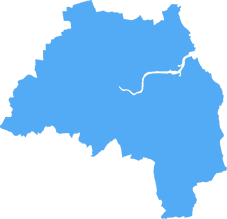
The NE11 postcode area is located in the Newcastle Upon Tyne postcode town region, within the county of Tyne and Wear, and contains a total of 704 individual postcodes.
There are 20 electoral wards in the NE11 postcode area, including Alnwick, Ashington, Bamburgh, Bedlington, Belford, Blaydon-On-Tyne, Blyth, Boldon Colliery, Chathill, Choppington, Corbridge, Cramlington, East Boldon, Gateshead, Haltwhistle, Hebburn, Hexham, Jarrow, Morpeth, Newbiggin-By-The-Sea, Newcastle Upon Tyne, North Shields, Prudhoe, Riding Mill, Rowlands Gill, Ryton, Seahouses, South Shields, Stocksfield, Wallsend, Washington, Whitley Bay, Wooler, Wylam which come under the local authority of the Gateshead Council.
Combining the whole postcode region, 15% of people in NE11 are classed as having an AB social grade, (i.e. 'white-collar' middle-upper class), compared to 27% across the UK.
This does not mean that the people of NE11 are poorer than other areas, but it may give an indication that there are areas of deprivation.
The NE11 postcode is situated in the Newcastle upon Tyne district in the north-east of England, covering such areas as Blaydon and Winlaton, along with the suburbs of Scotswood, Lemington, Blucher and High Spen.
The area is well known for its incredible views of the River Tyne, as well as its industrial heritage. There is a long and rich industrial history in this district, with the likes of George Crabtree, Robert Kelsall, Henry Cort and others having left their marks in industries such as shipbuilding, iron and steel production, coal mining, and engineering.
For those looking for culture, The Sage Gateshead is one of the largest and most renowned cultural destinations in the region. Built largely with funds from the National Lottery, it offers a mix of theatre, music, events, and conferences, and is home to the Royal Northern Sinfonia, the region's professional symphony orchestra.
In terms of religious sites, Cathedrals in St Nicholas' and St Mary's can both be found within the district. St Nicholas' is a certified outstanding building, while St Mary's is well known for its stained glass windows.
For those seeking outdoor activities, the area is brimful with parks, reserves, and green spaces; the town of Whickham, for example, is particularly known for its outdoor lifestyle, being the starting-point for many hiking and cycling trails in the area.
The area is also known for its sporting heritage, with clubs such as Gateshead Cricket Club, Winlaton Hockey Club, and Winlaton Football Club all prominent fixtures in the district. Local gyms and leisure centres such as The Great Park Sports Centre, and the Ryton Silver Urn are also popular spots for fitness enthusiasts.
The area has plenty of local amenities, from cafes and restaurants to shops and services. Popular eateries include St Luke's Caf�, The Running Fox Pub and Restaurant, and the popular Pizza Cottage takeaway. A range of shops are within easy reach, with everything from independent outlets to major supermarkets such as Morrisons and Aldi within the district.
In terms of transport links, the area offers a range of options to connect to the rest of the region, with the Tyne and Wear Metro, regional rail networks, and bus services all in the vicinity. In addition, Newcastle International Airport is nearby, giving access to national and international destinations.

Demographics

Tyne and Wear
NE11 is located in the county of Tyne and Wear, in England.
Tyne and Wear has a total population of 1,128,800, making it the 16th largest county in the UK.
Tyne and Wear has a total area of 210 square miles, and a population density of 2090 people per square kilometre. For comparison, Greater London has a density of 5,618 people/km2.

| Outward Code | NE11 |
| Postal Town | Newcastle Upon Tyne |
| MSOA Name | Gateshead 019 |
| LSOA Name | Gateshead 019B |
| County | Tyne and Wear |
| Region | Tyne and Wear |
| Country | England |
| Local Authority | Gateshead |
| Area Classification | Unclassified |
NE11 Electoral Wards
The postal region of NE11, includes the local towns, villages, electoral wards and stations of:
Dig even deeper into the NE11 postcode by clicking on a postcode below:
Click on an outward postal code below for more information about the area. Each 'outward' postcode give you a comprehensive list of all postcodes within the outward code area (NE) and estimated address.
Click on an 'outward' code for more information. For example, the outward postcode page 'EC2M' will give you an alphabetical list covering all postcodes located in the region, from 'EC2M 1BB' through to 'EC2M 7YA'.
Chris H
Sunday, April 7, 2024
We don't have any views of NE11 right now. If you live in NE11 or have visited it, please help us to help others by telling others what you think of this neighbourhood.
Add your view of NE11
People need your local expertise. If you live in NE11 or have first-hand knowledge of the neighbourhood, please consider sharing your views. It's completely anonymous - all we ask is for your initials.
Please tell us what you like about the NE11 postcode area, what you don't like, and what it's like to live or work here.
| LOCAL AMENITIES | |
| FAMILY FRIENDLY | |
| PARKING | |
| GREEN SPACES |
Local News County Durham
Who can you vote for at the North East mayoral election?
The full candidate list for the first North East mayoral election has been confirmed
Northern EchoDouble yellows lines won't be painted at Seaham homes
Double yellow lines which were due to be painted outside homes on North Road in Seaham have been stopped following residents parking concerns.
Northern EchoHave you visited Suit Culture in Bishop Auckland yet
Suit Culture relocated their store to Bishop Auckland Retail Park in December last year
Northern EchoThe 5 Asda & Tesco product to get rid of bathroom mould
If you have mould in your bathroom, what is the best way to go about removing it?
Northern EchoMan arrested after pedestrian hospitalised in West Chirton crash
A man has been arrested in Tyneside after a pedestrian was left with serious injuries in a crash.
Northern EchoFive 'unsung' villages you must visit in County Durham
County Durham is packed full of incredible places and amazing views.
Northern EchoYoung grey seal pup found dead on The Headland in Hartlepool
A young grey seal pup was found dead on The Headland in Hartlepool
Northern EchoGarry Gibson talks of his time as chairman of Hartlepool United
GARRY GIBSON, the former chairman of Hartlepool United, was kind enough to come to our Sport Memories meeting a few weeks ago and give us a talk about his experiences in football, life and business.
Northern EchoFrom the Postcode Area blog

Deciphering Crime Rates - a Deep Dive Into UK Postcode Analysis
Ever wondered about the crime rate in your UK postcode? You're not alone. We've dug deep into the data, uncovering trends and patterns that'll make your head spin.

Death of the High Street?
The BBC reports that despite councils' attempts to kurb them, the UK's high streets have seen a huge growth in fast food outlets. Could this mark the death knell for the Great British high street, and what can we do about it to halt its decline?

Discrimination by Postcode
You really couldn't make it up, could you? Some of the country's most vulnerable people are missing out on their weekly £25 Cold Weather Payment, just because the system that's in operation is discriminating against them because payments are based on postcode, rather than geographic location.

The Redesign is Underway
Well, the current website was absolutely in dire need of a good redesign - from the ground up. So I set out to pull it all apart and get it up and running again to become the most comprehensive guide to every postcode in the UK. And it's been a long, tough job from start to finish - and quite possibly the biggest project I've ever undertaken.
SOCIAL GRADES
According to census records, 15% of people here have a social grade of AB (highest), compared to the national average of 27%.