milton-keynes MK8 Postcodes
Spending a fortune on conveyancing?

Compare instant, low-cost online quotes from trusted conveyancing solicitors.
Backed by experts, our no-obligation service searches through the best conveyancing quotes on the market to save you time and money.
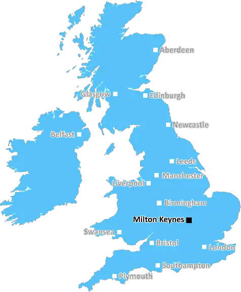
Milton Keynes (MK8)
The MK8 postcode area is located in the Milton Keynes postcode town region, within the county of Buckinghamshire, and contains a total of 550 individual postcodes.
There are 6 electoral wards in the MK8 postcode area, including Bedford, Buckingham, Milton Keynes, Newport Pagnell, Olney which come under the local authority of the Milton Keynes Council.
Combining the whole postcode region, 32% of people in MK8 are classed as having an AB social grade, (i.e. 'white-collar' middle-upper class), compared to 27% across the UK.
This does not mean that the people of MK8 are wealthier - or higher class - than average, but it can be an indication that the area may be prospering and desirable to live in.
The MK8 postcode is located within the Milton Keynes district in Buckinghamshire, England. It covers a wide area including the villages of Shenley Church End, Great Linford and the city of Stony Stratford.
In terms of the local environment, MK8 is an urban area of the Milton Keynes district that is close to open countryside, with plenty of green space for outdoor activities. There is a diverse range of housing in the area, from small terraces and family homes to larger and more contemporary developments. In terms of leisure and recreation activities, parks, public golf courses, and a variety of sporting and leisure facilities are located within the district.
In terms of transport links, MK8 is well served by the M1 motorway and A5, there are frequent bus services to other parts of the district and the city centre. The West Coast Mainline runs through the area. Milton Keynes Central train station is also easy to access from the postcode.
The postcode covers a number of educational establishments such as Shenley Church End Primary School, Stony Stratford Primary School, and Stony Stratford CofE (C) Junior School. Further education for older students can be found at Campbell Park Stony Stratford Community College and other nearby schools or colleges.
The area also has a wide variety of shops, restaurants, cafes and other amenities, such as grocery stores and convenience stores, chemists and banks, making it easy to access the essentials.
In terms of healthcare, the postcode also has convenient access to medical services. Some of the local Medical Centres, dentists and opticians include Stony Stratford Health Centre, MK23 Medical Centre, Mydentist Stony Stratford and CC Contacts Opticians, among many others.
The MK8 postcode provides an ideal balance between urban convenience and rural living. With plenty of amenities, educational institutions, leisure activities, transport links and healthcare services, it is an excellent choice for those looking for a good quality of life.

Demographics

Buckinghamshire

MK8 is located in the county of Buckinghamshire, in England.
Buckinghamshire has a total population of 799,200, making it the 30th largest county in the UK.
Buckinghamshire has a total area of 723 square miles, and a population density of 426 people per square kilometre. For comparison, Greater London has a density of 5,618 people/km2.
| Outward Code | MK8 |
| Postal Town | Milton Keynes |
| MSOA Name | Milton Keynes 020 |
| LSOA Name | Milton Keynes 020D |
| County | Buckinghamshire |
| Region | Buckinghamshire |
| Country | England |
| Local Authority | Milton Keynes |
| Area Classification | Urban with City and Town |
MK8 Electoral Wards
The postal region of MK8, includes the local towns, villages, electoral wards and stations of:
Dig even deeper into the MK8 postcode by clicking on a postcode below:
Click on an outward postal code below for more information about the area. Each 'outward' postcode give you a comprehensive list of all postcodes within the outward code area (MK) and estimated address.
Click on an 'outward' code for more information. For example, the outward postcode page 'EC2M' will give you an alphabetical list covering all postcodes located in the region, from 'EC2M 1BB' through to 'EC2M 7YA'.
Chris H
Sunday, April 7, 2024
We don't have any views of MK8 right now. If you live in MK8 or have visited it, please help us to help others by telling others what you think of this neighbourhood.
Add your view of MK8
People need your local expertise. If you live in MK8 or have first-hand knowledge of the neighbourhood, please consider sharing your views. It's completely anonymous - all we ask is for your initials.
Please tell us what you like about the MK8 postcode area, what you don't like, and what it's like to live or work here.
| LOCAL AMENITIES | |
| FAMILY FRIENDLY | |
| PARKING | |
| GREEN SPACES |
Local News Buckinghamshire
Sellar gets green light for Hertfordshire media facility
The developer has designed the scheme to appeal to the media sector, as well as being appropriate for logistics, warehousing and data centre uses.
Property WeekLuton Airport operating company buys hangars of collapsed airline Monarch
Hangars can accommodate wide body jets up to the size of a Boeing 767.
Property WeekMilton Keynes seeks developer for 174-home scheme
The Milton Keynes site occupies 15.6 acres of land with an additional 7.2 acres of green space.
Property WeekFour-year-old girl and mum missing, say police
The pair were last seen at their home in February and have links to Birmingham, police say.
BBC NewsHow a hard-boiled egg could determine Wembley glory
Kevin Chapman is going to be egging on Peterborough United in the EFL Trophy final on Sunday.
BBC NewsBoreham Wood 4-0 Wealdstone
Boreham Wood thump Wealdstone in a huge match at the bottom of the National League table.
BBC NewsPaddington hotel to go under the hammer for 16m at Strettons' April auction
The asset is among the highest-valued lots ever to be offered at an auction in the UK.
Property WeekRunning 5k every day while fasting during Ramadan
Bilal Hussain took on the challenge to raise money for Luton Food Bank.
BBC NewsFrom the Postcode Area blog

Deciphering Crime Rates - a Deep Dive Into UK Postcode Analysis
Ever wondered about the crime rate in your UK postcode? You're not alone. We've dug deep into the data, uncovering trends and patterns that'll make your head spin.

Death of the High Street?
The BBC reports that despite councils' attempts to kurb them, the UK's high streets have seen a huge growth in fast food outlets. Could this mark the death knell for the Great British high street, and what can we do about it to halt its decline?

Discrimination by Postcode
You really couldn't make it up, could you? Some of the country's most vulnerable people are missing out on their weekly £25 Cold Weather Payment, just because the system that's in operation is discriminating against them because payments are based on postcode, rather than geographic location.

The Redesign is Underway
Well, the current website was absolutely in dire need of a good redesign - from the ground up. So I set out to pull it all apart and get it up and running again to become the most comprehensive guide to every postcode in the UK. And it's been a long, tough job from start to finish - and quite possibly the biggest project I've ever undertaken.
SOCIAL GRADES
According to census records, 32% of people here have a social grade of AB (highest), compared to the national average of 27%.