milton-keynes MK45 Postcodes
Spending a fortune on conveyancing?

Compare instant, low-cost online quotes from trusted conveyancing solicitors.
Backed by experts, our no-obligation service searches through the best conveyancing quotes on the market to save you time and money.
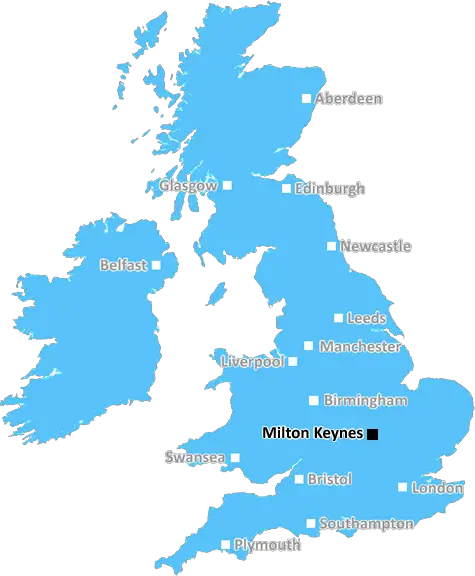
Milton Keynes (MK45)
The MK45 postcode area is located in the Milton Keynes postcode town region, within the county of Bedfordshire, and contains a total of 1614 individual postcodes.
There are 63 electoral wards in the MK45 postcode area, including Bedford, Buckingham, Milton Keynes, Newport Pagnell, Olney which come under the local authority of the Central Bedfordshire Council.
Combining the whole postcode region, 30% of people in MK45 are classed as having an AB social grade, (i.e. 'white-collar' middle-upper class), compared to 27% across the UK.
This does not mean that the people of MK45 are wealthier - or higher class - than average, but it can be an indication that the area may be prospering and desirable to live in.
The MK45 postcode is located in the Milton Keynes district of the United Kingdom. It encompasses a wide variety of different towns and villages, all within 30 miles of the city centre. The postcode district lies within the county of Bedfordshire and is bordered by the MK40, MK44, MK46, MK41, MK39, and NN19 postcodes.
Within the MK45 postcode zone, Bedfordshire is the predominant English county and most of its settlements fall into the district of Milton Keynes, including the main village of Flitton. Flitton boasts a wide range of services and amenities, such as a post office, village hall, nearby park and garden centre, local school, and an Anglican church. Other settlements in the MK45 postcode area include Ampthill, Carlton, Upper Shelton, Lower Shelton, and Chaul End.
The landscape of the postcode is made up primarily of rural farmland, interspersed with small villages, hamlets, and local woodland. It also incorporates a section of the Grand Union Canal, and there are a number of nature reserves in the area that are home to a variety of wildlife.
In terms of transport, the MK45 postcode zone is serviced by a selection of bus routes, with connections available to Bedford, Luton, and Northampton. Its proximity to the M1 motorway and major A-roads also provide access to a number of larger destinations. Other modes of transport include several cycleways, and Great Train Links, with Ashwell and Morden and Bedford railway stations both within close reach.
The MK45 postcode zone is home to a number of events throughout the year, including the Bedford to Ampthill Classic Car Run, the Ampthill Flair Festival, and the Ampthill Fair on the Square. It has a range of accommodation options for visitors, including camp sites, bed and breakfasts, and family-run guesthouses.
Generally, the MK45 postcode area is a peaceful and safe district, with low levels of crime and plenty of outdoor activities to get involved in. It has stunning views, charming villages, and plenty of opportunities for outdoor recreation.

Demographics

Bedfordshire

MK45 is located in the county of Bedfordshire, in England.
Bedfordshire has a total population of 664,500, making it the 36th largest county in the UK.
Bedfordshire has a total area of 477 square miles, and a population density of 537 people per square kilometre. For comparison, Greater London has a density of 5,618 people/km2.
| Outward Code | MK45 |
| Postal Town | Milton Keynes |
| MSOA Name | Central Bedfordshire 015 |
| LSOA Name | Central Bedfordshire 015A |
| County | Bedfordshire |
| Region | Bedfordshire |
| Country | England |
| Local Authority | Central Bedfordshire |
| Area Classification | Largely Rural (rural including hub towns 50-79%) |
MK45 Electoral Wards
The postal region of MK45, includes the local towns, villages, electoral wards and stations of:
Dig even deeper into the MK45 postcode by clicking on a postcode below:
Click on an outward postal code below for more information about the area. Each 'outward' postcode give you a comprehensive list of all postcodes within the outward code area (MK) and estimated address.
Click on an 'outward' code for more information. For example, the outward postcode page 'EC2M' will give you an alphabetical list covering all postcodes located in the region, from 'EC2M 1BB' through to 'EC2M 7YA'.
Chris H
Sunday, April 7, 2024
We don't have any views of MK45 right now. If you live in MK45 or have visited it, please help us to help others by telling others what you think of this neighbourhood.
Add your view of MK45
People need your local expertise. If you live in MK45 or have first-hand knowledge of the neighbourhood, please consider sharing your views. It's completely anonymous - all we ask is for your initials.
Please tell us what you like about the MK45 postcode area, what you don't like, and what it's like to live or work here.
| LOCAL AMENITIES | |
| FAMILY FRIENDLY | |
| PARKING | |
| GREEN SPACES |
Local News Bedfordshire
Forest Green Rovers 0-2 Milton Keynes Dons
MK Dons' automatic promotion hopes are handed a boost as goals in each half from Max Dean and Alex Gilbey sealed a 2-0 League Two win at bottom club Forest Green.
BBC NewsA huge victory' - Morris' 90th-minute goal lifts Luton
Carlton Morris' late winner boosts Luton's Premier League survival hopes as they come from behind to beat Bournemouth.
BBC NewsJust forgotten': The adults who can't read
Sue Warden is Coordinator at Readeasy in Milton Keynes which helps adults with literacy.
BBC NewsFour-year-old girl and mum missing, say police
The pair were last seen at their home in February and have links to Birmingham, police say.
BBC NewsHotel refugees 'gone by end of June', says MP
MP Andrew Selous says the Home Office has terminated its contract with the hotel.
BBC News99 for a private ambulance in Hertfordshire
MET Medical has launched the service for St Albans, Harpenden, Hatfield and Welwyn.
BBC NewsPrivate ambulance service aims to reduce NHS waits
It charges users to call a healthcare professional to their home for urgent but non-emergency cases.
BBC NewsNo hosepipe ban, says Anglian Water
Anglian Water says it has no plans to restrict the use of hosepipes this summer.
BBC NewsFrom the Postcode Area blog

Deciphering Crime Rates - a Deep Dive Into UK Postcode Analysis
Ever wondered about the crime rate in your UK postcode? You're not alone. We've dug deep into the data, uncovering trends and patterns that'll make your head spin.

Death of the High Street?
The BBC reports that despite councils' attempts to kurb them, the UK's high streets have seen a huge growth in fast food outlets. Could this mark the death knell for the Great British high street, and what can we do about it to halt its decline?

Discrimination by Postcode
You really couldn't make it up, could you? Some of the country's most vulnerable people are missing out on their weekly £25 Cold Weather Payment, just because the system that's in operation is discriminating against them because payments are based on postcode, rather than geographic location.

The Redesign is Underway
Well, the current website was absolutely in dire need of a good redesign - from the ground up. So I set out to pull it all apart and get it up and running again to become the most comprehensive guide to every postcode in the UK. And it's been a long, tough job from start to finish - and quite possibly the biggest project I've ever undertaken.
SOCIAL GRADES
According to census records, 30% of people here have a social grade of AB (highest), compared to the national average of 27%.