medway ME7 Postcodes
Spending a fortune on conveyancing?

Compare instant, low-cost online quotes from trusted conveyancing solicitors.
Backed by experts, our no-obligation service searches through the best conveyancing quotes on the market to save you time and money.
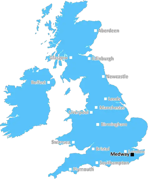
Medway (ME7)
The ME7 postcode area is located in the Medway postcode town region, within the county of Kent, and contains a total of 1393 individual postcodes.
There are 19 electoral wards in the ME7 postcode area, including Aylesford, Chatham, Faversham, Gillingham, Maidstone, Queenborough, Rochester, Sheerness, Sittingbourne, Snodland, West Malling which come under the local authority of the Medway Council.
Combining the whole postcode region, 17% of people in ME7 are classed as having an AB social grade, (i.e. 'white-collar' middle-upper class), compared to 27% across the UK.
This does not mean that the people of ME7 are poorer than other areas, but it may give an indication that there are areas of deprivation.
ME7 is a postcode located in the Medway Towns in Kent, in the south eastern region of England. Covering the area between the Towns of Strood, Rochester, Chatham and Gillingham, the postcode is bisected by the M2 motorway and is comprises of the ME7, ME7 4, ME7 6, ME7 8 and ME7 9 postcodes, each of which are further divided to allow for specific delivery to be made.
The postcode was created in the late 1960s following a massive expansion in the Medway Towns as part of the overspill population move from the larger cities. This dramatic surge in population necessitated a much needed update to the local postal system, with the changes in postcodes introduced in 1974. Prior to this, the area was covered by a mixture of postcodes many of which were allocated by towns or local districts.
The postcode is home to a large variety of industries, amenities and local attractions, with manufacturing being particularly prevalent. Major companies such as W.H. Smith Publishing, and medical suppliers, Smiths Medical, have their headquarters here.
ME7 is well-connected for commuters, with some of the country's busiest roads running through it. The M2 motorway, connecting Dover to London, runs through the district, as does the main London to Faversham mainline railway. The nearby Chatham and Maidstone East railway stations, offer services to London Bridge and Canterbury West respectively.
The area has a cultural wealth, with attractions such as the Historic Dockyards at Chatham, a variety of museums, and some fantastic parks to explore. The area is also a fantastic location for sports, with six football clubs based in the district, and plenty of other local teams to choose from.
Beyond sports, Medway also has the world's largest collection of preserved warships, the Royal Navy Reserve of ships, the Eltham Palace, the Napoleon Stables at Chatham, and the Turkish Sultans Baths in Strood.
For shopping, the city of Chatham boasts an impressive range of retail outlets, in addition to Rochester High Street, and the out of town shopping mall at Gillingham, which includes many large retail chains such as Next, Debenhams and Boots.
ME7 is an exciting, diverse and vibrant postcode that provides all the benefits of city living whilst still being close to the countryside, making it an ideal spot for both working and leisure time.

Demographics

Kent

ME7 is located in the county of Kent, in England.
Kent has a total population of 1,820,400, making it the 6th largest county in the UK.
Kent has a total area of 1443 square miles, and a population density of 486 people per square kilometre. For comparison, Greater London has a density of 5,618 people/km2.
| Outward Code | ME7 |
| Postal Town | Medway |
| MSOA Name | Medway 012 |
| LSOA Name | Medway 012D |
| County | Kent |
| Region | Kent |
| Country | England |
| Local Authority | Medway |
| Area Classification | Urban with City and Town |
ME7 Electoral Wards
The postal region of ME7, includes the local towns, villages, electoral wards and stations of:
Dig even deeper into the ME7 postcode by clicking on a postcode below:
Click on an outward postal code below for more information about the area. Each 'outward' postcode give you a comprehensive list of all postcodes within the outward code area (ME) and estimated address.
Click on an 'outward' code for more information. For example, the outward postcode page 'EC2M' will give you an alphabetical list covering all postcodes located in the region, from 'EC2M 1BB' through to 'EC2M 7YA'.
Chris H
Wednesday, April 10, 2024
We don't have any views of ME7 right now. If you live in ME7 or have visited it, please help us to help others by telling others what you think of this neighbourhood.
Add your view of ME7
People need your local expertise. If you live in ME7 or have first-hand knowledge of the neighbourhood, please consider sharing your views. It's completely anonymous - all we ask is for your initials.
Please tell us what you like about the ME7 postcode area, what you don't like, and what it's like to live or work here.
| LOCAL AMENITIES | |
| FAMILY FRIENDLY | |
| PARKING | |
| GREEN SPACES |
Local News Kent
Families visiting graves don't want to hear people drinking and laughing'
A vineyard will now be able to hold wine-tasting events - despite fears mourners at a neighbouring church graveyard will be disturbed.
Kent OnlineMixed-use London freehold to lead Allsop's March residential auction
Thefreeholdbuilding in Hampstead is guided at 2.5m-plus.
Property WeekMajority of trains cancelled due to rail strikes
Trains are running on the four routes in Kent as Aslef resumes strikes over pay and conditions.
BBC NewsArt by asylum-seeking children to go on show
The 'Leave to Remain' display in Margate showcases work from teenagers supported by a local charity.
BBC NewsThe truth behind the 'James Bond' boat in Kent harbour
A boat likened to a vessel befitting 007 has caused a stir after appearing in a Kent harbour.
Kent OnlineKent sign Swanepoel after Bartlett deal called off
South African all-rounder Beyers Swanepoel is to join Kent after Xavier Bartlett's deal falls through.
BBC NewsJohnson & Johnson signs lease at Tempo in Maidenhead
The pharmaceuticals giantwill move staff from its Thames Valley campuses in High Wycombe and Pinewood to the L&G-owned building.
Property WeekIt's meant to be a beautiful urban oasis but it's a polluted eyesore'
Fishing tackle, syringes, traffic cones, soiled underwear and drink bottles and cans were just some of the things found in a litter-strewn millpond.
Kent OnlineFrom the Postcode Area blog

Deciphering Crime Rates - a Deep Dive Into UK Postcode Analysis
Ever wondered about the crime rate in your UK postcode? You're not alone. We've dug deep into the data, uncovering trends and patterns that'll make your head spin.

Death of the High Street?
The BBC reports that despite councils' attempts to kurb them, the UK's high streets have seen a huge growth in fast food outlets. Could this mark the death knell for the Great British high street, and what can we do about it to halt its decline?

Discrimination by Postcode
You really couldn't make it up, could you? Some of the country's most vulnerable people are missing out on their weekly £25 Cold Weather Payment, just because the system that's in operation is discriminating against them because payments are based on postcode, rather than geographic location.

The Redesign is Underway
Well, the current website was absolutely in dire need of a good redesign - from the ground up. So I set out to pull it all apart and get it up and running again to become the most comprehensive guide to every postcode in the UK. And it's been a long, tough job from start to finish - and quite possibly the biggest project I've ever undertaken.
SOCIAL GRADES
According to census records, 17% of people here have a social grade of AB (highest), compared to the national average of 27%.