medway ME15 Postcodes
Spending a fortune on conveyancing?

Compare instant, low-cost online quotes from trusted conveyancing solicitors.
Backed by experts, our no-obligation service searches through the best conveyancing quotes on the market to save you time and money.
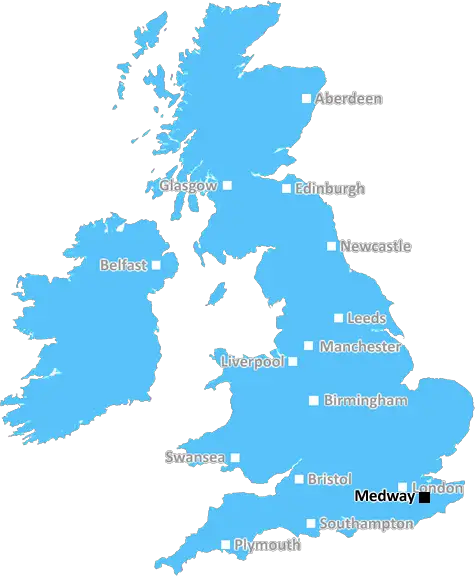
Medway (ME15)
The ME15 postcode area is located in the Medway postcode town region, within the county of Kent, and contains a total of 1657 individual postcodes.
There are 39 electoral wards in the ME15 postcode area, including Aylesford, Chatham, Faversham, Gillingham, Maidstone, Queenborough, Rochester, Sheerness, Sittingbourne, Snodland, West Malling which come under the local authority of the Maidstone Council.
Combining the whole postcode region, 21% of people in ME15 are classed as having an AB social grade, (i.e. 'white-collar' middle-upper class), compared to 27% across the UK.
This does not mean that the people of ME15 are poorer than other areas, but it may give an indication that there are areas of deprivation.
The ME15 postcode is located in the Medway district, which is within the county of Kent in South East England. The postcode includes the towns of Yalding, Laddingford, East Malling, West Malling and Kings Hill.
Yalding is a sprawling village along the River Medway and is famed for its locks, which include the world's oldest operating pair of locks. The village is known for its beautiful countryside, traditional pubs and its wide range of activities, including boating trips along its infamous waterways, which are still popular among tourists and locals alike. Yalding is also home to the popular medieval church of St. Peter's, which is a Grade I listed building.
The other towns in the ME15 postcode area � Laddingford, East Malling and West Malling � all have interesting histories of their own. Laddingford, for instance, is home to one of the oldest important castles in England, and East Malling has a strong historical connection to its apple-growing industry. West Malling is home to the renowned West Malling Heritage Centre, which provides visitors with a unique insight into the past of the town.
Kings Hill is the largest town in the ME15 postcode and was developed as a rural village in 1997 by Kent County Council. The town offers a range of residential and business locations including a business park, and is home to a variety of features such as the popular Kings Hill Adventure Park, the Kings Hill Sports Park, and a Sports Centre. Kings Hill is home to some of the finest schools in Kent, with a range of good, outstanding and highly performing establishments available.
The ME15 postcode area also includes some lovely countryside spots. The East Malling Trust Nature Reserve, located on the Parish boundary of East Malling and Laddingford, is a gorgeous site with an abundance of wildlife and a lovely woodland area for exploring. All of the towns in the postcode area are part of a borough called Tonbridge & Malling, which offers plenty of cultural attractions, including a wine and spirit festival, a cider festival, poetry and literature festivals, and amazing shopping opportunities.

Demographics

Kent

ME15 is located in the county of Kent, in England.
Kent has a total population of 1,820,400, making it the 6th largest county in the UK.
Kent has a total area of 1443 square miles, and a population density of 486 people per square kilometre. For comparison, Greater London has a density of 5,618 people/km2.
| Outward Code | ME15 |
| Postal Town | Medway |
| MSOA Name | Maidstone 016 |
| LSOA Name | Maidstone 016D |
| County | Kent |
| Region | Kent |
| Country | England |
| Local Authority | Maidstone |
| Area Classification | Urban with Significant Rural (rural including hub towns 26-49%) |
ME15 Electoral Wards
The postal region of ME15, includes the local towns, villages, electoral wards and stations of:
Dig even deeper into the ME15 postcode by clicking on a postcode below:
Click on an outward postal code below for more information about the area. Each 'outward' postcode give you a comprehensive list of all postcodes within the outward code area (ME) and estimated address.
Click on an 'outward' code for more information. For example, the outward postcode page 'EC2M' will give you an alphabetical list covering all postcodes located in the region, from 'EC2M 1BB' through to 'EC2M 7YA'.
Chris H
Sunday, April 7, 2024
We don't have any views of ME15 right now. If you live in ME15 or have visited it, please help us to help others by telling others what you think of this neighbourhood.
Add your view of ME15
People need your local expertise. If you live in ME15 or have first-hand knowledge of the neighbourhood, please consider sharing your views. It's completely anonymous - all we ask is for your initials.
Please tell us what you like about the ME15 postcode area, what you don't like, and what it's like to live or work here.
| LOCAL AMENITIES | |
| FAMILY FRIENDLY | |
| PARKING | |
| GREEN SPACES |
Local News Kent
TT Group sells Southampton industrial units for 5.7m
The 1.85-acre siteis split into two self-contained units, one let to Sentry Self Storage and the other to Active Freight Management.
Property WeekCarter Jonas opens first Kent office
The office will be lead by Steven Drennan, a partner in Carter Jonas's infrastructure team.
Property WeekGames retailer signs HQ pre-let at London Brentwood Commercial Park
Wayland Games will occupy the space at Goodman's Essex development from 2025.
Property WeekMan charged over 300 thefts at Co-op and Tesco stores
A man is in court following a spate of thefts from several convenience stores in towns across the county.
Kent OnlineAnother blow for theme park plans as key figure quits 2.5bn project
Another leading figure behind ambitious plans to build a multi-billion pound entertainment park in the county has quit.
Kent OnlineMotorcyclist dies in crash with car
The driver of the motorcycle died at the scene in Kent, police say.
BBC NewsL&G acquires Cambridgeshire BTR scheme from Stonebond
The 41-unit development comprises 10 flats and 31 houses.
Property WeekWeston Homes gets go-ahead for 33m resi scheme in Epping
The project will see the development of 62 homes and almost five acres of open space.
Property WeekFrom the Postcode Area blog

Deciphering Crime Rates - a Deep Dive Into UK Postcode Analysis
Ever wondered about the crime rate in your UK postcode? You're not alone. We've dug deep into the data, uncovering trends and patterns that'll make your head spin.

Death of the High Street?
The BBC reports that despite councils' attempts to kurb them, the UK's high streets have seen a huge growth in fast food outlets. Could this mark the death knell for the Great British high street, and what can we do about it to halt its decline?

Discrimination by Postcode
You really couldn't make it up, could you? Some of the country's most vulnerable people are missing out on their weekly £25 Cold Weather Payment, just because the system that's in operation is discriminating against them because payments are based on postcode, rather than geographic location.

The Redesign is Underway
Well, the current website was absolutely in dire need of a good redesign - from the ground up. So I set out to pull it all apart and get it up and running again to become the most comprehensive guide to every postcode in the UK. And it's been a long, tough job from start to finish - and quite possibly the biggest project I've ever undertaken.
SOCIAL GRADES
According to census records, 21% of people here have a social grade of AB (highest), compared to the national average of 27%.