medway ME13 Postcodes
Spending a fortune on conveyancing?

Compare instant, low-cost online quotes from trusted conveyancing solicitors.
Backed by experts, our no-obligation service searches through the best conveyancing quotes on the market to save you time and money.
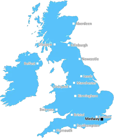
Medway (ME13)
The ME13 postcode area is located in the Medway postcode town region, within the county of Kent, and contains a total of 1222 individual postcodes.
There are 88 electoral wards in the ME13 postcode area, including Aylesford, Chatham, Faversham, Gillingham, Maidstone, Queenborough, Rochester, Sheerness, Sittingbourne, Snodland, West Malling which come under the local authority of the Swale Council.
Combining the whole postcode region, 27% of people in ME13 are classed as having an AB social grade, (i.e. 'white-collar' middle-upper class), compared to 27% across the UK.
This does not mean that the people of ME13 are poorer than other areas, but it may give an indication that there are areas of deprivation.
The ME13 postcode is part of the Medway district, a local government district in north Kent, England. It is situated on the west bank of River Medway, south of Swale and north of Maidstone.
The ME13 postcode refers to an area that covers the towns of Faversham, Sittingbourne and Sheppey, as well as the smaller settlements of the Blean, Grove, Iwade, Lynsted, Norton and Oare. This area is home to around 60,000 people, making it the second-most populous district in the Medway towns, after Chatham and Gillingham.
Faversham is a historic market town with an attractive centre and a wide range of amenities. Sittingbourne also has a bustling centre, while Sheppey offers a diverse landscape of marshland, farmland, shingle beaches and scenic coastline.
The postcode also serves a number of rural villages surrounding these three towns, including Bapchild, Bredgar, Davington, Murston, Newington, Rodmersham and Teynham.
ME13 is home to many cultural attractions such as the historic Fleur de Lis Heritage Centre in Faversham, the Sittingbourne Heritage Museum and the Goods Shed at Sittingbourne Station. It also has a range of outdoor activities like golf, fishing, bird watching and walking trails.
Moreover, education in the area is well-served by a variety of educational institutions such as Faversham College, New Line Learning Academy and Oare Primary School, among others. Shopping, leisure and recreational facilities are also available in the area, including Swale Film House in Faversham, Sheppey Leisure Complex and Mote Park in Sittingbourne.
Transport links in the area are good, with regular buses to Faversham, Sittingbourne and Maidstone, along with trains to London and other places in the Medway Towns. It is also conveniently located close to the M2 motorway.

Demographics

Kent

ME13 is located in the county of Kent, in England.
Kent has a total population of 1,820,400, making it the 6th largest county in the UK.
Kent has a total area of 1443 square miles, and a population density of 486 people per square kilometre. For comparison, Greater London has a density of 5,618 people/km2.
| Outward Code | ME13 |
| Postal Town | Medway |
| MSOA Name | Swale 016 |
| LSOA Name | Swale 016A |
| County | Kent |
| Region | Kent |
| Country | England |
| Local Authority | Swale |
| Area Classification | Largely Rural (rural including hub towns 50-79%) |
ME13 Electoral Wards
The postal region of ME13, includes the local towns, villages, electoral wards and stations of:
Dig even deeper into the ME13 postcode by clicking on a postcode below:
Click on an outward postal code below for more information about the area. Each 'outward' postcode give you a comprehensive list of all postcodes within the outward code area (ME) and estimated address.
Click on an 'outward' code for more information. For example, the outward postcode page 'EC2M' will give you an alphabetical list covering all postcodes located in the region, from 'EC2M 1BB' through to 'EC2M 7YA'.
Chris H
Sunday, April 7, 2024
We don't have any views of ME13 right now. If you live in ME13 or have visited it, please help us to help others by telling others what you think of this neighbourhood.
Add your view of ME13
People need your local expertise. If you live in ME13 or have first-hand knowledge of the neighbourhood, please consider sharing your views. It's completely anonymous - all we ask is for your initials.
Please tell us what you like about the ME13 postcode area, what you don't like, and what it's like to live or work here.
| LOCAL AMENITIES | |
| FAMILY FRIENDLY | |
| PARKING | |
| GREEN SPACES |
Local News Kent
Places for People acquires Rosewood Housing
The affordable homes provider was previously owned by housing developer Inland Homes.
Property WeekJohnson & Johnson signs lease at Tempo in Maidenhead
The pharmaceuticals giantwill move staff from its Thames Valley campuses in High Wycombe and Pinewood to the L&G-owned building.
Property WeekCan Surrey be beaten as County Championship returns?
With the new County Championship season starting on Friday, can anyone prevent Surrey winning a third straight title?
BBC NewsResidents baffled by diabolical' new parking permit scheme
Frustrated residents have branded a council's new parking permit scheme "diabolical" just days after it was launched.
Kent OnlineSavills bolsters Chelmsford office with return of senior development director
Kibblewhite originally joined the agency in 1990 and spent 16 years working there.
Property WeekCare home pulls out of Kent asylum-seeker deal
The Sheppey property will no longer open as a temporary home for asylum-seeking children.
BBC NewsJust because I'm gay and have MS doesn't mean I can't foster'
A foster carer who is gay and has multiple sclerosis (MS) is urging people not to rule out fostering over fears they are not the right fit.
Kent OnlineStarbucks partner signs lease at Prologis Park Hemel Hempstead
Food Service Logisticshas agreed a 15-year lease at the161,134 sq ftdistribution centre.
Property WeekFrom the Postcode Area blog

Deciphering Crime Rates - a Deep Dive Into UK Postcode Analysis
Ever wondered about the crime rate in your UK postcode? You're not alone. We've dug deep into the data, uncovering trends and patterns that'll make your head spin.

Death of the High Street?
The BBC reports that despite councils' attempts to kurb them, the UK's high streets have seen a huge growth in fast food outlets. Could this mark the death knell for the Great British high street, and what can we do about it to halt its decline?

Discrimination by Postcode
You really couldn't make it up, could you? Some of the country's most vulnerable people are missing out on their weekly £25 Cold Weather Payment, just because the system that's in operation is discriminating against them because payments are based on postcode, rather than geographic location.

The Redesign is Underway
Well, the current website was absolutely in dire need of a good redesign - from the ground up. So I set out to pull it all apart and get it up and running again to become the most comprehensive guide to every postcode in the UK. And it's been a long, tough job from start to finish - and quite possibly the biggest project I've ever undertaken.
SOCIAL GRADES
According to census records, 27% of people here have a social grade of AB (highest), compared to the national average of 27%.