manchester M2 Postcodes
Spending a fortune on conveyancing?

Compare instant, low-cost online quotes from trusted conveyancing solicitors.
Backed by experts, our no-obligation service searches through the best conveyancing quotes on the market to save you time and money.
Manchester (M2)
The M2 postcode area is located in the Manchester postcode town region, within the county of Greater Manchester, and contains a total of 682 individual postcodes.
There are 0 electoral wards in the M2 postcode area, including Manchester, Sale, Salford which come under the local authority of the Manchester Council.
Combining the whole postcode region, 41% of people in M2 are classed as having an AB social grade, (i.e. 'white-collar' middle-upper class), compared to 27% across the UK.
This does not mean that the people of M2 are wealthier - or higher class - than average, but it can be an indication that the area may be prospering and desirable to live in.
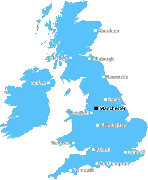
The M2 postcode is located in the centre of Manchester, UK. Covering a relatively small geographic area, largely enclosed within the M60 ring road that circles the city centre, it covers much of the geographical heart of Manchester.
As the commercial centre of the city, this area is home to a range of large businesses, transport and leisure facilities that make it an important centre for many of the city's inhabitants. Its main attractions include the flagship stores of the Trafford Centre, Manchester Arena, Piccadilly Train Station, Manchester Arndale, and a wide selection of restaurants, shops and bars.
M2 is also conveniently located for access to Manchester's main universities, such as the University of Manchester, and its main hospitals, including the Manchester Royal Infirmary, St Mary's Hospital, and Manchester Children's Hospital.
Home to a diverse range of cultures, the M2 postcode is often referred to as �the Village', due to its strong identity among residents, and the community spirit that is often observed amongst the local population.
In terms of accommodation, the M2 postcode caters for a range of housing needs, from city centre luxury apartments to more affordable mid and lower range properties. The location is also well served by a number of bus routes and Metrolink services, making getting around the city easy.
Manchester's Media City, located just north of M2, is also of great importance to the local area. Home to the BBC and ITV studios, the area is a major media hub for the North-West and includes the iconic �floating' tree lined pedestrian bridge.
The M2 postcode has grown significantly in recent years, becoming a central hub for many of the city's events, from large scale concerts and festivals, to educational and professional conferences. It is a postcode that provides a range of services, activities and amenities to many of Manchester's inhabitants, and is a key part of Manchester's thriving and diverse city centre.

Demographics
Greater Manchester

M2 is located in the county of Greater Manchester, in England.
Greater Manchester has a total population of 2,782,100, making it the 3rd largest county in the UK.
Greater Manchester has a total area of 492 square miles, and a population density of 2180 people per square kilometre. For comparison, Greater London has a density of 5,618 people/km2.
| Outward Code | M2 |
| Postal Town | Manchester |
| MSOA Name | Manchester 054 |
| LSOA Name | Manchester 054C |
| County | Greater Manchester |
| Region | Greater Manchester |
| Country | England |
| Local Authority | Manchester |
| Area Classification | Urban with Major Conurbation |
M2 Electoral Wards
The postal region of M2, includes the local towns, villages, electoral wards and stations of:
Dig even deeper into the M2 postcode by clicking on a postcode below:
Click on an outward postal code below for more information about the area. Each 'outward' postcode give you a comprehensive list of all postcodes within the outward code area (M) and estimated address.
Click on an 'outward' code for more information. For example, the outward postcode page 'EC2M' will give you an alphabetical list covering all postcodes located in the region, from 'EC2M 1BB' through to 'EC2M 7YA'.
Chris H
Monday, April 8, 2024
We don't have any views of M2 right now. If you live in M2 or have visited it, please help us to help others by telling others what you think of this neighbourhood.
Add your view of M2
People need your local expertise. If you live in M2 or have first-hand knowledge of the neighbourhood, please consider sharing your views. It's completely anonymous - all we ask is for your initials.
Please tell us what you like about the M2 postcode area, what you don't like, and what it's like to live or work here.
| LOCAL AMENITIES | |
| FAMILY FRIENDLY | |
| PARKING | |
| GREEN SPACES |
From the Postcode Area blog

Deciphering Crime Rates - a Deep Dive Into UK Postcode Analysis
Ever wondered about the crime rate in your UK postcode? You're not alone. We've dug deep into the data, uncovering trends and patterns that'll make your head spin.

Death of the High Street?
The BBC reports that despite councils' attempts to kurb them, the UK's high streets have seen a huge growth in fast food outlets. Could this mark the death knell for the Great British high street, and what can we do about it to halt its decline?

Discrimination by Postcode
You really couldn't make it up, could you? Some of the country's most vulnerable people are missing out on their weekly £25 Cold Weather Payment, just because the system that's in operation is discriminating against them because payments are based on postcode, rather than geographic location.

The Redesign is Underway
Well, the current website was absolutely in dire need of a good redesign - from the ground up. So I set out to pull it all apart and get it up and running again to become the most comprehensive guide to every postcode in the UK. And it's been a long, tough job from start to finish - and quite possibly the biggest project I've ever undertaken.
SOCIAL GRADES
According to census records, 41% of people here have a social grade of AB (highest), compared to the national average of 27%.