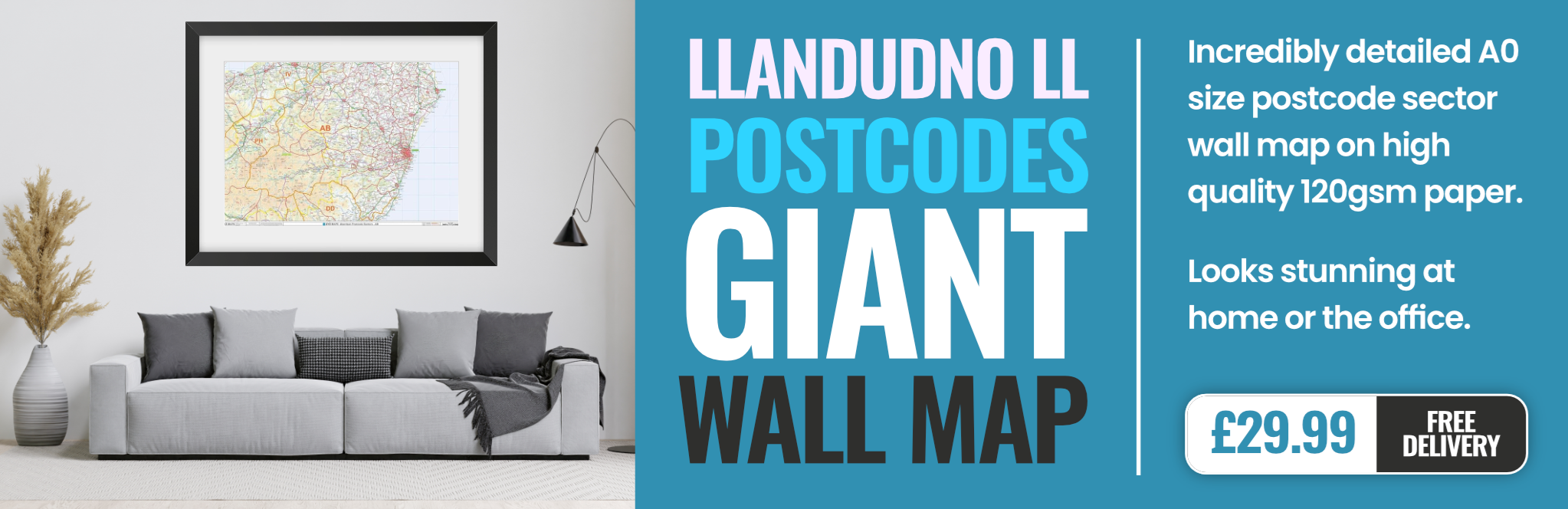
llandudno LL55 Postcodes
Spending a fortune on conveyancing?

Compare instant, low-cost online quotes from trusted conveyancing solicitors.
Backed by experts, our no-obligation service searches through the best conveyancing quotes on the market to save you time and money.
Llandudno (LL55)
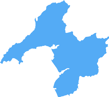
The LL55 postcode area is located in the Llandudno postcode town region, within the county of Gwynedd, and contains a total of 967 individual postcodes.
There are 90 electoral wards in the LL55 postcode area, including Aberdovey, Abergele, Amlwch, Arthog, Bala, Bangor, Barmouth, Beaumaris, Betws-Y-Coed, Blaenau Ffestiniog, Bodorgan, Brynteg, Caernarfon, Cemaes Bay, Colwyn Bay, Conwy, Corwen, Criccieth, Denbigh, Dolgellau, Dolwyddelan, Dulas, Dyffryn Ardudwy, Fairbourne, Gaerwen, Garndolbenmaen, Harlech, Holyhead, Llanbedr, Llanbedrgoch, Llandudno, Llandudno Junction, Llanerchymedd, Llanfairfechan, Llanfairpwllgwyngyll, Llangefni,Llangollen, Llanrwst, Llwyngwril, Marianglas, Menai Bridge, Moelfre, Penmaenmawr, Penrhyndeudraeth, Pentraeth, Penysarn, Porthmadog, Prestatyn, Pwllheli, Rhosgoch, Rhosneigr, Rhyl, Ruthin, St Asaph, Talsarnau, Talybont, Trefriw, Ty Croes, Tyn-Y-Gongl, Tywyn, Wrexham, Y Felinheli which come under the local authority of the Gwynedd Council.
Combining the whole postcode region, 20% of people in LL55 are classed as having an AB social grade, (i.e. 'white-collar' middle-upper class), compared to 27% across the UK.
This does not mean that the people of LL55 are poorer than other areas, but it may give an indication that there are areas of deprivation.
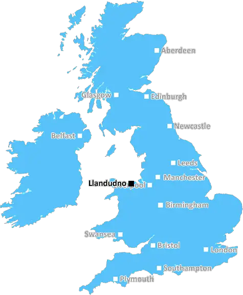
The LL55 postcode area in the Llandudno district is located in North Wales, in the Conwy county borough. It includes Llanfairfechan, Penmaenmawr, and the Victorian resort town of Llandudno.
In terms of geography, LL55 covers a mostly rural area which is dominated by the towns of Llanfairfechan, Penmaenmawr, and Llandudno. Llandudno is the largest and most populated town in the area, and is home to over 20,000 people. The town sprawls out along the North Wales coastline, and is especially popular with tourists, who come to visit the Victorian pier, enjoy the restaurants, theatres, and shopping opportunities, and take in the stunning coastal views.
At the heart of the LL55 postcode area lies the scenic Conwy Valley, which is a beautiful rural area that's home to a number of villages and hamlets. The area is popular with walkers and ramblers, who take in the stunning views of Snowdonia.
The LL55 postcode area is also home to a number of historic sites, including the impressive medieval Conwy Castle, which dates back to the thirteenth century and is now a UNESCO World Heritage Site. The town of Conwy also includes a number of timber-framed buildings that date back to the sixteenth and seventeenth centuries, including the Smallest House in Britain.
The LL55 postcode area is also home to the Eglwys Bach Nature Reserve, which is renowned for its diverse range of wildflowers and birdlife.
The LL55 postcode area is served by two railway lines; the Crewe to Holyhead line, and the Chester to Llandudno Junction line. The area is also served by regular bus services, and is just a few miles away from Conwy's larger and more accessible train station.
TheLL55 postcode area in the Llandudno district offers a great mix of attractions and activities. From the Victorian seaside town of Llandudno, to the beautiful Conwy Valley and its historic sites, the LL55 postcode area is a great place for visitors and locals alike.

Demographics
Gwynedd
LL55 is located in the county of Gwynedd, in Wales.
Gwynedd has a total population of 123,600, making it the 14th largest county in the UK.
Gwynedd has a total area of 984 square miles, and a population density of 48 people per square kilometre. For comparison, Greater London has a density of 5,618 people/km2.
| Outward Code | LL55 |
| Postal Town | Llandudno |
| MSOA Name | Gwynedd 006 |
| LSOA Name | Gwynedd 006B |
| County | Gwynedd |
| Region | Gwynedd |
| Country | Wales |
| Local Authority | Gwynedd |
| Area Classification | Unclassified |
LL55 Electoral Wards
The postal region of LL55, includes the local towns, villages, electoral wards and stations of:
Dig even deeper into the LL55 postcode by clicking on a postcode below:
Click on an outward postal code below for more information about the area. Each 'outward' postcode give you a comprehensive list of all postcodes within the outward code area (LL) and estimated address.
Click on an 'outward' code for more information. For example, the outward postcode page 'EC2M' will give you an alphabetical list covering all postcodes located in the region, from 'EC2M 1BB' through to 'EC2M 7YA'.
BH , Llandudno
Saturday, August 6, 2022
LL55 is an area of CAERNARFON. Miles away from Llandudno!!?.
Add your view of LL55
People need your local expertise. If you live in LL55 or have first-hand knowledge of the neighbourhood, please consider sharing your views. It's completely anonymous - all we ask is for your initials.
Please tell us what you like about the LL55 postcode area, what you don't like, and what it's like to live or work here.
| LOCAL AMENITIES | |
| FAMILY FRIENDLY | |
| PARKING | |
| GREEN SPACES |
From the Postcode Area blog

Deciphering Crime Rates - a Deep Dive Into UK Postcode Analysis
Ever wondered about the crime rate in your UK postcode? You're not alone. We've dug deep into the data, uncovering trends and patterns that'll make your head spin.

Death of the High Street?
The BBC reports that despite councils' attempts to kurb them, the UK's high streets have seen a huge growth in fast food outlets. Could this mark the death knell for the Great British high street, and what can we do about it to halt its decline?

Discrimination by Postcode
You really couldn't make it up, could you? Some of the country's most vulnerable people are missing out on their weekly £25 Cold Weather Payment, just because the system that's in operation is discriminating against them because payments are based on postcode, rather than geographic location.

The Redesign is Underway
Well, the current website was absolutely in dire need of a good redesign - from the ground up. So I set out to pull it all apart and get it up and running again to become the most comprehensive guide to every postcode in the UK. And it's been a long, tough job from start to finish - and quite possibly the biggest project I've ever undertaken.
SOCIAL GRADES
According to census records, 20% of people here have a social grade of AB (highest), compared to the national average of 27%.