llandudno LL49 Postcodes
Spending a fortune on conveyancing?

Compare instant, low-cost online quotes from trusted conveyancing solicitors.
Backed by experts, our no-obligation service searches through the best conveyancing quotes on the market to save you time and money.
Llandudno (LL49)
The LL49 postcode area is located in the Llandudno postcode town region, within the county of Gwynedd, and contains a total of 248 individual postcodes.
There are 12 electoral wards in the LL49 postcode area, including Aberdovey, Abergele, Amlwch, Arthog, Bala, Bangor, Barmouth, Beaumaris, Betws-Y-Coed, Blaenau Ffestiniog, Bodorgan, Brynteg, Caernarfon, Cemaes Bay, Colwyn Bay, Conwy, Corwen, Criccieth, Denbigh, Dolgellau, Dolwyddelan, Dulas, Dyffryn Ardudwy, Fairbourne, Gaerwen, Garndolbenmaen, Harlech, Holyhead, Llanbedr, Llanbedrgoch, Llandudno, Llandudno Junction, Llanerchymedd, Llanfairfechan, Llanfairpwllgwyngyll, Llangefni,Llangollen, Llanrwst, Llwyngwril, Marianglas, Menai Bridge, Moelfre, Penmaenmawr, Penrhyndeudraeth, Pentraeth, Penysarn, Porthmadog, Prestatyn, Pwllheli, Rhosgoch, Rhosneigr, Rhyl, Ruthin, St Asaph, Talsarnau, Talybont, Trefriw, Ty Croes, Tyn-Y-Gongl, Tywyn, Wrexham, Y Felinheli which come under the local authority of the Gwynedd Council.
Combining the whole postcode region, 18% of people in LL49 are classed as having an AB social grade, (i.e. 'white-collar' middle-upper class), compared to 27% across the UK.
This does not mean that the people of LL49 are poorer than other areas, but it may give an indication that there are areas of deprivation.
The LL49 postcode covers all of the Llyn Peninsula in Wales, and a large portion of the surrounding area in the county of Gwynedd. The Llyn Peninsula is a popular holiday spot with its stunning coastlines, numerous sandy beaches and rich culture.
The LL49 postcode covers the towns of Pwllheli, Criccieth, Abersoch, Porthmadog, Morfa Nefyn and Nefyn as well as numerous other villages. Pwllheli, the largest town in the postcode area, is a popular tourist destination thanks to its large harbour, notable architecture, historic buildings, range of pubs, bars, hotels and restaurants.
The postcode area is also home to many of Wales's finest beaches, with Llanbedrog, South Beach Pwllheli, Morfa Bach and Porth Oer all in the LL49 area and all outstanding for surfing and sunbathing. In addition, the Ll?n Coastal Path and Anglesey Coastal Path both make use of much of the Llyn Peninsula's coastal beauty.
Speaking of beauty, the LL49 postcode area has several impressive spots for outdoor activities, including Snowdonia National Park and the Ll?n Peninsula Coast AONB.
The LL49 postcode area is also home to many cultural and historical sites, including Castle Uchdryd, Nefyn Beach, Morfa Nefyn Golf Club, and St Tudwal's Island. Further inland are attractions such as Plas Glyn-y-Weddw art gallery and the Lloyd George Museum.
The area also has vast agricultural and industrial opportunities, such as the production of local traditional Celtic crafts, dairy products, beef, poultry, and vegetables. The local economy also includes tourism, fishing, sailing, and the energy industry.
Finally, the LL49 postcode area includes a number of excellent schools, including the independent Gryphon School and Nefyn Primary School. It has several youth centres, music venues, and places of worship, and is generally held in high regard by locals for its quality of life and leisure opportunities.

Demographics
Gwynedd
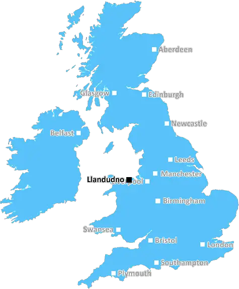
LL49 is located in the county of Gwynedd, in Wales.
Gwynedd has a total population of 123,600, making it the 14th largest county in the UK.
Gwynedd has a total area of 984 square miles, and a population density of 48 people per square kilometre. For comparison, Greater London has a density of 5,618 people/km2.
| Outward Code | LL49 |
| Postal Town | Llandudno |
| MSOA Name | Gwynedd 010 |
| LSOA Name | Gwynedd 010D |
| County | Gwynedd |
| Region | Gwynedd |
| Country | Wales |
| Local Authority | Gwynedd |
| Area Classification | Unclassified |
LL49 Electoral Wards
The postal region of LL49, includes the local towns, villages, electoral wards and stations of:
Dig even deeper into the LL49 postcode by clicking on a postcode below:
Click on an outward postal code below for more information about the area. Each 'outward' postcode give you a comprehensive list of all postcodes within the outward code area (LL) and estimated address.
Click on an 'outward' code for more information. For example, the outward postcode page 'EC2M' will give you an alphabetical list covering all postcodes located in the region, from 'EC2M 1BB' through to 'EC2M 7YA'.
Chris H
Wednesday, April 17, 2024
We don't have any views of LL49 right now. If you live in LL49 or have visited it, please help us to help others by telling others what you think of this neighbourhood.
Add your view of LL49
People need your local expertise. If you live in LL49 or have first-hand knowledge of the neighbourhood, please consider sharing your views. It's completely anonymous - all we ask is for your initials.
Please tell us what you like about the LL49 postcode area, what you don't like, and what it's like to live or work here.
| LOCAL AMENITIES | |
| FAMILY FRIENDLY | |
| PARKING | |
| GREEN SPACES |
From the Postcode Area blog

Deciphering Crime Rates - a Deep Dive Into UK Postcode Analysis
Ever wondered about the crime rate in your UK postcode? You're not alone. We've dug deep into the data, uncovering trends and patterns that'll make your head spin.

Death of the High Street?
The BBC reports that despite councils' attempts to kurb them, the UK's high streets have seen a huge growth in fast food outlets. Could this mark the death knell for the Great British high street, and what can we do about it to halt its decline?

Discrimination by Postcode
You really couldn't make it up, could you? Some of the country's most vulnerable people are missing out on their weekly £25 Cold Weather Payment, just because the system that's in operation is discriminating against them because payments are based on postcode, rather than geographic location.

The Redesign is Underway
Well, the current website was absolutely in dire need of a good redesign - from the ground up. So I set out to pull it all apart and get it up and running again to become the most comprehensive guide to every postcode in the UK. And it's been a long, tough job from start to finish - and quite possibly the biggest project I've ever undertaken.
SOCIAL GRADES
According to census records, 18% of people here have a social grade of AB (highest), compared to the national average of 27%.