llandrindod-wells LD4 Postcodes
Spending a fortune on conveyancing?

Compare instant, low-cost online quotes from trusted conveyancing solicitors.
Backed by experts, our no-obligation service searches through the best conveyancing quotes on the market to save you time and money.
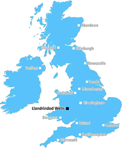
Llandrindod Wells (LD4)
The LD4 postcode area is located in the Llandrindod Wells postcode town region, within the county of Powys, and contains a total of 61 individual postcodes.
There are 10 electoral wards in the LD4 postcode area, including Brecon, Llanelwedd, Builth Wells, Knighton, Llandrindod Wells, Llangammarch Wells, Llanwrtyd Wells, Presteigne, Rhayader which come under the local authority of the Powys Council.
Combining the whole postcode region, 20% of people in LD4 are classed as having an AB social grade, (i.e. 'white-collar' middle-upper class), compared to 27% across the UK.
This does not mean that the people of LD4 are poorer than other areas, but it may give an indication that there are areas of deprivation.
The LD4 postcode is an area located within the Llandrindod Wells town district in Powys, Wales. It is a rural postcode, which consists of a number of hamlets and small villages. A major economic contributor in the postcode area is farming, with many originating from the Norman era, although forestry and tourism also play a large part in the district's economy.
Llandrindod Wells, the largest town in the area, is home to the LD4 postcode and is a popular area with tourists keen to explore the stunning scenery within the district. The town itself has a number of attractions, including the LD4 postcode sculpture trail, and the historic Regency Spa Complex along the river.
LD4 is within the Welsh Marches, an area of outstanding beauty and a hotspot for walkers and cyclists from all over the world. There are numerous trails and paths, as well as plenty of opportunities for birdwatching and wildlife spotting, with a number of rare birds being found in the area.
Education is also important in LD4, with a number of primary and secondary schools within the postcode as well as the renowned University of Wales Trinity Saint David.
Public transport is also well-served in this postcode, with a train station in Llandrindod Wells providing access to the major cities nearby, such as Cardiff, Swansea and Aberystwyth. Regular buses also operate in the area, as well as a network of private taxi services.
The local culture is vibrant, with many festivals and events celebrating the local area's culture. The LD4 postcode is also home to a number of local attractions, such as the Welsh Wildlife Centre, the Elan Valley Visitor Centre, and the Abbey Cwmhir Heritage Centre.
TheLD4 postcode is a rural area that is rich in cultural and natural heritage, and offers visitors and tourists the opportunity to explore and experience the unique charm of this area of Wales.

Demographics
Powys

LD4 is located in the county of Powys, in Wales.
Powys has a total population of 132,200, making it the 11th largest county in the UK.
Powys has a total area of 2000 square miles, and a population density of 25 people per square kilometre. For comparison, Greater London has a density of 5,618 people/km2.
| Outward Code | LD4 |
| Postal Town | Llandrindod Wells |
| MSOA Name | Powys 014 |
| LSOA Name | Powys 014E |
| County | Powys |
| Region | Powys |
| Country | Wales |
| Local Authority | Powys |
| Area Classification | Unclassified |
LD4 Electoral Wards
The postal region of LD4, includes the local towns, villages, electoral wards and stations of:
Dig even deeper into the LD4 postcode by clicking on a postcode below:
Click on an outward postal code below for more information about the area. Each 'outward' postcode give you a comprehensive list of all postcodes within the outward code area (LD) and estimated address.
Click on an 'outward' code for more information. For example, the outward postcode page 'EC2M' will give you an alphabetical list covering all postcodes located in the region, from 'EC2M 1BB' through to 'EC2M 7YA'.
Chris H
Wednesday, April 17, 2024
We don't have any views of LD4 right now. If you live in LD4 or have visited it, please help us to help others by telling others what you think of this neighbourhood.
Add your view of LD4
People need your local expertise. If you live in LD4 or have first-hand knowledge of the neighbourhood, please consider sharing your views. It's completely anonymous - all we ask is for your initials.
Please tell us what you like about the LD4 postcode area, what you don't like, and what it's like to live or work here.
| LOCAL AMENITIES | |
| FAMILY FRIENDLY | |
| PARKING | |
| GREEN SPACES |
From the Postcode Area blog

Deciphering Crime Rates - a Deep Dive Into UK Postcode Analysis
Ever wondered about the crime rate in your UK postcode? You're not alone. We've dug deep into the data, uncovering trends and patterns that'll make your head spin.

Death of the High Street?
The BBC reports that despite councils' attempts to kurb them, the UK's high streets have seen a huge growth in fast food outlets. Could this mark the death knell for the Great British high street, and what can we do about it to halt its decline?

Discrimination by Postcode
You really couldn't make it up, could you? Some of the country's most vulnerable people are missing out on their weekly £25 Cold Weather Payment, just because the system that's in operation is discriminating against them because payments are based on postcode, rather than geographic location.

The Redesign is Underway
Well, the current website was absolutely in dire need of a good redesign - from the ground up. So I set out to pull it all apart and get it up and running again to become the most comprehensive guide to every postcode in the UK. And it's been a long, tough job from start to finish - and quite possibly the biggest project I've ever undertaken.
SOCIAL GRADES
According to census records, 20% of people here have a social grade of AB (highest), compared to the national average of 27%.