leicester LE67 Postcodes
Spending a fortune on conveyancing?

Compare instant, low-cost online quotes from trusted conveyancing solicitors.
Backed by experts, our no-obligation service searches through the best conveyancing quotes on the market to save you time and money.
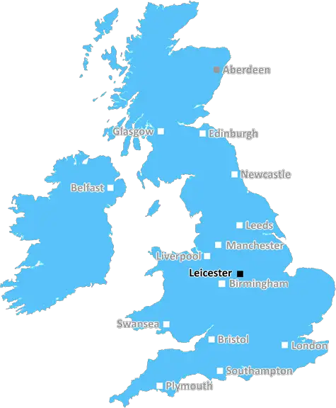
Leicester (LE67)
The LE67 postcode area is located in the Leicester postcode town region, within the county of Leicestershire, and contains a total of 1680 individual postcodes.
There are 56 electoral wards in the LE67 postcode area, including Ashby-De-La-Zouch, Coalville, Hinckley, Ibstock, Leicester, Loughborough, Lutterworth, Market Harborough, Markfield, Melton Mowbray, Oakham, Wigston which come under the local authority of the North West Leicestershire Council.
Combining the whole postcode region, 21% of people in LE67 are classed as having an AB social grade, (i.e. 'white-collar' middle-upper class), compared to 27% across the UK.
This does not mean that the people of LE67 are poorer than other areas, but it may give an indication that there are areas of deprivation.
The LE67 postcode primarily covers the villages of Bardon and Ibstock, located east of Leicester. It is part of the Hinckley and Bosworth district and is 26 miles from Nottingham and 33 from Birmingham.
The population of the LE67 post code as of the 2011 census was 4,735 which experienced a growth of about 11% since the 2000s. Residential areas consist of detached and semi-detached family homes with very few flats.
The average income is significantly higher than the national average, and the economic activity includes residents employed in areas such as manufacturing, retail, transport and health care. The average price for properties in this area is �302,545 which is considerably higher than the regional and national average.
There are a significant number of primary and secondary schools in the LE67 area, such as the much-acclaimed Ibstock Community College and Bardon Hill Primary School. Shopping is available in the town of Ibstock which has a selection of independent retailers, pubs, and leisure services including a football club, tennis court, and a swimming pool.
The village of Bardon, located close to the National Forest, has a selection of restaurants, cafes and pubs, as well as a selection of parks and open spaces with great scenic views. The National Forest itself is in proximity to the postcode, and it is part of a multi-million-pound project to promote and protect new generations of woodland.
The postcode has easy access to the A42 dual carriageway and the M1 Motorway, being within a half-hour drive of East Midlands Airport. There is also train access from nearby Coalville to Leicester, Nottingham and Loughborough.
One of the attractions of the area is its proximity to the larger city of Leicester, which offers a wide array of cultural activities, shopping and entertainment centres. With a gap of only 20 minutes' travel between the two locations, it's easy to sample the best of both worlds.

Demographics
Leicestershire

LE67 is located in the county of Leicestershire, in England.
Leicestershire has a total population of 1,031,300, making it the 21st largest county in the UK.
Leicestershire has a total area of 832 square miles, and a population density of 478 people per square kilometre. For comparison, Greater London has a density of 5,618 people/km2.
| Outward Code | LE67 |
| Postal Town | Leicester |
| MSOA Name | North West Leicestershire 010 |
| LSOA Name | North West Leicestershire 010D |
| County | Leicestershire |
| Region | Leicestershire |
| Country | England |
| Local Authority | North West Leicestershire |
| Area Classification | Largely Rural (rural including hub towns 50-79%) |
LE67 Electoral Wards
The postal region of LE67, includes the local towns, villages, electoral wards and stations of:
Dig even deeper into the LE67 postcode by clicking on a postcode below:
Click on an outward postal code below for more information about the area. Each 'outward' postcode give you a comprehensive list of all postcodes within the outward code area (LE) and estimated address.
Click on an 'outward' code for more information. For example, the outward postcode page 'EC2M' will give you an alphabetical list covering all postcodes located in the region, from 'EC2M 1BB' through to 'EC2M 7YA'.
Chris H
Saturday, April 6, 2024
We don't have any views of LE67 right now. If you live in LE67 or have visited it, please help us to help others by telling others what you think of this neighbourhood.
Add your view of LE67
People need your local expertise. If you live in LE67 or have first-hand knowledge of the neighbourhood, please consider sharing your views. It's completely anonymous - all we ask is for your initials.
Please tell us what you like about the LE67 postcode area, what you don't like, and what it's like to live or work here.
| LOCAL AMENITIES | |
| FAMILY FRIENDLY | |
| PARKING | |
| GREEN SPACES |
Local News Leicestershire
Selby considers future after loss to Wilson
Mark Selby says it's "maybe time to do something else" after losing 10-8 to Gary Wilson in the first round of the Tour Championship.
BBC NewsI reported explicit messages to police, says MP
Luke Evans says he was a victim of cyber-flashing in a suspected honeytrap plot targeting Westminster.
BBC NewsBereaved mum to help others through crash charity
Dee Beesley says she was "thrown into a world of unknowns" when her son, Reece, died in 2019.
BBC NewsYorkshire bowlers chip away at Leics at Headingley
George Hill takes three wickets as Yorkshire chip away at Leicestershire on a rain-hit opening day.
BBC NewsNearly 100 drivers flagged in car cruise crackdown
Officers targeted nuisance drivers in the Castle Donington area over the Easter weekend.
BBC NewsCommunity rallies to help fire-damaged pub reopen
The Leicestershire pub was badly damaged by a fire more than a year ago.
BBC NewsCan Surrey be beaten as County Championship returns?
With the new County Championship season starting on Friday, can anyone prevent Surrey winning a third straight title?
BBC NewsTMS commentator Agnew signs new deal with BBC Sport
Jonathan Agnew will continue to lead the Test Match Special team after agreeing a new four-year deal with BBC Sport.
BBC NewsFrom the Postcode Area blog

Deciphering Crime Rates - a Deep Dive Into UK Postcode Analysis
Ever wondered about the crime rate in your UK postcode? You're not alone. We've dug deep into the data, uncovering trends and patterns that'll make your head spin.

Death of the High Street?
The BBC reports that despite councils' attempts to kurb them, the UK's high streets have seen a huge growth in fast food outlets. Could this mark the death knell for the Great British high street, and what can we do about it to halt its decline?

Discrimination by Postcode
You really couldn't make it up, could you? Some of the country's most vulnerable people are missing out on their weekly £25 Cold Weather Payment, just because the system that's in operation is discriminating against them because payments are based on postcode, rather than geographic location.

The Redesign is Underway
Well, the current website was absolutely in dire need of a good redesign - from the ground up. So I set out to pull it all apart and get it up and running again to become the most comprehensive guide to every postcode in the UK. And it's been a long, tough job from start to finish - and quite possibly the biggest project I've ever undertaken.
SOCIAL GRADES
According to census records, 21% of people here have a social grade of AB (highest), compared to the national average of 27%.