leicester LE18 Postcodes
Spending a fortune on conveyancing?

Compare instant, low-cost online quotes from trusted conveyancing solicitors.
Backed by experts, our no-obligation service searches through the best conveyancing quotes on the market to save you time and money.
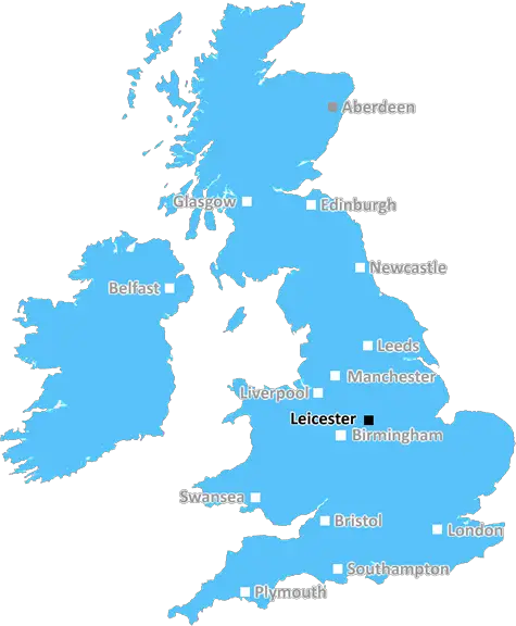
Leicester (LE18)
The LE18 postcode area is located in the Leicester postcode town region, within the county of Leicestershire, and contains a total of 892 individual postcodes.
There are 8 electoral wards in the LE18 postcode area, including Ashby-De-La-Zouch, Coalville, Hinckley, Ibstock, Leicester, Loughborough, Lutterworth, Market Harborough, Markfield, Melton Mowbray, Oakham, Wigston which come under the local authority of the Oadby and Wigston Council.
Combining the whole postcode region, 17% of people in LE18 are classed as having an AB social grade, (i.e. 'white-collar' middle-upper class), compared to 27% across the UK.
This does not mean that the people of LE18 are poorer than other areas, but it may give an indication that there are areas of deprivation.
The LE18 postcode belongs to the Leicester district in Leicestershire, England. The postcode area is made up of 32 postcode districts covering an area of over 110 sq miles and has a population of around 386,000 people.
The LE18 postcode is served mainly by Leicester city and is divided into two smaller postcode areas LE18 and LE19. It covers the northern and eastern suburbs of Leicester, including Wigston, Cosby, Houghton on the Hill and Desford, all the way to the M1 in the North and Leicestershire's borders with Rutland and Warwickshire in the East.
The area is serviced by three railway stations - Leicester, Wigston and Desford - all on the Midland Mainline offering connections to London St Pancras in around an hour. Bus services are widely available coupled with straightforward access to the motorway, making commuting from the area to nearby cities of Nottingham, Birmingham and Coventry relatively straightforward.
Leicester is known for its diverse culture with a range of religious and cultural centres, as well as excellent shopping, dining and nightlife. A walk along the River Soar, with its Victorian warehouses and quayside parks, is popular amongst locals and visitors alike as is the nearby National Space Centre.
The LE18 postcode is home to 10 primary schools and four secondary schools, including one private and one sixth form college. Within walking distance of Wigston is Leicester College, one of the UK's largest providers of Further Education.
The postcode area is home to several parks and greenspaces, offering outdoor activities for locals and visitors to enjoy. Wigston Fields has several large sports fields and a bowling green; Rutland Water Park offers boat trips, fishing, bird watching and cycling; and the Great Central Railway runs heritage steam-train services from Ruddington to Leicester.
For those seeking lively entertainment, O2 Academy, Leicester's biggest live music venue, is located in the city centre, and the Curve theatre provides shows for families and those seeking something a little bit different. With more than 150 places to eat and drink in Leicester, there is something for everyone.

Demographics
Leicestershire

LE18 is located in the county of Leicestershire, in England.
Leicestershire has a total population of 1,031,300, making it the 21st largest county in the UK.
Leicestershire has a total area of 832 square miles, and a population density of 478 people per square kilometre. For comparison, Greater London has a density of 5,618 people/km2.
| Outward Code | LE18 |
| Postal Town | Leicester |
| MSOA Name | Oadby and Wigston 005 |
| LSOA Name | Oadby and Wigston 005A |
| County | Leicestershire |
| Region | Leicestershire |
| Country | England |
| Local Authority | Oadby and Wigston |
| Area Classification | Urban with City and Town |
LE18 Electoral Wards
The postal region of LE18, includes the local towns, villages, electoral wards and stations of:
Dig even deeper into the LE18 postcode by clicking on a postcode below:
Click on an outward postal code below for more information about the area. Each 'outward' postcode give you a comprehensive list of all postcodes within the outward code area (LE) and estimated address.
Click on an 'outward' code for more information. For example, the outward postcode page 'EC2M' will give you an alphabetical list covering all postcodes located in the region, from 'EC2M 1BB' through to 'EC2M 7YA'.
A, leicester
Thursday, February 28, 2019
I like where I Live, the local transport available is good, and there is a very good range of shops locally. The bad bits are lack of Police around these days and more youths out and about all the time looking suspitious.
Add your view of LE18
People need your local expertise. If you live in LE18 or have first-hand knowledge of the neighbourhood, please consider sharing your views. It's completely anonymous - all we ask is for your initials.
Please tell us what you like about the LE18 postcode area, what you don't like, and what it's like to live or work here.
| LOCAL AMENITIES | |
| FAMILY FRIENDLY | |
| PARKING | |
| GREEN SPACES |
Local News Leicestershire
Body in caravan thought to be wanted sex offender
Police said Richard Scatchard had links to Leicestershire and was on prison recall.
BBC NewsI reported explicit messages to police, says MP
Luke Evans says he was a victim of cyber-flashing in a suspected honeytrap plot targeting Westminster.
BBC NewsYorkshire bowlers chip away at Leics at Headingley
George Hill takes three wickets as Yorkshire chip away at Leicestershire on a rain-hit opening day.
BBC NewsArrest after teenagers got into stranger's car
Police say the two girls and a boy left the car safely but are concerned for their "welfare".
BBC NewsBereaved mum to help others through crash charity
Dee Beesley says she was "thrown into a world of unknowns" when her son, Reece, died in 2019.
BBC NewsTeen with 'limited understanding' wrongly convicted
A judge rules he was not fit to enter a plea at the time he admitted robbery and other offences.
BBC NewsMP 'sorry' for sharing private numbers on dating app
Leicestershire Police say they are investigating one of up to 12 cases reported nationally.
BBC NewsBaby whose heart works at 20% reaches first birthday
Doctors feared Willow, who has dilated cardiomyopathy, would not survive but she defied the odds.
BBC NewsFrom the Postcode Area blog

Deciphering Crime Rates - a Deep Dive Into UK Postcode Analysis
Ever wondered about the crime rate in your UK postcode? You're not alone. We've dug deep into the data, uncovering trends and patterns that'll make your head spin.

Death of the High Street?
The BBC reports that despite councils' attempts to kurb them, the UK's high streets have seen a huge growth in fast food outlets. Could this mark the death knell for the Great British high street, and what can we do about it to halt its decline?

Discrimination by Postcode
You really couldn't make it up, could you? Some of the country's most vulnerable people are missing out on their weekly £25 Cold Weather Payment, just because the system that's in operation is discriminating against them because payments are based on postcode, rather than geographic location.

The Redesign is Underway
Well, the current website was absolutely in dire need of a good redesign - from the ground up. So I set out to pull it all apart and get it up and running again to become the most comprehensive guide to every postcode in the UK. And it's been a long, tough job from start to finish - and quite possibly the biggest project I've ever undertaken.
SOCIAL GRADES
According to census records, 17% of people here have a social grade of AB (highest), compared to the national average of 27%.