lancaster LA11 Postcodes
Spending a fortune on conveyancing?

Compare instant, low-cost online quotes from trusted conveyancing solicitors.
Backed by experts, our no-obligation service searches through the best conveyancing quotes on the market to save you time and money.
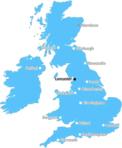
Lancaster (LA11)
The LA11 postcode area is located in the Lancaster postcode town region, within the county of Cumbria, and contains a total of 520 individual postcodes.
There are 56 electoral wards in the LA11 postcode area, including Ambleside, Askam-In-Furness, Barrow-In-Furness, Broughton-In-Furness, Carnforth, Coniston, Dalton-In-Furness, Grange-Over-Sands, Kendal, Kirkby-In-Furness, Lancaster, Millom, Milnthorpe, Morecambe, Sedbergh, Ulverston, Windermere which come under the local authority of the South Lakeland Council.
Combining the whole postcode region, 26% of people in LA11 are classed as having an AB social grade, (i.e. 'white-collar' middle-upper class), compared to 27% across the UK.
This does not mean that the people of LA11 are poorer than other areas, but it may give an indication that there are areas of deprivation.
The LA11 postcode in the Lancaster district of the United Kingdom is a part of the northern terminus of the historic county of Lancashire. It covers Ulverston, a town in the southern part of the district, and the smaller nearby settlements of Allithwaite, Backbarrow, Bardsea, Baycliff, Broughton-in-Furness, Cleator, Coniston, Dalton-in-Furness, Finsthwaite, Gleaston, Haverthwaite, and Kirkby-in-Furness.
Ulverston is a bustling market town full of life and charm with a wide range of independent shops, caf�s and eateries catering for all tastes. It has a strong creative and cultural identity, showcasing a wealth of arts and entertainment events throughout the year. Nearby attractions include the World of Beatrix Potter Attraction, Grizedale Forest Park, Haverthwaite Railway, and, of course, the site of the traditional twice-yearly Ulverston Charter Fair, held in May and October.
For those looking for a slower pace of life, the nearby villages are a great option as they boast breathtaking scenery and provide the perfect relaxation spot. Allithwaite is a classic, unspoilt fishing village located on the shore of Morecambe Bay and provides great opportunities to explore nature. Enjoy long walks on beaches washed by the North Atlantic Ocean and explore the renowned Morecambe Bay, Europe's largest expanse of intertidal flats.
The LA11 postcode district is also home to the South Lakes Safari Zoo, Levens Hall, Furness Abbey and the Holker Hall country house. All these attractions draw visitors from across the UK and around the world who want to take a leisurely stroll, observe exotic animals and soak up the old-world atmosphere of the region.
The area is well connected for those wishing to explore further afield with easy access to the M6, as well as the Lakes Line railway line situated close by. Whether you're looking for a family day out or a peaceful escape, the LA11 postcode district is the ideal home base.

Demographics
Cumbria

LA11 is located in the county of Cumbria, in England.
Cumbria has a total population of 497,900, making it the 41st largest county in the UK.
Cumbria has a total area of 2612 square miles, and a population density of 73 people per square kilometre. For comparison, Greater London has a density of 5,618 people/km2.
| Outward Code | LA11 |
| Postal Town | Lancaster |
| MSOA Name | South Lakeland 013 |
| LSOA Name | South Lakeland 013C |
| County | Cumbria |
| Region | Cumbria |
| Country | England |
| Local Authority | South Lakeland |
| Area Classification | Mainly Rural (rural including hub towns >=80%) |
LA11 Electoral Wards
The postal region of LA11, includes the local towns, villages, electoral wards and stations of:
Dig even deeper into the LA11 postcode by clicking on a postcode below:
Click on an outward postal code below for more information about the area. Each 'outward' postcode give you a comprehensive list of all postcodes within the outward code area (LA) and estimated address.
Click on an 'outward' code for more information. For example, the outward postcode page 'EC2M' will give you an alphabetical list covering all postcodes located in the region, from 'EC2M 1BB' through to 'EC2M 7YA'.
Chris H
Monday, April 8, 2024
We don't have any views of LA11 right now. If you live in LA11 or have visited it, please help us to help others by telling others what you think of this neighbourhood.
Add your view of LA11
People need your local expertise. If you live in LA11 or have first-hand knowledge of the neighbourhood, please consider sharing your views. It's completely anonymous - all we ask is for your initials.
Please tell us what you like about the LA11 postcode area, what you don't like, and what it's like to live or work here.
| LOCAL AMENITIES | |
| FAMILY FRIENDLY | |
| PARKING | |
| GREEN SPACES |
Local News Lancashire
Family jailed over multimillion-pound drugs trade
Ian Shacklady, his family and associates supplied large amounts of cocaine and heroin across the UK.
BBC NewsSpeaker left 'devastated' by father's death
Former Labour MP Lord Doug Hoyle was a "truly dedicated parliamentarian", Sir Lindsay Hoyle says.
BBC NewsSouthampton stumble goes on with draw at Blackburn
Blackburn Rovers hold Southampton to a goalless draw at Ewood Park as Saints fail to win for the third game in a row.
BBC NewsMan 'put through hell' after losing home to DWP
George Henderson said he made an "honest mistake" in claiming too much Carer's Allowance.
BBC NewsBritain's loudest birds are booming once again
The RSPB reports ten "booming" males at Leighton Moss - the most on the reserve since the 1990s.
BBC NewsWhere in the UK can you see Monday's solar eclipse?
People in the UK can also see the solar eclipse happening in the US next week
BBC NewsSurrey only face 21 balls on rain-affected day
Openers Rory Burns and Dom Sibley are only able to add four runs as rain ruins Surrey's reply to Lancashire's 202.
BBC NewsGhostbusters superfan lands role in latest film
Simon Gray has been collecting toys and merchandise for 30 years.
BBC NewsFrom the Postcode Area blog

Deciphering Crime Rates - a Deep Dive Into UK Postcode Analysis
Ever wondered about the crime rate in your UK postcode? You're not alone. We've dug deep into the data, uncovering trends and patterns that'll make your head spin.

Death of the High Street?
The BBC reports that despite councils' attempts to kurb them, the UK's high streets have seen a huge growth in fast food outlets. Could this mark the death knell for the Great British high street, and what can we do about it to halt its decline?

Discrimination by Postcode
You really couldn't make it up, could you? Some of the country's most vulnerable people are missing out on their weekly £25 Cold Weather Payment, just because the system that's in operation is discriminating against them because payments are based on postcode, rather than geographic location.

The Redesign is Underway
Well, the current website was absolutely in dire need of a good redesign - from the ground up. So I set out to pull it all apart and get it up and running again to become the most comprehensive guide to every postcode in the UK. And it's been a long, tough job from start to finish - and quite possibly the biggest project I've ever undertaken.
SOCIAL GRADES
According to census records, 26% of people here have a social grade of AB (highest), compared to the national average of 27%.