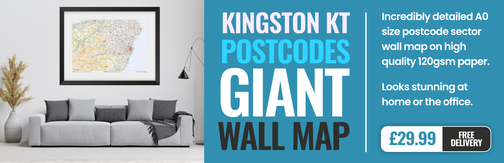
kingston-upon-thames KT15 Postcodes
Spending a fortune on conveyancing?

Compare instant, low-cost online quotes from trusted conveyancing solicitors.
Backed by experts, our no-obligation service searches through the best conveyancing quotes on the market to save you time and money.
Kingston Upon Thames (KT15)
The KT15 postcode area is located in the Kingston Upon Thames postcode town region, within the county of Surrey, and contains a total of 1015 individual postcodes.
There are 9 electoral wards in the KT15 postcode area, including Addlestone, Ashtead, Chertsey, Chessington, Cobham, East Molesey, Epsom, Esher, Kingston Upon Thames, Leatherhead, New Malden, Surbiton, Tadworth, Thames Ditton, Walton-On-Thames, West Byfleet, West Molesey, Weybridge, Worcester Park which come under the local authority of the Runnymede Council.
Combining the whole postcode region, 29% of people in KT15 are classed as having an AB social grade, (i.e. 'white-collar' middle-upper class), compared to 27% across the UK.
This does not mean that the people of KT15 are wealthier - or higher class - than average, but it can be an indication that the area may be prospering and desirable to live in.
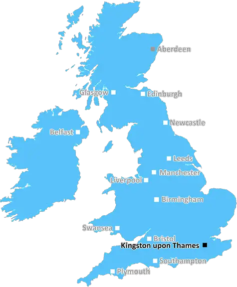
KT15 is a postcode in the borough of Elmbridge in Surrey, located approximately 14 miles south west of London in the Royal Borough of Kingston upon Thames. The postcode covers the area of Addlestone, Chertsey, New Haw, Thorpe and Ottershaw.
Addlestone is a small town with a population of around 20,000 people and is famous for being the first area to host a branch railway station in England, opening in 1839. The town has two shopping centres: The Square Shopping Centre and The Oaks, boasting a variety of shops, cafes and restaurants. The KT15 postcode features a range of sports facilities including Addlestone Sports Centre, Guildford Hockey Club, the David Lloyd Centre and Star Dome. The area also has many parks and reserves such as Addlestone Moor and Minley Windmill Nature Reserve.
Chertsey is a town between London and the M25 motorway, home to around 21,000 people. The town's history can be traced back to the Anglo-Saxons and the area is renowned for its historical sites and attractions such as Chertsey Abbey, Saxon Tower and Chertsey Bridge. The KT15 postcode includes the historic riverside town of Runnymede, the site of the Magna Carta, as well as the National Trust run Langley Vale Wood and the nearby chalk hill Fort Meadows.
New Haw is a small village of around 5,000 people, formerly called Trollyhail, and is situated on the banks of the River Thames. The village has a few shops, a pub, a community centre and a cricket ground. The area is an ideal spot for picnics as it contains the picturesque Hawley Lake, a popular spot for birdwatchers.
Thorpe is situated between the A320 and A320/A3 and is gradually becoming a commuter hotspot due to the relatively short commuting distance into London. The KT15 postcode contains the local primary and secondary school, Thorpe Edge Community Primary School, as well as its own sports centre with a swimming pool and other sporting facilities.
Ottershaw is a small village with a population of approximately 2,500 people. It is located on the banks of the River Thames with views up to Windsor and across to the Chiltern Hills. The area is known for its country walks and nature trails, as well as its local golf club, Ottershaw Park Golf Club. The KT15 postcode includes the historic Church of St Mary the Virgin, situated in the centre of the village, along with numerous other smaller churches and chapels.

Demographics
Surrey

KT15 is located in the county of Surrey, in England.
Surrey has a total population of 1,176,500, making it the 13th largest county in the UK.
Surrey has a total area of 642 square miles, and a population density of 707 people per square kilometre. For comparison, Greater London has a density of 5,618 people/km2.
| Outward Code | KT15 |
| Postal Town | Kingston Upon Thames |
| MSOA Name | Runnymede 007 |
| LSOA Name | Runnymede 007G |
| County | Surrey |
| Region | Surrey |
| Country | England |
| Local Authority | Runnymede |
| Area Classification | Urban with Major Conurbation |
KT15 Electoral Wards
The postal region of KT15, includes the local towns, villages, electoral wards and stations of:
Dig even deeper into the KT15 postcode by clicking on a postcode below:
Click on an outward postal code below for more information about the area. Each 'outward' postcode give you a comprehensive list of all postcodes within the outward code area (KT) and estimated address.
Click on an 'outward' code for more information. For example, the outward postcode page 'EC2M' will give you an alphabetical list covering all postcodes located in the region, from 'EC2M 1BB' through to 'EC2M 7YA'.
Chris H
Saturday, April 6, 2024
We don't have any views of KT15 right now. If you live in KT15 or have visited it, please help us to help others by telling others what you think of this neighbourhood.
Add your view of KT15
People need your local expertise. If you live in KT15 or have first-hand knowledge of the neighbourhood, please consider sharing your views. It's completely anonymous - all we ask is for your initials.
Please tell us what you like about the KT15 postcode area, what you don't like, and what it's like to live or work here.
| LOCAL AMENITIES | |
| FAMILY FRIENDLY | |
| PARKING | |
| GREEN SPACES |
Local News Surrey
Gold in reach for GB's first male Olympic climber
Great Britain's first male Olympic sport climber Toby Roberts on going for gold in Paris.
BBC NewsThe cheapest Surrey postcode to buy a home which is still 100k more than UK average
Nowhere in Surrey had an average house price that was equal to or less than the UK average
Get SurreyGirl, 13, missing from Horley for two days with police concerned for her safety
Gabija was last seen on Tuesday 2 April at her home address, Surrey Police said
Get SurreyBromley 1-1 Woking
Bromley drop two points in their National League play-off bid as they are held to a 1-1 draw by visitors Woking.
BBC NewsCan Surrey be beaten as County Championship returns?
With the new County Championship season starting on Friday, can anyone prevent Surrey winning a third straight title?
BBC NewsNew plans for beauty spot near Surrey branded 'huge disappointment'
The 'Hyde Park sized' conservation area, which was planned to act as a haven for at-risk wildlife, has been subject to much controversy
Get SurreyResidents of closing care unit yet to get new home
Council working to find new accommodation for six residents of Jutland Place which is closing.
BBC NewsSurrey company fined 15k after illegally chopping down 100 protected trees
Two firms were fined almost 20,000 after pleading guilty to felling more than 100 protected tress
Get SurreyFrom the Postcode Area blog

Deciphering Crime Rates - a Deep Dive Into UK Postcode Analysis
Ever wondered about the crime rate in your UK postcode? You're not alone. We've dug deep into the data, uncovering trends and patterns that'll make your head spin.

Death of the High Street?
The BBC reports that despite councils' attempts to kurb them, the UK's high streets have seen a huge growth in fast food outlets. Could this mark the death knell for the Great British high street, and what can we do about it to halt its decline?

Discrimination by Postcode
You really couldn't make it up, could you? Some of the country's most vulnerable people are missing out on their weekly £25 Cold Weather Payment, just because the system that's in operation is discriminating against them because payments are based on postcode, rather than geographic location.

The Redesign is Underway
Well, the current website was absolutely in dire need of a good redesign - from the ground up. So I set out to pull it all apart and get it up and running again to become the most comprehensive guide to every postcode in the UK. And it's been a long, tough job from start to finish - and quite possibly the biggest project I've ever undertaken.
SOCIAL GRADES
According to census records, 29% of people here have a social grade of AB (highest), compared to the national average of 27%.