ipswich IP5 Postcodes
Spending a fortune on conveyancing?

Compare instant, low-cost online quotes from trusted conveyancing solicitors.
Backed by experts, our no-obligation service searches through the best conveyancing quotes on the market to save you time and money.
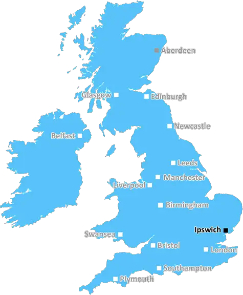
Ipswich (IP5)
The IP5 postcode area is located in the Ipswich postcode town region, within the county of Suffolk, and contains a total of 875 individual postcodes.
There are 12 electoral wards in the IP5 postcode area, including Aldeburgh, Brandon, Bury St Edmunds, Diss, Eye, Felixstowe, Halesworth, Harleston, Ipswich, Leiston, Saxmundham, Southwold, Stowmarket, Thetford, Woodbridge which come under the local authority of the Suffolk Coastal Council.
Combining the whole postcode region, 32% of people in IP5 are classed as having an AB social grade, (i.e. 'white-collar' middle-upper class), compared to 27% across the UK.
This does not mean that the people of IP5 are wealthier - or higher class - than average, but it can be an indication that the area may be prospering and desirable to live in.
IP5 is a postcode in the Ipswich post town of the Suffolk county region in the United Kingdom. It covers part of the Rushmere St Andrew ward of the Ipswich Borough Council. This area consists mainly of residential suburbs including Bixley, Thackeray, Kesgrave, Henley, Bucklesham, and Martlesham Heath, all of which are situated in the north-east corner of what is colloquially known as Greater Ipswich.
The postcode IP5 primarily covers the residential area and there are no major employers based in IP5. Although the B1448 connects Kesgrave to the neighbouring villages of Martlesham and Waldringfield, other roads connecting IP5 to the nearby city centre of Ipswich are the B1385, B1439, Henley Road, Bixley Road and Kesgrave Road.
This region has a number of churches, a synagogue and a mosque, as well as a range of shopping amenities for residents, such as the Waitrose supermarket in Kesgrave and the shops in Martlesham Heath and Henley. Likewise, there are a number of leisure activities in the area, such as tennis courts, a bowls club, a parkrun, a golf club, a cricket club, and various other organisations.
Public transport services in IP5 include the 63 and 64 bus routes from Kesgrave to Ipswich, as well as the 63A and 64A routes from Martlesham Heath and Henley to Ipswich. The local railway station is located in Martlesham Heath.
In terms of education, IP5 is home to a number of primary schools, such as the Kesgrave Community Primary School, Hartismere High School and Henley Primary School as well as the new Kings Fleet Primary School. In addition, there is a village academy called the Kesgrave Sixth Form College.
IP5 provides residents with a peaceful and enjoyable lifestyle, with good access to both town and country, and a close-knit community atmosphere.

Demographics
Suffolk

IP5 is located in the county of Suffolk, in England.
Suffolk has a total population of 745,300, making it the 32nd largest county in the UK.
Suffolk has a total area of 1500 square miles, and a population density of 196 people per square kilometre. For comparison, Greater London has a density of 5,618 people/km2.
| Outward Code | IP5 |
| Postal Town | Ipswich |
| MSOA Name | Suffolk Coastal 009 |
| LSOA Name | Suffolk Coastal 009D |
| County | Suffolk |
| Region | Suffolk |
| Country | England |
| Local Authority | Suffolk Coastal |
| Area Classification | Largely Rural (rural including hub towns 50-79%) |
IP5 Electoral Wards
The postal region of IP5, includes the local towns, villages, electoral wards and stations of:
Dig even deeper into the IP5 postcode by clicking on a postcode below:
Click on an outward postal code below for more information about the area. Each 'outward' postcode give you a comprehensive list of all postcodes within the outward code area (IP) and estimated address.
Click on an 'outward' code for more information. For example, the outward postcode page 'EC2M' will give you an alphabetical list covering all postcodes located in the region, from 'EC2M 1BB' through to 'EC2M 7YA'.
JY, Ipswich
Thursday, October 15, 2020
Everything, very quiet
Add your view of IP5
People need your local expertise. If you live in IP5 or have first-hand knowledge of the neighbourhood, please consider sharing your views. It's completely anonymous - all we ask is for your initials.
Please tell us what you like about the IP5 postcode area, what you don't like, and what it's like to live or work here.
| LOCAL AMENITIES | |
| FAMILY FRIENDLY | |
| PARKING | |
| GREEN SPACES |
Local News Suffolk
Celebrating Eid in Christchurch Park
Muslims have celebrated Eid al-Fitr in Christchurch Park for the first time.
BBC News'Unhealthy' market sweet stall stays after U-turn
A council gets itself into a sticky situation as residents object to the closure of a sweet stall.
BBC NewseBay hub volunteers giving family charity a boost
Selling donations online now accounts for 30% of Suffolk charity's trading income.
BBC NewsIpswich miss out on top spot as Watford claim draw
Ipswich Town miss the chance to go top of the Championship as they are held to a goalless draw by Watford at Portman Road.
BBC NewsMan dies after car hits tree
The man is taken to hospital by helicopter, but two passengers in the car are not hurt in the crash.
BBC News'Full-on Ipswich fanatic' dies after brain tumour
His "bucket list" dream of watching a match from an executive suite turned out to be his last game.
BBC NewsRendlesham man cycling to Spain in memory of wife
Steve Howe will cycle 1000 miles in remembrance of his wife Rachel who died in 2022.
BBC NewsThe fans don't know the full story - Downes
Flynn Downes shares his frustrations after being booed by his former club's supporters.
BBC NewsFrom the Postcode Area blog

Deciphering Crime Rates - a Deep Dive Into UK Postcode Analysis
Ever wondered about the crime rate in your UK postcode? You're not alone. We've dug deep into the data, uncovering trends and patterns that'll make your head spin.

Death of the High Street?
The BBC reports that despite councils' attempts to kurb them, the UK's high streets have seen a huge growth in fast food outlets. Could this mark the death knell for the Great British high street, and what can we do about it to halt its decline?

Discrimination by Postcode
You really couldn't make it up, could you? Some of the country's most vulnerable people are missing out on their weekly £25 Cold Weather Payment, just because the system that's in operation is discriminating against them because payments are based on postcode, rather than geographic location.

The Redesign is Underway
Well, the current website was absolutely in dire need of a good redesign - from the ground up. So I set out to pull it all apart and get it up and running again to become the most comprehensive guide to every postcode in the UK. And it's been a long, tough job from start to finish - and quite possibly the biggest project I've ever undertaken.
SOCIAL GRADES
According to census records, 32% of people here have a social grade of AB (highest), compared to the national average of 27%.