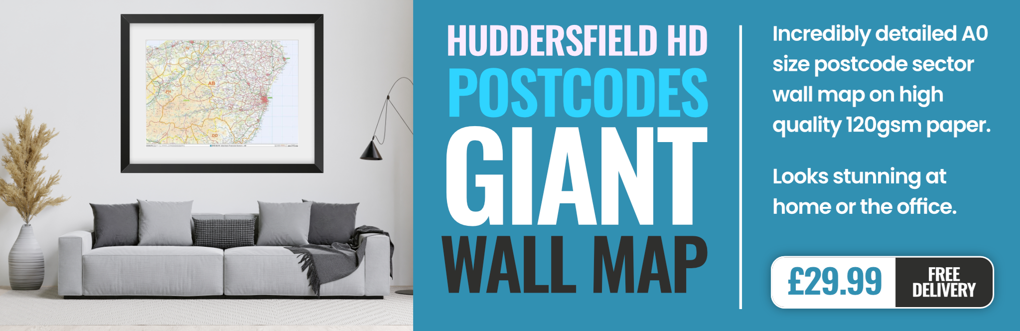
huddersfield HD9 Postcodes
Spending a fortune on conveyancing?

Compare instant, low-cost online quotes from trusted conveyancing solicitors.
Backed by experts, our no-obligation service searches through the best conveyancing quotes on the market to save you time and money.
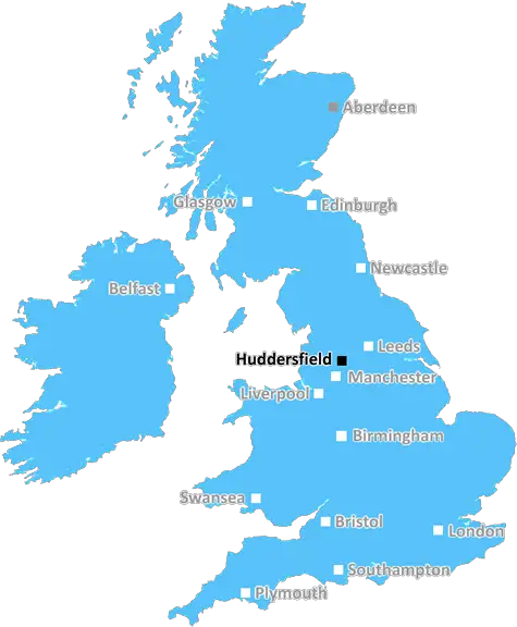
Huddersfield (HD9)
The HD9 postcode area is located in the Huddersfield postcode town region, within the county of West Yorkshire, and contains a total of 1408 individual postcodes.
There are 63 electoral wards in the HD9 postcode area, including Brighouse, Holmfirth, Huddersfield which come under the local authority of the Kirklees Council.
Combining the whole postcode region, 31% of people in HD9 are classed as having an AB social grade, (i.e. 'white-collar' middle-upper class), compared to 27% across the UK.
This does not mean that the people of HD9 are wealthier - or higher class - than average, but it can be an indication that the area may be prospering and desirable to live in.
The HD9 postcode is located in the Huddersfield district of West Yorkshire, England, and covers several towns and villages including Holmfirth, New Mill, Brockholes, Hepworth, Honley, Scholes, Upperthong, Wooldale, Thongsbridge, Shelley, and Cartworth Moor.
The landscape of the HD9 area consists of rolling hills, croplands, and expansive moorlands. It is situated within the Peak District National Park and other areas in the Yorkshire Dales. Holmfirth and its surrounding villages are known for their beautiful natural environment, and popular leisure activities such as walking and cycling. The area is also well known for its range of historic attractions including Rupert Bear's stone house in Holmfirth, Castle Hill at Bolster Moor, Far Flat Barns at Netherthong, and Dunford Bridge Roman Fort on the River Don.
The HD9 postcode is home to a diverse population of both rural and urban communities. The largest town in the district is Holmfirth, with over 10,000 people living in its built-up area. This is followed by other larger settlements such as New Mill, Brockholes, Hepworth, Honley, Scholes, Upperthong, Wooldale, Thongsbridge, Shelley, and Cartworth Moor. These places offer a wide range of services, including shops, pubs, schools, and medical facilities.
The HD9 postcode also holds some important centers of industry and commerce. In Holmfirth there is a large number of engineering and manufacturing businesses, as well as tourism attractions. New Mill is known for its textile production, while Upperthong is home to a variety of small businesses. Brockholes is notable for its quarry, which provides stone for the local building industry. In Shelley, there are many golf courses and other sport-related businesses.
TheHD9 postcode is an attractive place to live or visit, with its diverse range of cultural attractions, business activities, and natural landscapes. The area is well connected to major cities in Yorkshire and to the rest of the UK through road, rail, and air networks.

Demographics
West Yorkshire

HD9 is located in the county of West Yorkshire, in England.
West Yorkshire has a total population of 2,299,700, making it the 4th largest county in the UK.
West Yorkshire has a total area of 783 square miles, and a population density of 1133 people per square kilometre. For comparison, Greater London has a density of 5,618 people/km2.
| Outward Code | HD9 |
| Postal Town | Huddersfield |
| MSOA Name | Kirklees 059 |
| LSOA Name | Kirklees 059B |
| County | West Yorkshire |
| Region | West Yorkshire |
| Country | England |
| Local Authority | Kirklees |
| Area Classification | Urban with Major Conurbation |
HD9 Electoral Wards
The postal region of HD9, includes the local towns, villages, electoral wards and stations of:
Dig even deeper into the HD9 postcode by clicking on a postcode below:
Click on an outward postal code below for more information about the area. Each 'outward' postcode give you a comprehensive list of all postcodes within the outward code area (HD) and estimated address.
Click on an 'outward' code for more information. For example, the outward postcode page 'EC2M' will give you an alphabetical list covering all postcodes located in the region, from 'EC2M 1BB' through to 'EC2M 7YA'.
Chris H
Wednesday, April 10, 2024
We don't have any views of HD9 right now. If you live in HD9 or have visited it, please help us to help others by telling others what you think of this neighbourhood.
Add your view of HD9
People need your local expertise. If you live in HD9 or have first-hand knowledge of the neighbourhood, please consider sharing your views. It's completely anonymous - all we ask is for your initials.
Please tell us what you like about the HD9 postcode area, what you don't like, and what it's like to live or work here.
| LOCAL AMENITIES | |
| FAMILY FRIENDLY | |
| PARKING | |
| GREEN SPACES |
Local News West Yorkshire
Harry Brook: England batter hits century as Yorkshire draw with Leicestershire in County Championship
England's Harry Brook hits a century to help Yorkshire draw with Leicestershire in their opening County Championship game.
BBC NewsLeeds woman given terminal diagnosis after doctors missed tumour on scan
Leeds NHS trust says it is "deeply sorry" after Anne Shaw's cancer went undiagnosed for two years.
BBC NewsRapper Ja Rule denied UK entry ahead of Cardiff gig
The musician says his criminal record was the reason he has to shelve the British leg of his tour.
BBC NewsFebruary 29: 'Leaplings' finally get to celebrate their birthdays
Three people in Yorkshire born on 29 February can only mark their "real" birthdays every four years.
BBC NewsElland waste tip to close for up to two weeks
The waste recycling centre's closure is to allow "essential drainage works" to take place.
BBC NewsCriminals' cash pays to train future plumbers
Cash seized under the Proceeds of Crime Act is funding training for teenagers in West Yorkshire.
BBC News1970 FA Cup final: The most brutal game in English football history
As Chelsea get set to face Leeds in the FA Cup fifth round, BBC Sport looks back at the notoriously ferocious 1970 FA Cup final replay between the two sides.
BBC NewsHalifax volunteers save 99-year-old library from closure
Volunteers say they are determined to make the library a community focal point.
BBC NewsFrom the Postcode Area blog

Deciphering Crime Rates - a Deep Dive Into UK Postcode Analysis
Ever wondered about the crime rate in your UK postcode? You're not alone. We've dug deep into the data, uncovering trends and patterns that'll make your head spin.

Death of the High Street?
The BBC reports that despite councils' attempts to kurb them, the UK's high streets have seen a huge growth in fast food outlets. Could this mark the death knell for the Great British high street, and what can we do about it to halt its decline?

Discrimination by Postcode
You really couldn't make it up, could you? Some of the country's most vulnerable people are missing out on their weekly £25 Cold Weather Payment, just because the system that's in operation is discriminating against them because payments are based on postcode, rather than geographic location.

The Redesign is Underway
Well, the current website was absolutely in dire need of a good redesign - from the ground up. So I set out to pull it all apart and get it up and running again to become the most comprehensive guide to every postcode in the UK. And it's been a long, tough job from start to finish - and quite possibly the biggest project I've ever undertaken.
SOCIAL GRADES
According to census records, 31% of people here have a social grade of AB (highest), compared to the national average of 27%.