huddersfield HD8 Postcodes
Spending a fortune on conveyancing?

Compare instant, low-cost online quotes from trusted conveyancing solicitors.
Backed by experts, our no-obligation service searches through the best conveyancing quotes on the market to save you time and money.
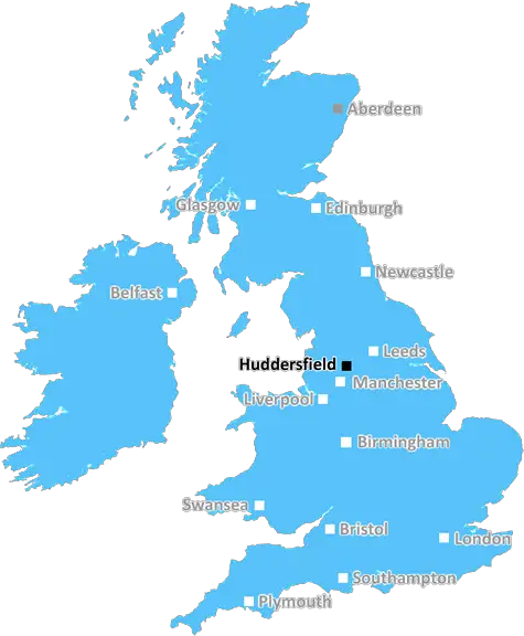
Huddersfield (HD8)
The HD8 postcode area is located in the Huddersfield postcode town region, within the county of West Yorkshire, and contains a total of 1169 individual postcodes.
There are 63 electoral wards in the HD8 postcode area, including Brighouse, Holmfirth, Huddersfield which come under the local authority of the Kirklees Council.
Combining the whole postcode region, 30% of people in HD8 are classed as having an AB social grade, (i.e. 'white-collar' middle-upper class), compared to 27% across the UK.
This does not mean that the people of HD8 are wealthier - or higher class - than average, but it can be an indication that the area may be prospering and desirable to live in.
The HD8 postcode is a regional postcode in the district of Huddersfield, in the United Kingdom. The postcode is within the Kirklees Metropolitan Borough Council administrative district and is classified as a semi- urban postcode district. It covers an area that includes parts of Clayton West, Denby Dale, and High Flatts, as well as outlying areas.
The area has a rich historical heritage thanks to the industrial revolution. Denby Dale is known for the famous Denby Dale Pie, while Historic High Flatts was founded in 1790. HD8 is sandwiched between the A629 and A635 roads, making it conveniently situated for travel. The neighbouring postcode is HD9.
Property in the HD8 postcode region is varied and affordable, with a mixture of detached, semi-detached and terraced housing, as well as townhouses and bungalows. The area is served by several local schools including Denby Dale Primary School, Clayton West Primary School, Shelley College, and Kirkburton Middle School. Several rural villages are nearby, such as Flockton, Chickenley, and Kirkburton.
Local amenities in the HD8 region are abundant. There are several local shops, pubs, restaurants and caf�s, as well as health clubs, golf courses, and theatres. There are numerous parks and outdoor recreational facilities, including the stunning Beaumont Park and Denby Dale Recreational Ground. The area is also home to Denby Pottery, a world-famous retail shopping centre and factory outlet.
Residents of HD8 have easy access to neighbouring towns and cities including Wakefield, Leeds, Dewsbury, Halifax, and Barnsley. There are excellent transport links, including direct trains to London, and there are bus services from Huddersfield to Manchester and other cities. The area is also well-serviced by motorways, with the M1 and M62 close by.
The HD8 postcode is a great area for those seeking the amenities of a larger town with the benefits of a rural setting. For those looking for affordable housing, excellent transport links, and plenty of character and things to do and see, the HD8 postcode is a great choice.

Demographics
West Yorkshire

HD8 is located in the county of West Yorkshire, in England.
West Yorkshire has a total population of 2,299,700, making it the 4th largest county in the UK.
West Yorkshire has a total area of 783 square miles, and a population density of 1133 people per square kilometre. For comparison, Greater London has a density of 5,618 people/km2.
| Outward Code | HD8 |
| Postal Town | Huddersfield |
| MSOA Name | Kirklees 032 |
| LSOA Name | Kirklees 032D |
| County | West Yorkshire |
| Region | West Yorkshire |
| Country | England |
| Local Authority | Kirklees |
| Area Classification | Urban with Major Conurbation |
HD8 Electoral Wards
The postal region of HD8, includes the local towns, villages, electoral wards and stations of:
Dig even deeper into the HD8 postcode by clicking on a postcode below:
Click on an outward postal code below for more information about the area. Each 'outward' postcode give you a comprehensive list of all postcodes within the outward code area (HD) and estimated address.
Click on an 'outward' code for more information. For example, the outward postcode page 'EC2M' will give you an alphabetical list covering all postcodes located in the region, from 'EC2M 1BB' through to 'EC2M 7YA'.
SJ, huddersfield
Tuesday, May 28, 2019
A great little quiet village to live in, friendly people, very good facilities (shops, post office, beauty salons, health centres, dentist, opticians wine bar, choice of restaurants and eateries). Easy commute to many surrounding towns, the Pennines and Peak District
Add your view of HD8
People need your local expertise. If you live in HD8 or have first-hand knowledge of the neighbourhood, please consider sharing your views. It's completely anonymous - all we ask is for your initials.
Please tell us what you like about the HD8 postcode area, what you don't like, and what it's like to live or work here.
| LOCAL AMENITIES | |
| FAMILY FRIENDLY | |
| PARKING | |
| GREEN SPACES |
Local News West Yorkshire
Deaf team assistant condemns 'offensive' jibes
Footballers in the Leeds team are regularly mocked for having impaired hearing, Matt Dixon says.
BBC NewsLeeds United fan injured during FA Cup tie at Chelsea
A Leeds United supporter is "in the hands of the emergency services" after appearing to fall from the stand in their FA Cup tie at Chelsea.
BBC NewsYorkshire: ECB must prevent 'return to business as usual', say MPs
The England and Wales Cricket Board (ECB) must "closely monitor" Yorkshire to prevent a "return to business as usual", say MPs.
BBC NewsWakefield council tax rise agreed amid angry scenes at meeting
A Wakefield Council budget meeting is adjourned after a heated debate over spending cuts.
BBC NewsCriminals' cash pays to train future plumbers
Cash seized under the Proceeds of Crime Act is funding training for teenagers in West Yorkshire.
BBC NewsRapper Ja Rule denied UK entry ahead of Cardiff gig
The musician says his criminal record was the reason he has to shelve the British leg of his tour.
BBC NewsLeeds woman given terminal diagnosis after doctors missed tumour on scan
Leeds NHS trust says it is "deeply sorry" after Anne Shaw's cancer went undiagnosed for two years.
BBC NewsHorbury: Plans to convert WW2 gas site into caf rejected
Objectors say the project would "fail to preserve the special historic interest" of the structure.
BBC NewsFrom the Postcode Area blog

Deciphering Crime Rates - a Deep Dive Into UK Postcode Analysis
Ever wondered about the crime rate in your UK postcode? You're not alone. We've dug deep into the data, uncovering trends and patterns that'll make your head spin.

Death of the High Street?
The BBC reports that despite councils' attempts to kurb them, the UK's high streets have seen a huge growth in fast food outlets. Could this mark the death knell for the Great British high street, and what can we do about it to halt its decline?

Discrimination by Postcode
You really couldn't make it up, could you? Some of the country's most vulnerable people are missing out on their weekly £25 Cold Weather Payment, just because the system that's in operation is discriminating against them because payments are based on postcode, rather than geographic location.

The Redesign is Underway
Well, the current website was absolutely in dire need of a good redesign - from the ground up. So I set out to pull it all apart and get it up and running again to become the most comprehensive guide to every postcode in the UK. And it's been a long, tough job from start to finish - and quite possibly the biggest project I've ever undertaken.
SOCIAL GRADES
According to census records, 30% of people here have a social grade of AB (highest), compared to the national average of 27%.