huddersfield HD4 Postcodes
Spending a fortune on conveyancing?

Compare instant, low-cost online quotes from trusted conveyancing solicitors.
Backed by experts, our no-obligation service searches through the best conveyancing quotes on the market to save you time and money.
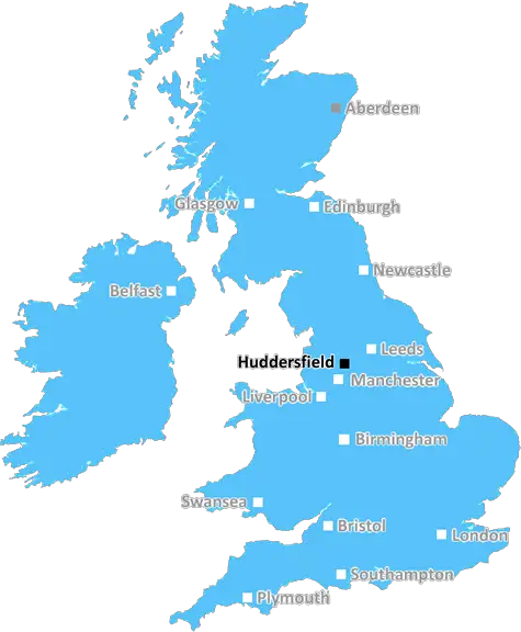
Huddersfield (HD4)
The HD4 postcode area is located in the Huddersfield postcode town region, within the county of West Yorkshire, and contains a total of 848 individual postcodes.
There are 38 electoral wards in the HD4 postcode area, including Brighouse, Holmfirth, Huddersfield which come under the local authority of the Kirklees Council.
Combining the whole postcode region, 20% of people in HD4 are classed as having an AB social grade, (i.e. 'white-collar' middle-upper class), compared to 27% across the UK.
This does not mean that the people of HD4 are poorer than other areas, but it may give an indication that there are areas of deprivation.
The postcode HD4 is a postcode district in the HD postcode area and part of the Huddersfield post town. It covers parts of the boroughs of Kirklees and Calderdale in the West Yorkshire county.
The HD4 postcode district is roughly rectangular and encompasses an area mainly to the north of the centre of Huddersfield. It is surrounded by postcode districts HD1 to the south, HD3 to the east, HD5 to the west and HD6 to the north.
The district is mainly residential with some rural parts, especially to the north. It contains a number of small villages, including Sheepridge, Woodhouse, Dalton, Deighton, Fixby, Brackenhall, Edgerton and Hillhouse. It is also home to part of Huddersfield town centre, which borders the northern outskirts of the area.
As of 2019, the estimated population of the HD4 postcode district is 19,712, with the average age being 41. The population is mainly composed of white British people, with a higher proportion of the population being in the lower to middle-income brackets. However, the area around Woodhouse is considered affluent.
Public transport links are good especially to areas around Huddersfield Town Centre with regular buses running through the area. The Calderdale Way cycle path passes through the area, providing a safe route of travel for cyclists.
The HD4 postcode district has a number of amenities that cater to its residents. Health facilities such as doctors surgeries, dentists and pharmacies are well-served in the area. Educational organisations exist for all age groups, including nursery, primary, secondary and further education. Shopping facilities are mainly on-street with convenience shops available in all major locations. There are also several pubs, take-aways, restaurants and fast-food outlets in the area. Local leisure facilities include outdoor play and recreational areas, including Paddock Moor, Dalton Cricket & Tennis Club, Deighton Playing Fields and Brackenhall Playing Fields.

Demographics
West Yorkshire

HD4 is located in the county of West Yorkshire, in England.
West Yorkshire has a total population of 2,299,700, making it the 4th largest county in the UK.
West Yorkshire has a total area of 783 square miles, and a population density of 1133 people per square kilometre. For comparison, Greater London has a density of 5,618 people/km2.
| Outward Code | HD4 |
| Postal Town | Huddersfield |
| MSOA Name | Kirklees 039 |
| LSOA Name | Kirklees 039C |
| County | West Yorkshire |
| Region | West Yorkshire |
| Country | England |
| Local Authority | Kirklees |
| Area Classification | Urban with Major Conurbation |
HD4 Electoral Wards
The postal region of HD4, includes the local towns, villages, electoral wards and stations of:
Dig even deeper into the HD4 postcode by clicking on a postcode below:
Click on an outward postal code below for more information about the area. Each 'outward' postcode give you a comprehensive list of all postcodes within the outward code area (HD) and estimated address.
Click on an 'outward' code for more information. For example, the outward postcode page 'EC2M' will give you an alphabetical list covering all postcodes located in the region, from 'EC2M 1BB' through to 'EC2M 7YA'.
Chris H
Saturday, April 6, 2024
We don't have any views of HD4 right now. If you live in HD4 or have visited it, please help us to help others by telling others what you think of this neighbourhood.
Add your view of HD4
People need your local expertise. If you live in HD4 or have first-hand knowledge of the neighbourhood, please consider sharing your views. It's completely anonymous - all we ask is for your initials.
Please tell us what you like about the HD4 postcode area, what you don't like, and what it's like to live or work here.
| LOCAL AMENITIES | |
| FAMILY FRIENDLY | |
| PARKING | |
| GREEN SPACES |
Local News West Yorkshire
National Coal Mining Museum hosts miners' memories of 1980s strike
Memories of the 1984 miners' strike at centre of 40th anniversary exhibition.
BBC NewsCoroner raises concern over indefinite jail terms after man's death
John Hobson has urged the Ministry of Justice to consider the impact on offender's mental health.
BBC NewsElland waste tip to close for up to two weeks
The waste recycling centre's closure is to allow "essential drainage works" to take place.
BBC NewsWakefield council tax rise agreed amid angry scenes at meeting
A Wakefield Council budget meeting is adjourned after a heated debate over spending cuts.
BBC News1970 FA Cup final: The most brutal game in English football history
As Chelsea get set to face Leeds in the FA Cup fifth round, BBC Sport looks back at the notoriously ferocious 1970 FA Cup final replay between the two sides.
BBC NewsSuper League: Castleford Tigers 36-24 Salford Red Devils - Cas get first win of season
Four Innes Senior tries help Castleford Tigers taste Super League victory for the first time in 2024, with a win over Salford.
BBC NewsMurder victim told police she feared ex-partner would kill her
Katie Higton warned officers of threats from Marcus Osborne, a timeline obtained by the BBC reveals.
BBC NewsDeaf team assistant condemns 'offensive' jibes
Footballers in the Leeds team are regularly mocked for having impaired hearing, Matt Dixon says.
BBC NewsFrom the Postcode Area blog

Deciphering Crime Rates - a Deep Dive Into UK Postcode Analysis
Ever wondered about the crime rate in your UK postcode? You're not alone. We've dug deep into the data, uncovering trends and patterns that'll make your head spin.

Death of the High Street?
The BBC reports that despite councils' attempts to kurb them, the UK's high streets have seen a huge growth in fast food outlets. Could this mark the death knell for the Great British high street, and what can we do about it to halt its decline?

Discrimination by Postcode
You really couldn't make it up, could you? Some of the country's most vulnerable people are missing out on their weekly £25 Cold Weather Payment, just because the system that's in operation is discriminating against them because payments are based on postcode, rather than geographic location.

The Redesign is Underway
Well, the current website was absolutely in dire need of a good redesign - from the ground up. So I set out to pull it all apart and get it up and running again to become the most comprehensive guide to every postcode in the UK. And it's been a long, tough job from start to finish - and quite possibly the biggest project I've ever undertaken.
SOCIAL GRADES
According to census records, 20% of people here have a social grade of AB (highest), compared to the national average of 27%.