hemel-hempstead HP23 Postcodes
Spending a fortune on conveyancing?

Compare instant, low-cost online quotes from trusted conveyancing solicitors.
Backed by experts, our no-obligation service searches through the best conveyancing quotes on the market to save you time and money.
Hemel Hempstead (HP23)
The HP23 postcode area is located in the Hemel Hempstead postcode town region, within the county of Hertfordshire, and contains a total of 883 individual postcodes.
There are 44 electoral wards in the HP23 postcode area, including Amersham, Aylesbury, Beaconsfield, Berkhamsted, Chalfont St Giles, Chesham, Great Missenden, Hemel Hempstead, High Wycombe, Princes Risborough, Tring which come under the local authority of the Dacorum Council.
Combining the whole postcode region, 38% of people in HP23 are classed as having an AB social grade, (i.e. 'white-collar' middle-upper class), compared to 27% across the UK.
This does not mean that the people of HP23 are wealthier - or higher class - than average, but it can be an indication that the area may be prospering and desirable to live in.
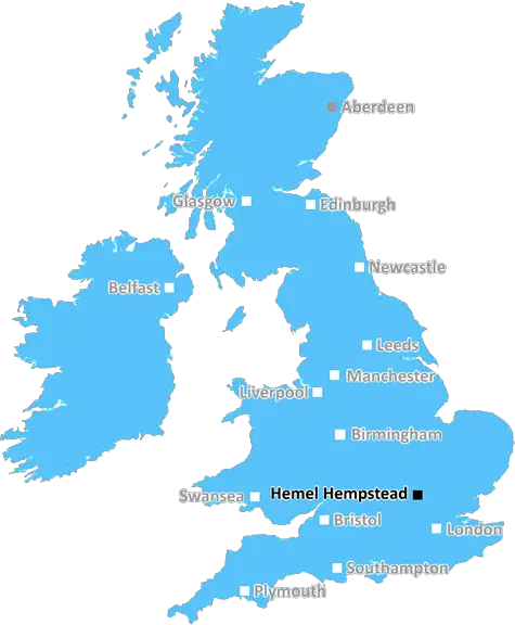
The HP23 post code is located in the district of Hemel Hempstead, within Hertfordshire, in the south east of England, located close to the county border of Buckinghamshire. The post code serves the town of Hemel Hempstead and areas such as the towns of Markyate and Flaunden, as well as the hamlets and villages of Chipperfield, Frogmore, Kings Langley, Nash Mills, Leverstock Green, Bovingdon and Felden.
The area falls within a Geographical Information System (GIS) region classed as SE, or South East. As part of this region, the post code is in catchment of the South East Coast Ambulance Service (SECAmb). The HP23 post code covers approximately 25.7 km in total, over which an estimated population of 43,355 people reside.
The area of Hemel Hempstead covered is mostly flat, with an elevation ranging from just over 74 meters above sea level at its highest point, to under 50 meters at its lowest. It is estimated that the average household in HP23 is made up of 2.7 people, and that the average house price (as of 2020) stands at �402,000. The post code region also contains several GP practices, in addition to a number of independent hospitals, such as Vegetable Studio and St Giles Private Medical Centre.
Primary and secondary education in the area is provided by a range of local schools, such as Berkhamsted School, Marlowes Primary School, Fenny Hill Primary School, King's Langley Primary School, and Markyate Primary School. Major transport links within the area include local bus services, operated by Red Rose Travel and Arriva, and the M1, M25 and A41 motorways.
The area also provides many shopping options, with several large retail outlets in the town centre as well as smaller shops and markets located across the district. Additionally, the area offers a selection of leisure activities such as golfing, bowling and water sports facilities located at the nearby rivers of Bulbourne and Gade. Visitors to the area can also find many bars and restaurants, as well as sporting venues for a wide range of outdoor activities.

Demographics
Hertfordshire

HP23 is located in the county of Hertfordshire, in England.
Hertfordshire has a total population of 1,176,700, making it the 12th largest county in the UK.
Hertfordshire has a total area of 634 square miles, and a population density of 716 people per square kilometre. For comparison, Greater London has a density of 5,618 people/km2.
| Outward Code | HP23 |
| Postal Town | Hemel Hempstead |
| MSOA Name | Dacorum 002 |
| LSOA Name | Dacorum 002D |
| County | Hertfordshire |
| Region | Hertfordshire |
| Country | England |
| Local Authority | Dacorum |
| Area Classification | Urban with Significant Rural (rural including hub towns 26-49%) |
HP23 Electoral Wards
The postal region of HP23, includes the local towns, villages, electoral wards and stations of:
Dig even deeper into the HP23 postcode by clicking on a postcode below:
Click on an outward postal code below for more information about the area. Each 'outward' postcode give you a comprehensive list of all postcodes within the outward code area (HP) and estimated address.
Click on an 'outward' code for more information. For example, the outward postcode page 'EC2M' will give you an alphabetical list covering all postcodes located in the region, from 'EC2M 1BB' through to 'EC2M 7YA'.
Chris H
Friday, May 10, 2024
We don't have any views of HP23 right now. If you live in HP23 or have visited it, please help us to help others by telling others what you think of this neighbourhood.
Add your view of HP23
People need your local expertise. If you live in HP23 or have first-hand knowledge of the neighbourhood, please consider sharing your views. It's completely anonymous - all we ask is for your initials.
Please tell us what you like about the HP23 postcode area, what you don't like, and what it's like to live or work here.
| LOCAL AMENITIES | |
| FAMILY FRIENDLY | |
| PARKING | |
| GREEN SPACES |
Local News Hertfordshire
Ex-England cricketer quits George Galloway's party
Monty Panesar was among dozens of MP candidates being lined up by the Workers Party of Britain.
BBC NewsSunrisers beat Southern Vipers by three wickets
Eve Jones makes an unbeaten 136 to lead Central Sparks to victory over Thunder in the Rachael Heyhoe Flint Trophy.
BBC NewsHumiliated' by being turned away from a cruise
Mike Ashton from Flitwick was told he couldn't board the P&O ship in his wheelchair.
BBC NewsAnderson and Alexandrou depart Stevenage
Harry Anderson and Theo Alexandrou are released by Stevenage after the club announce their retained list for next season.
BBC NewsStevenage reappoint Revell as manager
League One club Stevenage reappoint Alex Revell as their head coach following Steve Evans' departure to Rotherham United.
BBC NewsBedfordshire elects first Labour PCC in eight years
John Tizard becomes police and crime commissioner, beating Conservative Festus Akinbusoye.
BBC NewsEgg supplier makes changes after neglect claims
Bird Bros, which supplies four million eggs a week, says it is moving hens from cages to barns.
BBC NewsCrawley and MK Dons' play-off game postponed
The League Two play-off semi-final first leg between Crawley Town and Milton Keynes Dons is postponed because of a waterlogged pitch.
BBC NewsFrom the Postcode Area blog

Deciphering Crime Rates - a Deep Dive Into UK Postcode Analysis
Ever wondered about the crime rate in your UK postcode? You're not alone. We've dug deep into the data, uncovering trends and patterns that'll make your head spin.

Death of the High Street?
The BBC reports that despite councils' attempts to kurb them, the UK's high streets have seen a huge growth in fast food outlets. Could this mark the death knell for the Great British high street, and what can we do about it to halt its decline?

Discrimination by Postcode
You really couldn't make it up, could you? Some of the country's most vulnerable people are missing out on their weekly £25 Cold Weather Payment, just because the system that's in operation is discriminating against them because payments are based on postcode, rather than geographic location.

The Redesign is Underway
Well, the current website was absolutely in dire need of a good redesign - from the ground up. So I set out to pull it all apart and get it up and running again to become the most comprehensive guide to every postcode in the UK. And it's been a long, tough job from start to finish - and quite possibly the biggest project I've ever undertaken.
SOCIAL GRADES
According to census records, 38% of people here have a social grade of AB (highest), compared to the national average of 27%.