hemel-hempstead HP2 Postcodes
Spending a fortune on conveyancing?

Compare instant, low-cost online quotes from trusted conveyancing solicitors.
Backed by experts, our no-obligation service searches through the best conveyancing quotes on the market to save you time and money.
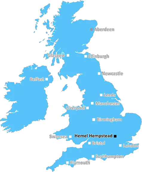
Hemel Hempstead (HP2)
The HP2 postcode area is located in the Hemel Hempstead postcode town region, within the county of Hertfordshire, and contains a total of 1363 individual postcodes.
There are 17 electoral wards in the HP2 postcode area, including Amersham, Aylesbury, Beaconsfield, Berkhamsted, Chalfont St Giles, Chesham, Great Missenden, Hemel Hempstead, High Wycombe, Princes Risborough, Tring which come under the local authority of the Dacorum Council.
Combining the whole postcode region, 22% of people in HP2 are classed as having an AB social grade, (i.e. 'white-collar' middle-upper class), compared to 27% across the UK.
This does not mean that the people of HP2 are poorer than other areas, but it may give an indication that there are areas of deprivation.
The HP2 postcode is part of the Hemel Hempstead district in the United Kingdom. It covers the area of Marlowes and includes the surrounding areas of Apsley, Bennetts End, Adeyfield, Piccotts End and Parts of Maylands, and St Albans Road.
This postcode is largely comprised of residential areas with local amenities including supermarkets, schools, play parks and leisure centres. In these residential neighbourhoods, houses vary in style from large family homes with gardens to small modern apartments. The proximity to the train station and the main shopping centre, the Marlowes, make this a desirable area.
The HP2 postcode plays host to annual community events such as carnivals and is well-known for its selection of pubs and restaurants. Public transport links are excellent, with bus routes to the surrounding areas as well as connections to the London area. This makes the area a popular choice for commuters and those who need to travel further afield.
The local Hemel Industrial estate is situated within the HP2 postcode and provides employment for many of its residents. As well as industrial units, there is a range of retail outlets and cafes offering a place to meet, eat and shop. There are also a number of leisure activities nearby, including a nearby theatre and a cinema.
The HP2 postcode is a diverse area with something to suit everybody's needs. From the local shops, pubs and cafes to the educational facilities, businesses and leisure activities, the area has lots to offer residents and visitors alike. It's well connected to the surrounding districts, offering easy access to transport links and all the amenities of the bigger cities, whilst maintaining the close-knit and relaxed atmosphere of a suburb.

Demographics
Hertfordshire

HP2 is located in the county of Hertfordshire, in England.
Hertfordshire has a total population of 1,176,700, making it the 12th largest county in the UK.
Hertfordshire has a total area of 634 square miles, and a population density of 716 people per square kilometre. For comparison, Greater London has a density of 5,618 people/km2.
| Outward Code | HP2 |
| Postal Town | Hemel Hempstead |
| MSOA Name | Dacorum 015 |
| LSOA Name | Dacorum 015D |
| County | Hertfordshire |
| Region | Hertfordshire |
| Country | England |
| Local Authority | Dacorum |
| Area Classification | Urban with Significant Rural (rural including hub towns 26-49%) |
HP2 Electoral Wards
The postal region of HP2, includes the local towns, villages, electoral wards and stations of:
Dig even deeper into the HP2 postcode by clicking on a postcode below:
Click on an outward postal code below for more information about the area. Each 'outward' postcode give you a comprehensive list of all postcodes within the outward code area (HP) and estimated address.
Click on an 'outward' code for more information. For example, the outward postcode page 'EC2M' will give you an alphabetical list covering all postcodes located in the region, from 'EC2M 1BB' through to 'EC2M 7YA'.
GB, Hemel Hempstead
Saturday, December 11, 2021
Its a lovely area with loads of green spaces and good entertainment places like old town, town, gadebridge park and more. There's plenty of schools. But town in Hemel Hempstead could be nicer as the shops don't look very welcoming.
Add your view of HP2
People need your local expertise. If you live in HP2 or have first-hand knowledge of the neighbourhood, please consider sharing your views. It's completely anonymous - all we ask is for your initials.
Please tell us what you like about the HP2 postcode area, what you don't like, and what it's like to live or work here.
| LOCAL AMENITIES | |
| FAMILY FRIENDLY | |
| PARKING | |
| GREEN SPACES |
Local News Hertfordshire
Running 5k every day while fasting during Ramadan
Bilal Hussain took on the challenge to raise money for Luton Food Bank.
BBC NewsNo hosepipe ban, says Anglian Water
Anglian Water says it has no plans to restrict the use of hosepipes this summer.
BBC NewsDelays on M25 and M1 as equipment is transported
An abnormal load bound for a power station will affect some M1 and M25 traffic this weekend.
BBC NewsUniversal begins public meetings for UK theme park
The company says the public engagement does not mean the proposal is confirmed.
BBC NewsPrivate ambulance service aims to reduce NHS waits
It charges users to call a healthcare professional to their home for urgent but non-emergency cases.
BBC NewsWatford and Preston play out goalless draw
Watford and Preston play out a relatively drab goalless draw in the Championship.
BBC NewsHow a hard-boiled egg could determine Wembley glory
Kevin Chapman is going to be egging on Peterborough United in the EFL Trophy final on Sunday.
BBC NewsHotel refugees 'gone by end of June', says MP
MP Andrew Selous says the Home Office has terminated its contract with the hotel.
BBC NewsFrom the Postcode Area blog

Deciphering Crime Rates - a Deep Dive Into UK Postcode Analysis
Ever wondered about the crime rate in your UK postcode? You're not alone. We've dug deep into the data, uncovering trends and patterns that'll make your head spin.

Death of the High Street?
The BBC reports that despite councils' attempts to kurb them, the UK's high streets have seen a huge growth in fast food outlets. Could this mark the death knell for the Great British high street, and what can we do about it to halt its decline?

Discrimination by Postcode
You really couldn't make it up, could you? Some of the country's most vulnerable people are missing out on their weekly £25 Cold Weather Payment, just because the system that's in operation is discriminating against them because payments are based on postcode, rather than geographic location.

The Redesign is Underway
Well, the current website was absolutely in dire need of a good redesign - from the ground up. So I set out to pull it all apart and get it up and running again to become the most comprehensive guide to every postcode in the UK. And it's been a long, tough job from start to finish - and quite possibly the biggest project I've ever undertaken.
SOCIAL GRADES
According to census records, 22% of people here have a social grade of AB (highest), compared to the national average of 27%.