hemel-hempstead HP1 Postcodes
Spending a fortune on conveyancing?

Compare instant, low-cost online quotes from trusted conveyancing solicitors.
Backed by experts, our no-obligation service searches through the best conveyancing quotes on the market to save you time and money.
Hemel Hempstead (HP1)
The HP1 postcode area is located in the Hemel Hempstead postcode town region, within the county of Hertfordshire, and contains a total of 1143 individual postcodes.
There are 23 electoral wards in the HP1 postcode area, including Amersham, Aylesbury, Beaconsfield, Berkhamsted, Chalfont St Giles, Chesham, Great Missenden, Hemel Hempstead, High Wycombe, Princes Risborough, Tring which come under the local authority of the Dacorum Council.
Combining the whole postcode region, 33% of people in HP1 are classed as having an AB social grade, (i.e. 'white-collar' middle-upper class), compared to 27% across the UK.
This does not mean that the people of HP1 are wealthier - or higher class - than average, but it can be an indication that the area may be prospering and desirable to live in.
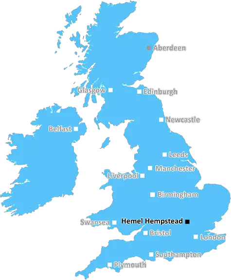
The HP1 postcode district is located in the county of Hertfordshire, within the Hemel Hempstead district. The postcode covers part of the town of Hemel Hempstead as well as the neighbouring villages of Bovingdon, Chipperfield, Flaunden, Kings Langley, Little Gaddesden, Nettleden and St Leonards. It is bordered by the HP2, HP3, WD4, WD5, WD6, HP4 and HP5 postcode areas.
This postcode area encompasses the Bennetts End and Boxmoor districts of the town, as well as Hemel Hempstead town centre. It is situated between junction 8 of the M25 motorway to the south and the M1 motorway to the north. The district has plenty of shops, caf�s, restaurants, and local amenities, as well as a leisure centre and public park.
Schools in the postcode include Cavendish School, Queensbury Lower School, Swallow Dell Primary School, Chambersbury Special School, Lemsford Village Primary, Cavendish Primary School, Woodhouse Primary, John F Kennedy Catholic School, and Hemel Hempstead School.
The area is served by two train stations; Apsley and Hemel Hempstead. There is also excellent bus links covering Hemel Hempstead, Watford, and neighbouring towns, as well as the A41 and M1 motorway. The district is close to the nearby towns of Kings Langley, Watford, St Albans and Aylesbury.
The HP1 postcode district has a diverse population, with a wide range of housing styles and sizes. There are a large number of stately homes, modern apartments as well as terraced houses in the area, particularly around Bennetts End, Apsley, and Boxmoor.
The district is home to many parks, green spaces, and waterways, such as the Hertfordshire Way, Apsley lock, and the Grand Union Canal. There are also a number of pubs, bars and live music venues in the area. The HP1 postcode district is a vibrant and diverse place to live.

Demographics

Hertfordshire

HP1 is located in the county of Hertfordshire, in England.
Hertfordshire has a total population of 1,176,700, making it the 12th largest county in the UK.
Hertfordshire has a total area of 634 square miles, and a population density of 716 people per square kilometre. For comparison, Greater London has a density of 5,618 people/km2.
| Outward Code | HP1 |
| Postal Town | Hemel Hempstead |
| MSOA Name | Dacorum 015 |
| LSOA Name | Dacorum 015D |
| County | Hertfordshire |
| Region | Hertfordshire |
| Country | England |
| Local Authority | Dacorum |
| Area Classification | Urban with Significant Rural (rural including hub towns 26-49%) |
HP1 Electoral Wards
The postal region of HP1, includes the local towns, villages, electoral wards and stations of:
Dig even deeper into the HP1 postcode by clicking on a postcode below:
Click on an outward postal code below for more information about the area. Each 'outward' postcode give you a comprehensive list of all postcodes within the outward code area (HP) and estimated address.
Click on an 'outward' code for more information. For example, the outward postcode page 'EC2M' will give you an alphabetical list covering all postcodes located in the region, from 'EC2M 1BB' through to 'EC2M 7YA'.
Chris H
Monday, April 8, 2024
We don't have any views of HP1 right now. If you live in HP1 or have visited it, please help us to help others by telling others what you think of this neighbourhood.
Add your view of HP1
People need your local expertise. If you live in HP1 or have first-hand knowledge of the neighbourhood, please consider sharing your views. It's completely anonymous - all we ask is for your initials.
Please tell us what you like about the HP1 postcode area, what you don't like, and what it's like to live or work here.
| LOCAL AMENITIES | |
| FAMILY FRIENDLY | |
| PARKING | |
| GREEN SPACES |
Local News Hertfordshire
How a hard-boiled egg could determine Wembley glory
Kevin Chapman is going to be egging on Peterborough United in the EFL Trophy final on Sunday.
BBC NewsFormer Luton Town manager Kinnear dies aged 77
Former Wimbledon and Newcastle United manager Joe Kinnear dies at the age of 77, his family announces.
BBC NewsWatford and Preston play out goalless draw
Watford and Preston play out a relatively drab goalless draw in the Championship.
BBC NewsBus driver in hospital after crashing into wall
Police are appealing for information, such as dashcam footage, following the collision in St Albans.
BBC NewsSpanish funeral cancelled after UK passport mishap
Keith Rudd had five months left on his passport, but was not allowed to fly out of a UK airport.
BBC NewsBurrows stars as Posh beat Wycombe to lift EFL Trophy
Harrison Burrows scores twice, including a stoppage-time winner, as Peterborough beat Wycombe at Wembley to secure the EFL Trophy for a second time.
BBC NewsGB newcomer Newman-Baronius equals world record
Olivia Newman-Baronius, 17, equals the S14 100m butterfly world record in her first major event to all but confirm her place at this summer's Paralympics.
BBC NewsLate Posh strike breaks Wycombe hearts at Wembley
Harrison Burrows scores twice, including a stoppage-time winner, as Peterborough beat Wycombe at Wembley to secure the EFL Trophy for a second time.
BBC NewsFrom the Postcode Area blog

Deciphering Crime Rates - a Deep Dive Into UK Postcode Analysis
Ever wondered about the crime rate in your UK postcode? You're not alone. We've dug deep into the data, uncovering trends and patterns that'll make your head spin.

Death of the High Street?
The BBC reports that despite councils' attempts to kurb them, the UK's high streets have seen a huge growth in fast food outlets. Could this mark the death knell for the Great British high street, and what can we do about it to halt its decline?

Discrimination by Postcode
You really couldn't make it up, could you? Some of the country's most vulnerable people are missing out on their weekly £25 Cold Weather Payment, just because the system that's in operation is discriminating against them because payments are based on postcode, rather than geographic location.

The Redesign is Underway
Well, the current website was absolutely in dire need of a good redesign - from the ground up. So I set out to pull it all apart and get it up and running again to become the most comprehensive guide to every postcode in the UK. And it's been a long, tough job from start to finish - and quite possibly the biggest project I've ever undertaken.
SOCIAL GRADES
According to census records, 33% of people here have a social grade of AB (highest), compared to the national average of 27%.