gloucester GL15 Postcodes
Spending a fortune on conveyancing?

Compare instant, low-cost online quotes from trusted conveyancing solicitors.
Backed by experts, our no-obligation service searches through the best conveyancing quotes on the market to save you time and money.
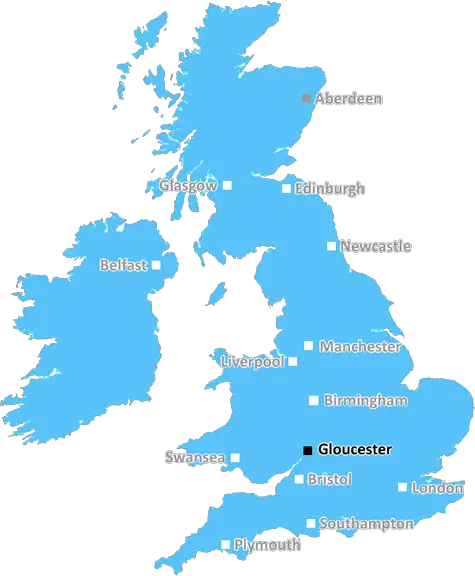
Gloucester (GL15)
The GL15 postcode area is located in the Gloucester postcode town region, within the county of Gloucestershire, and contains a total of 898 individual postcodes.
There are 88 electoral wards in the GL15 postcode area, including Badminton, Berkeley, Blakeney, Cheltenham, Chipping Campden, Cinderford, Cirencester, Coleford, Drybrook, Dursley, Dymock, Fairford, Gloucester, Lechlade, Longhope, Lydbrook, Lydney, Mitcheldean, Moreton-In-Marsh, Newent, Newnham, Ruardean, Stonehouse, Stroud, Tetbury, Tewkesbury, Westbury-On-Severn, Wotton-Under-Edge which come under the local authority of the Forest of Dean Council.
Combining the whole postcode region, 22% of people in GL15 are classed as having an AB social grade, (i.e. 'white-collar' middle-upper class), compared to 27% across the UK.
This does not mean that the people of GL15 are poorer than other areas, but it may give an indication that there are areas of deprivation.
The GL15 postcode is located in the Gloucester district in the English county of Gloucestershire. The postcode covers the town of Newent in its entirety, as well as small elements of the nearby villages of Longhope and Oxenhall. The postcode also extends to parts of the Forest of Dean and the Wye Valley, making it a great spot for outdoor activity.
Newent itself is a market town which has a market every Thursday. The town is known for its food, with places such as an open-air market, butchers, bakers, greengrocers, and cafes. It is also home to Newent Lake, a beauty spot which is of particular note to bird watchers, as it attracts a wide variety of species.
The village of Longhope is a small village but boasts a strong community feel. It has two pubs, The Crown Inn and The Royal Oak, as well as a selection of local shops and a church. This village has a rural market, taking place the third Saturday of each month, where local traders from across the GL15 postcode region gather to sell their wares.
The small village of Oxenhall is situated in the GL15 postcode near the border between Gloucestershire and Herefordshire. The village is home to a large cricket tea-room, which is also a tearoom and shop selling local produce. The village also has a pub, The Pound Inn. It is known for its pretty open countryside and the local wildlife.
This GL15 postcode is a great place for those interested in the outdoor activity due to its proximity to the Forest of Dean and Wye Valley, as well as being a great place for food lovers and those looking for a small village atmosphere.

Demographics
Gloucestershire

GL15 is located in the county of Gloucestershire, in England.
Gloucestershire has a total population of 900,800, making it the 23rd largest county in the UK.
Gloucestershire has a total area of 1216 square miles, and a population density of 285 people per square kilometre. For comparison, Greater London has a density of 5,618 people/km2.
| Outward Code | GL15 |
| Postal Town | Gloucester |
| MSOA Name | Forest of Dean 005 |
| LSOA Name | Forest of Dean 005A |
| County | Gloucestershire |
| Region | Gloucestershire |
| Country | England |
| Local Authority | Forest of Dean |
| Area Classification | Mainly Rural (rural including hub towns >=80%) |
GL15 Electoral Wards
The postal region of GL15, includes the local towns, villages, electoral wards and stations of:
Dig even deeper into the GL15 postcode by clicking on a postcode below:
Click on an outward postal code below for more information about the area. Each 'outward' postcode give you a comprehensive list of all postcodes within the outward code area (GL) and estimated address.
Click on an 'outward' code for more information. For example, the outward postcode page 'EC2M' will give you an alphabetical list covering all postcodes located in the region, from 'EC2M 1BB' through to 'EC2M 7YA'.
Chris H
Tuesday, April 9, 2024
We don't have any views of GL15 right now. If you live in GL15 or have visited it, please help us to help others by telling others what you think of this neighbourhood.
Add your view of GL15
People need your local expertise. If you live in GL15 or have first-hand knowledge of the neighbourhood, please consider sharing your views. It's completely anonymous - all we ask is for your initials.
Please tell us what you like about the GL15 postcode area, what you don't like, and what it's like to live or work here.
| LOCAL AMENITIES | |
| FAMILY FRIENDLY | |
| PARKING | |
| GREEN SPACES |
Local News Gloucestershire
Major road closure for two weeks for construction work
Part of the A417 near the Air Balloon roundabout will be closed overnight for two weeks from Monday.
BBC NewsEaster 'washout' for tourism businesses
A camping business says they had to cancel more than 30 bookings because of the wet weather.
BBC NewsJones and Lewis extend Gloucester-Hartpury deals
Ireland and Wales internationals Neve Jones and Bethan Lewis sign new deals to stay with Gloucester-Hartpury, along with Carmen Castelluci.
BBC NewsRelive Monday's League One & Two action
Aaron Collins scores a hat-trick for Bolton and Carlisle move closer to relegation - relive Monday's games in League One and League Two.
BBC NewsTwo arrests after man suffers serious head injuries
A man was taken to hospital by air ambulance after being assaulted near Gloucester Docks.
BBC NewsPlans for 47 new homes to be discussed
Forest of Dean District Council will consider plans to develop land in Milkwall, near Coleford.
BBC NewsLeyton Orient 3-1 Cheltenham Town
Leyton Orient find their shooting boots to inflict a League One defeat on relegation-haunted Cheltenham.
BBC NewsCheltenham fans group increase shares in club
A Cheltenham Town fans group says they want to build "solid supporter ownership" after increasing their shares in the club.
BBC NewsFrom the Postcode Area blog

Deciphering Crime Rates - a Deep Dive Into UK Postcode Analysis
Ever wondered about the crime rate in your UK postcode? You're not alone. We've dug deep into the data, uncovering trends and patterns that'll make your head spin.

Death of the High Street?
The BBC reports that despite councils' attempts to kurb them, the UK's high streets have seen a huge growth in fast food outlets. Could this mark the death knell for the Great British high street, and what can we do about it to halt its decline?

Discrimination by Postcode
You really couldn't make it up, could you? Some of the country's most vulnerable people are missing out on their weekly £25 Cold Weather Payment, just because the system that's in operation is discriminating against them because payments are based on postcode, rather than geographic location.

The Redesign is Underway
Well, the current website was absolutely in dire need of a good redesign - from the ground up. So I set out to pull it all apart and get it up and running again to become the most comprehensive guide to every postcode in the UK. And it's been a long, tough job from start to finish - and quite possibly the biggest project I've ever undertaken.
SOCIAL GRADES
According to census records, 22% of people here have a social grade of AB (highest), compared to the national average of 27%.