glasgow G83 Postcodes
Spending a fortune on conveyancing?

Compare instant, low-cost online quotes from trusted conveyancing solicitors.
Backed by experts, our no-obligation service searches through the best conveyancing quotes on the market to save you time and money.
Glasgow (G83)
The G83 postcode area is located in the Glasgow postcode town region, within the county of Dunbartonshire, and contains a total of 768 individual postcodes.
There are 65 electoral wards in the G83 postcode area, including Alexandria, Arrochar, Clydebank, Dumbarton, Glasgow, Helensburgh which come under the local authority of the West Dunbartonshire Council.
Combining the whole postcode region, 0% of people in G83 are classed as having an AB social grade, (i.e. 'white-collar' middle-upper class), compared to 27% across the UK.
This does not mean that the people of G83 are poorer than other areas, but it may give an indication that there are areas of deprivation.
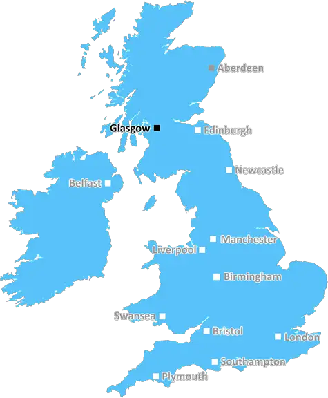
G83 is a postcode district located in the region of Glasgow, Scotland. It covers the northernmost part of the Strathclyde region and part of Argyll and Bute council area.
G83 postcode district includes the villages of Arrochar and Succoth, as well as the settlements around them. It also includes parts of Helensburgh, including Shandon, Cardross and Rhu. G83 is located off the A82 road, which is the main route between Glasgow and Inverness.
The main local industries include tourism, retail, small businesses, and fishing. The laneway by Arrochar, a popular spot for families, is the A-87 Loch Lomond road. Helensburgh has a range of pubs, restaurants, and nightlife, as well as retail outlets. The nearby Loch Lomond and Trossachs National Park is a popular tourist spot, attracting many visitors to the area.
There is a large expat community living in G83, drawn by the beauty of the area and the variety of outdoor activities. There are several golf courses in the area, and bike trails to explore. Lovers of outdoor activities will appreciate the numerous nearby hills, lakes, and forests. G83 postcode district also boasts historic sites, including the Samuel Balliol Elliott Tower, which is an internationally-renowned Neo-Gothic landmark.
The G83 postcode area is served by a number of rail and bus links, including Helensburgh railway station which is on the Glasgow to Oban Line. The region is also easily accessed by road, with good access to the A82 and A83 routes.
In terms of local amenities, G83 has much to offer, with supermarkets, post offices, banks, and other services all within the district. Healthcare services include GP surgeries, a physiotherapy/sports injuries clinic, and Helensburgh's Victoria Hospital. Education options include a number of primary, secondary, and tertiary institutions. Furthermore, the area has several places of worship, as well as leisure centres and sports clubs.

Demographics
Dunbartonshire

G83 is located in the county of Dunbartonshire, in Scotland.
Dunbartonshire has a total population of 0, making it the largest county in the UK.
Dunbartonshire has a total area of square miles, and a population density of people per square kilometre. For comparison, Greater London has a density of 5,618 people/km2.
| Outward Code | G83 |
| Postal Town | Glasgow |
| MSOA Name | IZ Fifteen |
| LSOA Name | |
| County | Dunbartonshire |
| Region | Dunbartonshire |
| Country | Scotland |
| Local Authority | West Dunbartonshire |
| Area Classification | Unclassified |
G83 Electoral Wards
The postal region of G83, includes the local towns, villages, electoral wards and stations of:
Dig even deeper into the G83 postcode by clicking on a postcode below:
Click on an outward postal code below for more information about the area. Each 'outward' postcode give you a comprehensive list of all postcodes within the outward code area (G) and estimated address.
Click on an 'outward' code for more information. For example, the outward postcode page 'EC2M' will give you an alphabetical list covering all postcodes located in the region, from 'EC2M 1BB' through to 'EC2M 7YA'.
Chris H
Sunday, April 7, 2024
We don't have any views of G83 right now. If you live in G83 or have visited it, please help us to help others by telling others what you think of this neighbourhood.
Add your view of G83
People need your local expertise. If you live in G83 or have first-hand knowledge of the neighbourhood, please consider sharing your views. It's completely anonymous - all we ask is for your initials.
Please tell us what you like about the G83 postcode area, what you don't like, and what it's like to live or work here.
| LOCAL AMENITIES | |
| FAMILY FRIENDLY | |
| PARKING | |
| GREEN SPACES |
From the Postcode Area blog

Deciphering Crime Rates - a Deep Dive Into UK Postcode Analysis
Ever wondered about the crime rate in your UK postcode? You're not alone. We've dug deep into the data, uncovering trends and patterns that'll make your head spin.

Death of the High Street?
The BBC reports that despite councils' attempts to kurb them, the UK's high streets have seen a huge growth in fast food outlets. Could this mark the death knell for the Great British high street, and what can we do about it to halt its decline?

Discrimination by Postcode
You really couldn't make it up, could you? Some of the country's most vulnerable people are missing out on their weekly £25 Cold Weather Payment, just because the system that's in operation is discriminating against them because payments are based on postcode, rather than geographic location.

The Redesign is Underway
Well, the current website was absolutely in dire need of a good redesign - from the ground up. So I set out to pull it all apart and get it up and running again to become the most comprehensive guide to every postcode in the UK. And it's been a long, tough job from start to finish - and quite possibly the biggest project I've ever undertaken.
SOCIAL GRADES
According to census records, 0% of people here have a social grade of AB (highest), compared to the national average of 27%.