glasgow G72 Postcodes
Spending a fortune on conveyancing?

Compare instant, low-cost online quotes from trusted conveyancing solicitors.
Backed by experts, our no-obligation service searches through the best conveyancing quotes on the market to save you time and money.
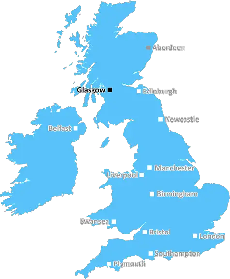
Glasgow (G72)
The G72 postcode area is located in the Glasgow postcode town region, within the county of Lanarkshire, and contains a total of 1359 individual postcodes.
There are 26 electoral wards in the G72 postcode area, including Alexandria, Arrochar, Clydebank, Dumbarton, Glasgow, Helensburgh which come under the local authority of the South Lanarkshire Council.
Combining the whole postcode region, 0% of people in G72 are classed as having an AB social grade, (i.e. 'white-collar' middle-upper class), compared to 27% across the UK.
This does not mean that the people of G72 are poorer than other areas, but it may give an indication that there are areas of deprivation.
The G72 postcode covers parts of Cambuslang, Rutherglen and Newton, which are located in the South Lanarkshire and Glasgow districts of Scotland. The postcode area is heavily populated, with an estimated population of 21,615 in 2019.
Most of the area is served by Cambuslang railway station, on the Glasgow South Western Line, which provides regular services to and from Glasgow City Centre.
The postcode of G72 includes some of the historic architecture of Glasgow such as the restored 18th century Rutherglen Mansion and the Category B Listed Building at Newfield House, a Herbert Simpson designed brick building in the former village of Newton. There is also a large parkland area to the west and north of the postcode, including David Livingstone Centre and Yew Tree Farm Visitor Centre.
The current postcode covers a relatively small area of Glasgow, however is located 6 miles south of the city centre, close to the M74 motorway. The area is highly desirable due to its easy access to Glasgow and its surrounding areas, as well as its popular local amenities. Due to its proximity to the motorway, it has become a popular commuter choice, making it an ideal location for many young professionals looking to make the most of their work and leisure time.
The G72 postcode benefits from a variety of local shops, including two small local supermarkets, independent stores, restaurants, and a thriving night-time economy. The area also provides a wide range of leisure activities, including sports and recreation centres, cinemas, and theatres. There are also several schools in the area, such as Hillhead High School and Trinity High School, offering a range of educational to meet all needs. In addition, the postcode is well served by local health services, and access to public transport, including buses and trains.

Demographics
Lanarkshire

G72 is located in the county of Lanarkshire, in Scotland.
Lanarkshire has a total population of 0, making it the largest county in the UK.
Lanarkshire has a total area of square miles, and a population density of people per square kilometre. For comparison, Greater London has a density of 5,618 people/km2.
| Outward Code | G72 |
| Postal Town | Glasgow |
| MSOA Name | Blantytre North and Coatshill |
| LSOA Name | |
| County | Lanarkshire |
| Region | Lanarkshire |
| Country | Scotland |
| Local Authority | South Lanarkshire |
| Area Classification | Unclassified |
G72 Electoral Wards
The postal region of G72, includes the local towns, villages, electoral wards and stations of:
Dig even deeper into the G72 postcode by clicking on a postcode below:
Click on an outward postal code below for more information about the area. Each 'outward' postcode give you a comprehensive list of all postcodes within the outward code area (G) and estimated address.
Click on an 'outward' code for more information. For example, the outward postcode page 'EC2M' will give you an alphabetical list covering all postcodes located in the region, from 'EC2M 1BB' through to 'EC2M 7YA'.
Chris H
Saturday, April 6, 2024
We don't have any views of G72 right now. If you live in G72 or have visited it, please help us to help others by telling others what you think of this neighbourhood.
Add your view of G72
People need your local expertise. If you live in G72 or have first-hand knowledge of the neighbourhood, please consider sharing your views. It's completely anonymous - all we ask is for your initials.
Please tell us what you like about the G72 postcode area, what you don't like, and what it's like to live or work here.
| LOCAL AMENITIES | |
| FAMILY FRIENDLY | |
| PARKING | |
| GREEN SPACES |
From the Postcode Area blog

Deciphering Crime Rates - a Deep Dive Into UK Postcode Analysis
Ever wondered about the crime rate in your UK postcode? You're not alone. We've dug deep into the data, uncovering trends and patterns that'll make your head spin.

Death of the High Street?
The BBC reports that despite councils' attempts to kurb them, the UK's high streets have seen a huge growth in fast food outlets. Could this mark the death knell for the Great British high street, and what can we do about it to halt its decline?

Discrimination by Postcode
You really couldn't make it up, could you? Some of the country's most vulnerable people are missing out on their weekly £25 Cold Weather Payment, just because the system that's in operation is discriminating against them because payments are based on postcode, rather than geographic location.

The Redesign is Underway
Well, the current website was absolutely in dire need of a good redesign - from the ground up. So I set out to pull it all apart and get it up and running again to become the most comprehensive guide to every postcode in the UK. And it's been a long, tough job from start to finish - and quite possibly the biggest project I've ever undertaken.
SOCIAL GRADES
According to census records, 0% of people here have a social grade of AB (highest), compared to the national average of 27%.