glasgow G11 Postcodes
Spending a fortune on conveyancing?

Compare instant, low-cost online quotes from trusted conveyancing solicitors.
Backed by experts, our no-obligation service searches through the best conveyancing quotes on the market to save you time and money.
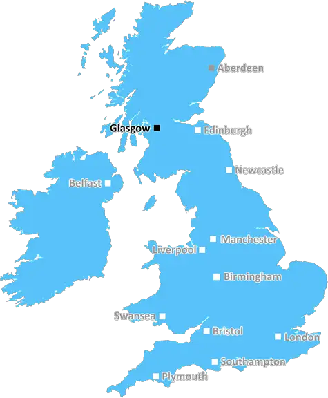
Glasgow (G11)
The G11 postcode area is located in the Glasgow postcode town region, within the county of Lanarkshire, and contains a total of 760 individual postcodes.
There are 3 electoral wards in the G11 postcode area, including Alexandria, Arrochar, Clydebank, Dumbarton, Glasgow, Helensburgh which come under the local authority of the Glasgow City Council.
Combining the whole postcode region, 0% of people in G11 are classed as having an AB social grade, (i.e. 'white-collar' middle-upper class), compared to 27% across the UK.
This does not mean that the people of G11 are poorer than other areas, but it may give an indication that there are areas of deprivation.
The G11 postcode covers the West End of Glasgow, Scotland. It includes the areas of Drumchapel, Knightswood, Yoker, Scotstoun and Whiteinch. It is bordered by the G12 postcode to the east, the G13 postcode to the north and the G14 postcode to the south.
The G11 postcode is a densely populated residential area and the population is predominantly working class. It contains some of Scotland's most multi-cultural communities with a large number of Somali, Pakistani, Vietnamese and Chinese people living in the area.
The area is served by Scotstoun's Queen Elizabeth University, Yoker's Whitecrook Primary School and St. German's Episcopal Church in Drumchapel.
The G11 postcode has a range of green space, including a large country park in the north-west of the area. It also contains a number of parks, playing fields and playgrounds, making it an ideal spot for recreation.
The area has a diverse selection of shops from corner stores to large supermarkets, with some of the best restaurants in the city available. There are clubs, pubs and venues, as well as a variety of leisure activities. The area also has libraries, a post office and a GP's practice.
The G11 postcode is well served by public transport. There is a local station in Drumchapel, as well as buses running on the main trunk roads. The M8 motorway runs through the area, providing access to the city centre and other suburbs.
The G11 postcode comprises of several neighbourhoods which all feature distinctive architecture, from traditional tenement buildings in Drumchapel to the modernist high-rise buildings of Whiteinch. The area also features a range of interesting industrial sites, enabling it to play an important role in the city's industrial heritage.

Demographics
Lanarkshire

G11 is located in the county of Lanarkshire, in Scotland.
Lanarkshire has a total population of 0, making it the largest county in the UK.
Lanarkshire has a total area of square miles, and a population density of people per square kilometre. For comparison, Greater London has a density of 5,618 people/km2.
| Outward Code | G11 |
| Postal Town | Glasgow |
| MSOA Name | Partickhill and Hyndland |
| LSOA Name | |
| County | Lanarkshire |
| Region | Lanarkshire |
| Country | Scotland |
| Local Authority | Glasgow City |
| Area Classification | Unclassified |
G11 Electoral Wards
The postal region of G11, includes the local towns, villages, electoral wards and stations of:
Dig even deeper into the G11 postcode by clicking on a postcode below:
Click on an outward postal code below for more information about the area. Each 'outward' postcode give you a comprehensive list of all postcodes within the outward code area (G) and estimated address.
Click on an 'outward' code for more information. For example, the outward postcode page 'EC2M' will give you an alphabetical list covering all postcodes located in the region, from 'EC2M 1BB' through to 'EC2M 7YA'.
Chris H
Sunday, April 7, 2024
We don't have any views of G11 right now. If you live in G11 or have visited it, please help us to help others by telling others what you think of this neighbourhood.
Add your view of G11
People need your local expertise. If you live in G11 or have first-hand knowledge of the neighbourhood, please consider sharing your views. It's completely anonymous - all we ask is for your initials.
Please tell us what you like about the G11 postcode area, what you don't like, and what it's like to live or work here.
| LOCAL AMENITIES | |
| FAMILY FRIENDLY | |
| PARKING | |
| GREEN SPACES |
From the Postcode Area blog

Deciphering Crime Rates - a Deep Dive Into UK Postcode Analysis
Ever wondered about the crime rate in your UK postcode? You're not alone. We've dug deep into the data, uncovering trends and patterns that'll make your head spin.

Death of the High Street?
The BBC reports that despite councils' attempts to kurb them, the UK's high streets have seen a huge growth in fast food outlets. Could this mark the death knell for the Great British high street, and what can we do about it to halt its decline?

Discrimination by Postcode
You really couldn't make it up, could you? Some of the country's most vulnerable people are missing out on their weekly £25 Cold Weather Payment, just because the system that's in operation is discriminating against them because payments are based on postcode, rather than geographic location.

The Redesign is Underway
Well, the current website was absolutely in dire need of a good redesign - from the ground up. So I set out to pull it all apart and get it up and running again to become the most comprehensive guide to every postcode in the UK. And it's been a long, tough job from start to finish - and quite possibly the biggest project I've ever undertaken.
SOCIAL GRADES
According to census records, 0% of people here have a social grade of AB (highest), compared to the national average of 27%.