falkirk FK7 Postcodes
Spending a fortune on conveyancing?

Compare instant, low-cost online quotes from trusted conveyancing solicitors.
Backed by experts, our no-obligation service searches through the best conveyancing quotes on the market to save you time and money.
Falkirk (FK7)
The FK7 postcode area is located in the Falkirk postcode town region, within the county of Stirlingshire, and contains a total of 1027 individual postcodes.
There are 24 electoral wards in the FK7 postcode area, including Alloa, Alva, Bonnybridge, Callander, Clackmannan, Crianlarich, Denny, Dollar, Doune, Dunblane, Falkirk, Grangemouth, Killin, Larbert, Lochearnhead, Menstrie, Stirling, Tillicoultry which come under the local authority of the Stirling Council.
Combining the whole postcode region, 0% of people in FK7 are classed as having an AB social grade, (i.e. 'white-collar' middle-upper class), compared to 27% across the UK.
This does not mean that the people of FK7 are poorer than other areas, but it may give an indication that there are areas of deprivation.
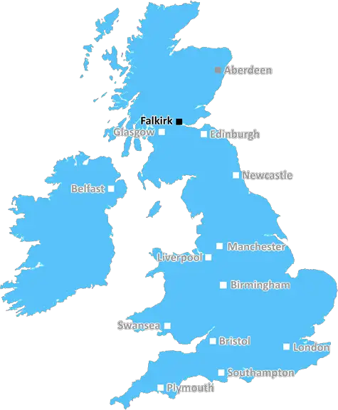
FK7 postcode is an area found in the central belt of Scotland. It covers a large area from Stirling in the south, to the roman camp of Boghall in the north, and extends from the bonnie banks of Loch Lomond in the west to the rolling hills of the Campsie Fells in the east.
It includes the historic town of Stirling, a famous and bustling centre for business, art, culture and entertainment, as well as the city's suburbs, many of which have beautiful views of the surrounding countryside. It is also home to nearby villages such as Bridge of Allan and Bannockburn, as well as part of the famous Trossachs National Park.
The postcode covers a diverse range of areas: rural to urban, from traditional to modern. It also includes both high- and low-density housing, giving a mix of residential, commercial, industrial and agricultural land. Due to its variety of facilities and strong transport links, the FK7 postcode region has become home to a variety of industries, from IT to engineering.
For education, a number of secondary schools serve the area � such as Wallace High, Stirling High, and St Modan's High. Meanwhile, numerous primary schools are located in the area, with a variety of independent and private schools also present. A wide range of colleges and universities are also close to the area, making FK7 a popular choice for students.
The region also contains a network of local government, health, police and fire services, as well as many sport and leisure facilities. There are a variety of parks, sports grounds and leisure centres, such as Stirling Sports Village and Allan Park.
FK7 is a charming area surrounded by nature. It encompasses scenic lochs, including Loch Lomond, as well as imposing and picturesque mountains, such as Ben Lomond. Popular visitor attractions include the historic Stirling Castle, the National Wallace Monument and the picturesque Lake of Menteith. The FK7 postcode also includes the magnificent North Coast 500 route, a 500 mile journey around Scotland's North Coast.

Demographics
Stirlingshire

FK7 is located in the county of Stirlingshire, in Scotland.
Stirlingshire has a total population of 0, making it the largest county in the UK.
Stirlingshire has a total area of square miles, and a population density of people per square kilometre. For comparison, Greater London has a density of 5,618 people/km2.
| Outward Code | FK7 |
| Postal Town | Falkirk |
| MSOA Name | Bannockburn |
| LSOA Name | |
| County | Stirlingshire |
| Region | Stirlingshire |
| Country | Scotland |
| Local Authority | Stirling |
| Area Classification | Unclassified |
FK7 Electoral Wards
The postal region of FK7, includes the local towns, villages, electoral wards and stations of:
Dig even deeper into the FK7 postcode by clicking on a postcode below:
Click on an outward postal code below for more information about the area. Each 'outward' postcode give you a comprehensive list of all postcodes within the outward code area (FK) and estimated address.
Click on an 'outward' code for more information. For example, the outward postcode page 'EC2M' will give you an alphabetical list covering all postcodes located in the region, from 'EC2M 1BB' through to 'EC2M 7YA'.
Chris H
Sunday, April 7, 2024
We don't have any views of FK7 right now. If you live in FK7 or have visited it, please help us to help others by telling others what you think of this neighbourhood.
Add your view of FK7
People need your local expertise. If you live in FK7 or have first-hand knowledge of the neighbourhood, please consider sharing your views. It's completely anonymous - all we ask is for your initials.
Please tell us what you like about the FK7 postcode area, what you don't like, and what it's like to live or work here.
| LOCAL AMENITIES | |
| FAMILY FRIENDLY | |
| PARKING | |
| GREEN SPACES |
From the Postcode Area blog

Deciphering Crime Rates - a Deep Dive Into UK Postcode Analysis
Ever wondered about the crime rate in your UK postcode? You're not alone. We've dug deep into the data, uncovering trends and patterns that'll make your head spin.

Death of the High Street?
The BBC reports that despite councils' attempts to kurb them, the UK's high streets have seen a huge growth in fast food outlets. Could this mark the death knell for the Great British high street, and what can we do about it to halt its decline?

Discrimination by Postcode
You really couldn't make it up, could you? Some of the country's most vulnerable people are missing out on their weekly £25 Cold Weather Payment, just because the system that's in operation is discriminating against them because payments are based on postcode, rather than geographic location.

The Redesign is Underway
Well, the current website was absolutely in dire need of a good redesign - from the ground up. So I set out to pull it all apart and get it up and running again to become the most comprehensive guide to every postcode in the UK. And it's been a long, tough job from start to finish - and quite possibly the biggest project I've ever undertaken.
SOCIAL GRADES
According to census records, 0% of people here have a social grade of AB (highest), compared to the national average of 27%.