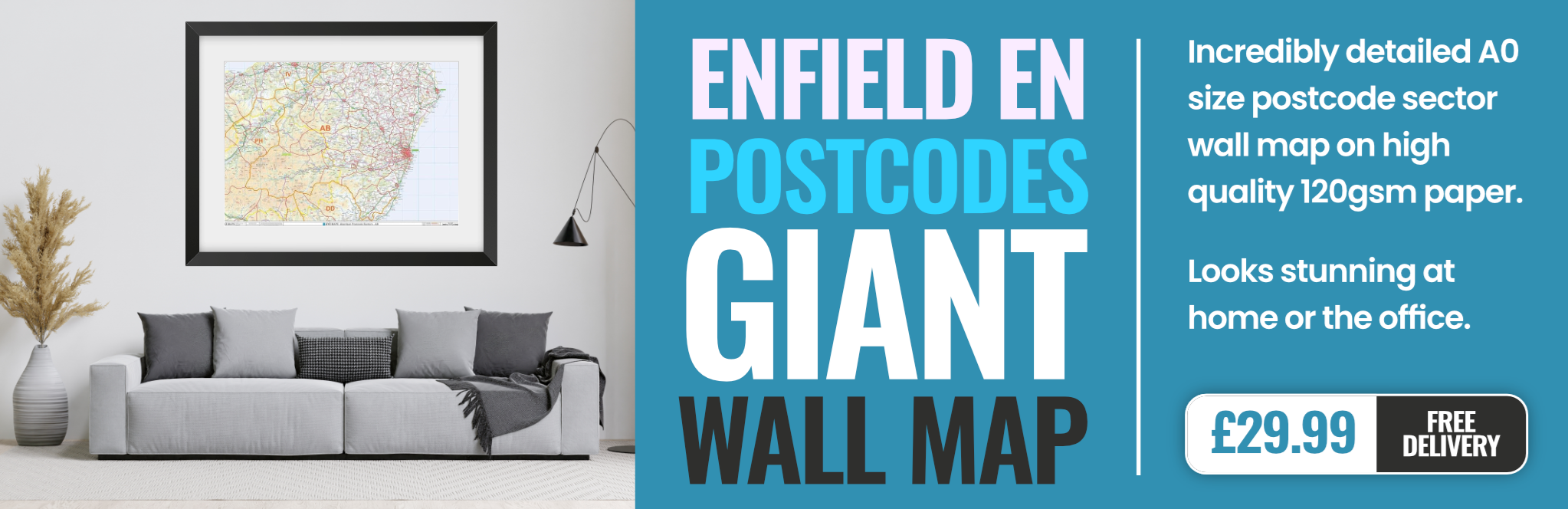
enfield EN6 Postcodes
Spending a fortune on conveyancing?

Compare instant, low-cost online quotes from trusted conveyancing solicitors.
Backed by experts, our no-obligation service searches through the best conveyancing quotes on the market to save you time and money.
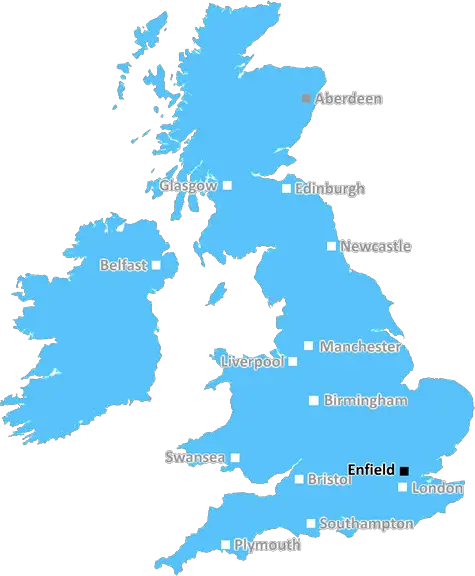
Enfield (EN6)
The EN6 postcode area is located in the Enfield postcode town region, within the county of Hertfordshire, and contains a total of 1383 individual postcodes.
There are 12 electoral wards in the EN6 postcode area, including Barnet, Broxbourne, Enfield, Hoddesdon, Potters Bar, Waltham Abbey, Waltham Cross which come under the local authority of the Hertsmere Council.
Combining the whole postcode region, 31% of people in EN6 are classed as having an AB social grade, (i.e. 'white-collar' middle-upper class), compared to 27% across the UK.
This does not mean that the people of EN6 are wealthier - or higher class - than average, but it can be an indication that the area may be prospering and desirable to live in.
EN6 is a postcode located in the Enfield District of London, England. It covers an area in the north and east of the borough, including the villages of Bullsmoor, Enfield Lock, Enfield Wash, Freezywater, Enfield Town, Ponders End, Edmonton, Southgate and a small part of Enfield Highway.
Enfield Town is the main centre for the postcode and is a large, bustling area in the heart of the borough. It is a large, traditional town with a population of around 26,000, and it is located in the middle of the postcode area with regards to geographical location and socio-economic characteristics. It contains a range of leisure and shopping facilities, as well as a large range of services and amenities reflecting the fact that it is the main centre for the postcode.
The area around Freezywater in the east of the postcode has an agricultural past, with the River Lea forming a picturesque backdrop and allowing a range of wildlife to thrive in the area. The western part of the postcode is much more suburban in character, with wide tree-lined avenues and a range of large homes. It is an area of greenery and includes Cedar and Town parks, as well as the large Trent Country Park.
Bullsmoor is a small residential area located in the north west of the postcode area. It is characterised by a range of older residential streets and a sprinkling of newer housing developments. In its heart is the Bullsmoor High Street, which is the traditional meeting place for the residents.
Enfield Lock and Wash is situated in the east of the postcode and benefits from being bordered by the River Lea. It is a small area made up of a large park, which is ideal for walking and cycling, a lovely set of cottages, a range of restaurants and other services.
Ponders End is located in the east of EN6 and is the gateway to the area from the nearby borough of Enfield. It is characterised by older homes, an abundance of green open spaces, an old mill that was once the centre of local industry, and a number of independent shops.
Finally, in the south of the postcode is Edmonton, an area with a range of terraced, semi-detached and detached homes, along with a selection of green spaces. There are plenty of local amenities including a selection of supermarkets and a number of health centres.
EN6 is an area of contrasts, boasting a wide variety of differing residential areas, parks, shops, services and amenities. With the River Lea offering an attractive backdrop in some areas, it is in many ways a pleasant and comfortable place to live.

Demographics
Hertfordshire

EN6 is located in the county of Hertfordshire, in England.
Hertfordshire has a total population of 1,176,700, making it the 12th largest county in the UK.
Hertfordshire has a total area of 634 square miles, and a population density of 716 people per square kilometre. For comparison, Greater London has a density of 5,618 people/km2.
| Outward Code | EN6 |
| Postal Town | Enfield |
| MSOA Name | Hertsmere 001 |
| LSOA Name | Hertsmere 001C |
| County | Hertfordshire |
| Region | Hertfordshire |
| Country | England |
| Local Authority | Hertsmere |
| Area Classification | Urban with Major Conurbation |
EN6 Electoral Wards
The postal region of EN6, includes the local towns, villages, electoral wards and stations of:
Dig even deeper into the EN6 postcode by clicking on a postcode below:
Click on an outward postal code below for more information about the area. Each 'outward' postcode give you a comprehensive list of all postcodes within the outward code area (EN) and estimated address.
Click on an 'outward' code for more information. For example, the outward postcode page 'EC2M' will give you an alphabetical list covering all postcodes located in the region, from 'EC2M 1BB' through to 'EC2M 7YA'.
Chris H
Sunday, April 7, 2024
We don't have any views of EN6 right now. If you live in EN6 or have visited it, please help us to help others by telling others what you think of this neighbourhood.
Add your view of EN6
People need your local expertise. If you live in EN6 or have first-hand knowledge of the neighbourhood, please consider sharing your views. It's completely anonymous - all we ask is for your initials.
Please tell us what you like about the EN6 postcode area, what you don't like, and what it's like to live or work here.
| LOCAL AMENITIES | |
| FAMILY FRIENDLY | |
| PARKING | |
| GREEN SPACES |
From the Postcode Area blog

Deciphering Crime Rates - a Deep Dive Into UK Postcode Analysis
Ever wondered about the crime rate in your UK postcode? You're not alone. We've dug deep into the data, uncovering trends and patterns that'll make your head spin.

Death of the High Street?
The BBC reports that despite councils' attempts to kurb them, the UK's high streets have seen a huge growth in fast food outlets. Could this mark the death knell for the Great British high street, and what can we do about it to halt its decline?

Discrimination by Postcode
You really couldn't make it up, could you? Some of the country's most vulnerable people are missing out on their weekly £25 Cold Weather Payment, just because the system that's in operation is discriminating against them because payments are based on postcode, rather than geographic location.

The Redesign is Underway
Well, the current website was absolutely in dire need of a good redesign - from the ground up. So I set out to pull it all apart and get it up and running again to become the most comprehensive guide to every postcode in the UK. And it's been a long, tough job from start to finish - and quite possibly the biggest project I've ever undertaken.
SOCIAL GRADES
According to census records, 31% of people here have a social grade of AB (highest), compared to the national average of 27%.