dudley DY6 Postcodes
Spending a fortune on conveyancing?

Compare instant, low-cost online quotes from trusted conveyancing solicitors.
Backed by experts, our no-obligation service searches through the best conveyancing quotes on the market to save you time and money.
Dudley (DY6)
The DY6 postcode area is located in the Dudley postcode town region, within the county of Staffordshire, and contains a total of 1001 individual postcodes.
There are 6 electoral wards in the DY6 postcode area, including Bewdley, Brierley Hill, Dudley, Kidderminster, Kingswinford, Stourbridge, Stourport-On-Severn, Tipton which come under the local authority of the South Staffordshire Council.
Combining the whole postcode region, 24% of people in DY6 are classed as having an AB social grade, (i.e. 'white-collar' middle-upper class), compared to 27% across the UK.
This does not mean that the people of DY6 are poorer than other areas, but it may give an indication that there are areas of deprivation.
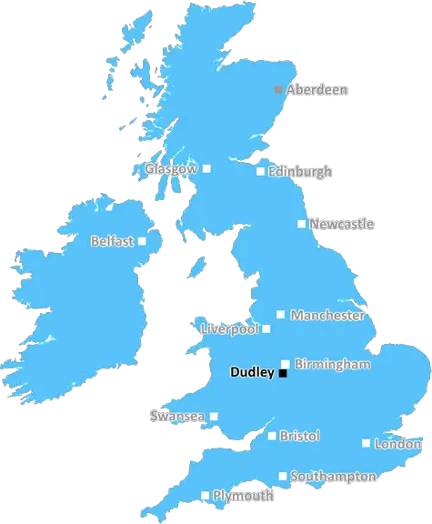
The DY6 postcode in UK is a geographical area representing part of the borough of Dudley in the West Midlands. The postcode is located in the southern part of the borough, close to Sedgley, Gornal, Kingswinford, Wombourne and roughly twelve miles from the city of Birmingham. It comprises of 4 suburbs: Castlecroft, Lanesfield, Wallbrook and Woodside.
The majority of the DY6 postcode district is occupied by housing comprising mainly of terraced homes, with some small developments of bungalows and semi-detached properties. Most of the housing is owner-occupied, although there is an increasing trend towards renting. Local amenities are available, such as schools, a library, supermarkets, a health centre, several places of worship, and a few small parks.
The DY6 area has developed from an area of mixed farming and coal-mining to a relatively quiet suburban area. The area is largely separated by the main A449 (Wolverhampton to Kidderminster Road) which runs north-south, and the A4123 (Stourbridge to Wolverhampton Road) which runs east-west and bisects the area. These roads provide easy access to the major cities of the West Midlands as well as the M5 motorway.
The local economy is mainly driven by retail, with most people using the nearby towns such as Dudley and Wolverhampton for their shopping needs. There is limited light industry in the area and local people are more likely to find employment in the cities and towns close by.
Despite its close proximity to these larger urban centres, the area is fairly self-contained and has a distinct local identity. This is reflected in the local culture, with numerous local events taking place every year. The DY6 area is home to a variety of cultures and has traditionally been a centre of the local area's Sikh population. The area is also known for its association with the coal-mining industry, with several heritage sites associated with the industry.

Demographics
Staffordshire

DY6 is located in the county of Staffordshire, in England.
Staffordshire has a total population of 1,120,300, making it the 17th largest county in the UK.
Staffordshire has a total area of 1047 square miles, and a population density of 412 people per square kilometre. For comparison, Greater London has a density of 5,618 people/km2.
| Outward Code | DY6 |
| Postal Town | Dudley |
| MSOA Name | South Staffordshire 014 |
| LSOA Name | South Staffordshire 014C |
| County | Staffordshire |
| Region | Staffordshire |
| Country | England |
| Local Authority | South Staffordshire |
| Area Classification | Urban with Significant Rural (rural including hub towns 26-49%) |
DY6 Electoral Wards
The postal region of DY6, includes the local towns, villages, electoral wards and stations of:
Dig even deeper into the DY6 postcode by clicking on a postcode below:
Click on an outward postal code below for more information about the area. Each 'outward' postcode give you a comprehensive list of all postcodes within the outward code area (DY) and estimated address.
Click on an 'outward' code for more information. For example, the outward postcode page 'EC2M' will give you an alphabetical list covering all postcodes located in the region, from 'EC2M 1BB' through to 'EC2M 7YA'.
Chris H
Friday, April 12, 2024
We don't have any views of DY6 right now. If you live in DY6 or have visited it, please help us to help others by telling others what you think of this neighbourhood.
Add your view of DY6
People need your local expertise. If you live in DY6 or have first-hand knowledge of the neighbourhood, please consider sharing your views. It's completely anonymous - all we ask is for your initials.
Please tell us what you like about the DY6 postcode area, what you don't like, and what it's like to live or work here.
| LOCAL AMENITIES | |
| FAMILY FRIENDLY | |
| PARKING | |
| GREEN SPACES |
Local News Staffordshire
Scams on the rise as end of financial year looms
Trading Standards officers in Staffordshire are reminding businesses to be particularly vigilant as they prepare for the end of the financial year on 5 April.
Staffordshire County CouncilImprovements at major Staffordshire transport gateway progresses with new traffic arrangements
A scheme bringing major improvements to a key Staffordshire gateway junction is progressing well, with new traffic management introduced from next week.
Staffordshire County CouncilTrading Standards issues spring warning over rogue traders and cowboy builders
Staffordshire County Council's Trading Standards service has issued a warning to residents about the growing menace of rogue traders operating in the county.
Staffordshire County CouncilGirl, 13, cured of rare disease that causes extreme swelling in Royal Stoke 'world first'
Kai Xue, 13, is one of just 21 globally recorded cases of a lymphatic condition called Wild syndrome
Stoke SentinelBiddulph's ex-Premier League ref facing a new challenge
Phil Dowd on his battle with Parkinson's Disease.
BBC NewsFairytale castle where you can stay a stone's throw away from Alton Towers
Caverswall Castle is a stunning Grade I-listed property built in the early 17th century on the site of a 13th-century castle and is surrounded by a moat
Stoke SentinelStokie schoolboy heads to pub as he parts ways with 'scary' 6ft 6in Bob on BBC's Bidding Room
Braxton Klebuwkowski, 10, and grandad Graham Klebukowski, 66, appeared on the Bidding Room with their 6ft 6in fibreglass golfer statue - and then went for a pub meal to celebrate after earning 140
Stoke SentinelThe price of feeding deer is dear, warns countryside officers
Feeding deer makes them vulnerable to disease, poaching and overpopulation, so rangers are urging country park users to buck the trend.
Staffordshire County CouncilFrom the Postcode Area blog

Deciphering Crime Rates - a Deep Dive Into UK Postcode Analysis
Ever wondered about the crime rate in your UK postcode? You're not alone. We've dug deep into the data, uncovering trends and patterns that'll make your head spin.

Death of the High Street?
The BBC reports that despite councils' attempts to kurb them, the UK's high streets have seen a huge growth in fast food outlets. Could this mark the death knell for the Great British high street, and what can we do about it to halt its decline?

Discrimination by Postcode
You really couldn't make it up, could you? Some of the country's most vulnerable people are missing out on their weekly £25 Cold Weather Payment, just because the system that's in operation is discriminating against them because payments are based on postcode, rather than geographic location.

The Redesign is Underway
Well, the current website was absolutely in dire need of a good redesign - from the ground up. So I set out to pull it all apart and get it up and running again to become the most comprehensive guide to every postcode in the UK. And it's been a long, tough job from start to finish - and quite possibly the biggest project I've ever undertaken.
SOCIAL GRADES
According to census records, 24% of people here have a social grade of AB (highest), compared to the national average of 27%.