derby DE73 Postcodes
Spending a fortune on conveyancing?

Compare instant, low-cost online quotes from trusted conveyancing solicitors.
Backed by experts, our no-obligation service searches through the best conveyancing quotes on the market to save you time and money.
Derby (DE73)
The DE73 postcode area is located in the Derby postcode town region, within the county of Derbyshire, and contains a total of 894 individual postcodes.
There are 35 electoral wards in the DE73 postcode area, including Alfreton, Ashbourne, Bakewell, Belper, Burton-On-Trent, Derby, Heanor, Ilkeston, Matlock, Ripley, Swadlincote which come under the local authority of the South Derbyshire Council.
Combining the whole postcode region, 32% of people in DE73 are classed as having an AB social grade, (i.e. 'white-collar' middle-upper class), compared to 27% across the UK.
This does not mean that the people of DE73 are wealthier - or higher class - than average, but it can be an indication that the area may be prospering and desirable to live in.
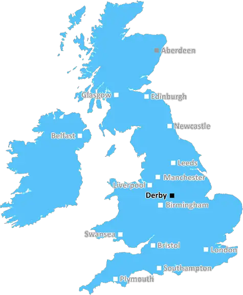
DE73 is a postcode district in the Derby district of Derbyshire, located in the East Midlands region of England. The postcode district is located to the south of the city of Derby and stretches southeastwards to the town of Melbourne, covering an area of approximately 24 square miles. The area is largely rural with smaller villages and hamlets.
The DE73 postcode district is largely populated by commuters and rural workers, with many of the villages and hamlets in the area having a more traditional, rural feel encompassing both the rolling hills and valleys of the Derbyshire countryside. The area is known for its picturesque natural environment, offering rural living and beautiful countryside views.
The DE73 postcode district is served by the Derby to Lichfield railway line which runs through Melbourne, in addition to the nearby M1 motorway. There is also a bus service that runs through the area.
There are several schools located in the district, ranging from primary to secondary level such as Melbourne Primary School and Samuel Barlow C of E School. Moreover, leisure activities are available throughout the postcode district such as the Royal Oak Inn which provides a traditional pub experience.
In terms of local amenities there are several shops and supermarkets available in Melbourne, such as the Co-op and the Spar. Additionally, Melbourne has a local market every Thursday, where local vendors are able to sell fresh produce and homemade goods. Furthermore, there are a few local churches located near the town, notably St Mary's Church which dates back to 1147 and has since undergone extensive restoration to become a well-known local attraction.
Derby district's DE73 postcode district is an attractive and picturesque area, offering a touch of rural living close to the city of Derby. Residents are drawn to the area for its quaint villages & hamlets, picturesque countryside views, good transport links and access to local amenities.

Demographics

Derbyshire

DE73 is located in the county of Derbyshire, in England.
Derbyshire has a total population of 1,042,000, making it the 20th largest county in the UK.
Derbyshire has a total area of 1013 square miles, and a population density of 396 people per square kilometre. For comparison, Greater London has a density of 5,618 people/km2.
| Outward Code | DE73 |
| Postal Town | Derby |
| MSOA Name | South Derbyshire 006 |
| LSOA Name | South Derbyshire 006D |
| County | Derbyshire |
| Region | Derbyshire |
| Country | England |
| Local Authority | South Derbyshire |
| Area Classification | Urban with Significant Rural (rural including hub towns 26-49%) |
DE73 Electoral Wards
The postal region of DE73, includes the local towns, villages, electoral wards and stations of:
Dig even deeper into the DE73 postcode by clicking on a postcode below:
Click on an outward postal code below for more information about the area. Each 'outward' postcode give you a comprehensive list of all postcodes within the outward code area (DE) and estimated address.
Click on an 'outward' code for more information. For example, the outward postcode page 'EC2M' will give you an alphabetical list covering all postcodes located in the region, from 'EC2M 1BB' through to 'EC2M 7YA'.
Chris H
Saturday, April 6, 2024
We don't have any views of DE73 right now. If you live in DE73 or have visited it, please help us to help others by telling others what you think of this neighbourhood.
Add your view of DE73
People need your local expertise. If you live in DE73 or have first-hand knowledge of the neighbourhood, please consider sharing your views. It's completely anonymous - all we ask is for your initials.
Please tell us what you like about the DE73 postcode area, what you don't like, and what it's like to live or work here.
| LOCAL AMENITIES | |
| FAMILY FRIENDLY | |
| PARKING | |
| GREEN SPACES |
Local News Derbyshire
Allestree residents livid as 'brutal' bungalow extension allowed
Residents shouted at councillors 'shame on you' and 'disgrace'
Derby TelegraphTonnes of soil used to contain chemical spill
The spill - of a chemical which can be an irritant if it gets on skin - was spotted on Wednesday.
BBC NewsChip shop opened in World War Two to close
Owner Gary Tennant says he wants to retire but will "miss it so much".
BBC NewsCouncil considers future of children's centre
The Bolsover site is under scrutiny as the county council faces a multi-million pound deficit.
BBC NewsPlans to tighten shared home rules put to public
Residents are concerned too many shared homes creates problems like parking and fly-tipping.
BBC News'I wish our daughter had spoken to this police force'
The parents of Gracie Spinks, who was killed by her stalker, visit a dedicated police unit.
BBC News'Stuck living in the past' - Queen's Leisure Centre demolition row continues as readers wade in
The Queen's Leisure Centre in Derby is set to be demolished and replaced with a new swimming pool and leisure complex - but some people are not happy
Derby TelegraphCan Surrey be beaten as County Championship returns?
With the new County Championship season starting on Friday, can anyone prevent Surrey winning a third straight title?
BBC NewsFrom the Postcode Area blog

Deciphering Crime Rates - a Deep Dive Into UK Postcode Analysis
Ever wondered about the crime rate in your UK postcode? You're not alone. We've dug deep into the data, uncovering trends and patterns that'll make your head spin.

Death of the High Street?
The BBC reports that despite councils' attempts to kurb them, the UK's high streets have seen a huge growth in fast food outlets. Could this mark the death knell for the Great British high street, and what can we do about it to halt its decline?

Discrimination by Postcode
You really couldn't make it up, could you? Some of the country's most vulnerable people are missing out on their weekly £25 Cold Weather Payment, just because the system that's in operation is discriminating against them because payments are based on postcode, rather than geographic location.

The Redesign is Underway
Well, the current website was absolutely in dire need of a good redesign - from the ground up. So I set out to pull it all apart and get it up and running again to become the most comprehensive guide to every postcode in the UK. And it's been a long, tough job from start to finish - and quite possibly the biggest project I've ever undertaken.
SOCIAL GRADES
According to census records, 32% of people here have a social grade of AB (highest), compared to the national average of 27%.