derby DE4 Postcodes
Spending a fortune on conveyancing?

Compare instant, low-cost online quotes from trusted conveyancing solicitors.
Backed by experts, our no-obligation service searches through the best conveyancing quotes on the market to save you time and money.
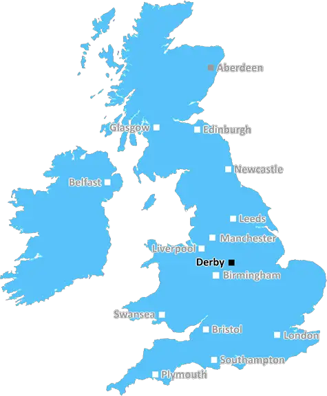
Derby (DE4)
The DE4 postcode area is located in the Derby postcode town region, within the county of Derbyshire, and contains a total of 1502 individual postcodes.
There are 119 electoral wards in the DE4 postcode area, including Alfreton, Ashbourne, Bakewell, Belper, Burton-On-Trent, Derby, Heanor, Ilkeston, Matlock, Ripley, Swadlincote which come under the local authority of the Derbyshire Dales Council.
Combining the whole postcode region, 29% of people in DE4 are classed as having an AB social grade, (i.e. 'white-collar' middle-upper class), compared to 27% across the UK.
This does not mean that the people of DE4 are wealthier - or higher class - than average, but it can be an indication that the area may be prospering and desirable to live in.
DE4 is a postcode district situated in the county of Derbyshire, which lies in the East Midlands region of England. It covers a large area which includes the towns and villages of Bakewell, Tideswell, Matlock, Wirksworth, Ashbourne, Alsop-en-le-Dale, and many more.
The nearby River Wye and River Derwent provide a natural backdrop for the area, while its steep hills and jagged limestone outcrops are perfect for walkers and climbers. The area is a hotspot for nature lovers, with a host of National Nature Reserves, National Parks, local and county Wildlife Trust sites, and stately homes to explore. Additionally, historic buildings, monuments, and ancient sites pepper the area.
For those interested in exploring places to eat, shop and stay, DE4 postcode area has plenty to offer, ranging from traditional farmer's markets to award-winning restaurants. Antique shops, home decor stores, and even exciting attractions like the National Stone Centre are located in the district. Popular for its rural charm, DE4 is becoming a sought-after holiday destination, with numerous spa resorts, country houses, and luxury lodges on offer.
Due to its narrow country roads, the area is thankfully a relatively quiet one, with little to no light pollution. This has earned it its Dark Sky status, and on a clear night the skies of DE4 are reportedly some of the most vibrant in the UK.
In terms of transport, regular bus services link Bakewell, Tideswell, and Matlock, while Ashbourne, Wirksworth, and surrounding villages have railway access. Highways, roads, and airports in Sheffield, Derby, and Manchester offer intercity reach. The nearest major airports are Heathrow and East Midlands airport.

Demographics

Derbyshire

DE4 is located in the county of Derbyshire, in England.
Derbyshire has a total population of 1,042,000, making it the 20th largest county in the UK.
Derbyshire has a total area of 1013 square miles, and a population density of 396 people per square kilometre. For comparison, Greater London has a density of 5,618 people/km2.
| Outward Code | DE4 |
| Postal Town | Derby |
| MSOA Name | Derbyshire Dales 003 |
| LSOA Name | Derbyshire Dales 003A |
| County | Derbyshire |
| Region | Derbyshire |
| Country | England |
| Local Authority | Derbyshire Dales |
| Area Classification | Mainly Rural (rural including hub towns >=80%) |
DE4 Electoral Wards
The postal region of DE4, includes the local towns, villages, electoral wards and stations of:
Dig even deeper into the DE4 postcode by clicking on a postcode below:
Click on an outward postal code below for more information about the area. Each 'outward' postcode give you a comprehensive list of all postcodes within the outward code area (DE) and estimated address.
Click on an 'outward' code for more information. For example, the outward postcode page 'EC2M' will give you an alphabetical list covering all postcodes located in the region, from 'EC2M 1BB' through to 'EC2M 7YA'.
Chris H
Tuesday, April 9, 2024
We don't have any views of DE4 right now. If you live in DE4 or have visited it, please help us to help others by telling others what you think of this neighbourhood.
Add your view of DE4
People need your local expertise. If you live in DE4 or have first-hand knowledge of the neighbourhood, please consider sharing your views. It's completely anonymous - all we ask is for your initials.
Please tell us what you like about the DE4 postcode area, what you don't like, and what it's like to live or work here.
| LOCAL AMENITIES | |
| FAMILY FRIENDLY | |
| PARKING | |
| GREEN SPACES |
Local News Derbyshire
Peak District wild campers rescued after underestimating Storm Kathleen conditions
Despite being well-equipped the pair did not expect the weather conditions to be that bad
Derby TelegraphPaedophile jailed for 'campaign of rape' over years
The 42-year-old carried out "an appalling catalogue of offending", a judge says.
BBC NewsExperts say that newly-discovered superfood could 'help with diabetes and obesity'
The berry is rich in omega-3, omega-6 fatty acids, vitamins A, B, E and polyphenols.
Derby Telegraph143 affordable homes to be built in 'picturesque' Derbyshire village after planning permission secured
There will be a selection of two- and four-bedroom homes on the 15-acre plot
Derby TelegraphWoman attacked in alleyway off St Peter's Street in Derby city centre
A police cordon was in place following the incident
Derby TelegraphBanking hub plan for Peak District town where last bank recently closed
The final bank in Bakewell, NatWest, closed in February
Derby TelegraphSpider Island live updates as overturned car causes Derby traffic chaos
The Allenton incident is causing 'major problems' for motorists this evening
Derby TelegraphDisruption warning as programme of A38 closures between Toyota Island and Mickleover announced
Repair work will be carried out under a combination of full carriageway closures and lane closures
Derby TelegraphFrom the Postcode Area blog

Deciphering Crime Rates - a Deep Dive Into UK Postcode Analysis
Ever wondered about the crime rate in your UK postcode? You're not alone. We've dug deep into the data, uncovering trends and patterns that'll make your head spin.

Death of the High Street?
The BBC reports that despite councils' attempts to kurb them, the UK's high streets have seen a huge growth in fast food outlets. Could this mark the death knell for the Great British high street, and what can we do about it to halt its decline?

Discrimination by Postcode
You really couldn't make it up, could you? Some of the country's most vulnerable people are missing out on their weekly £25 Cold Weather Payment, just because the system that's in operation is discriminating against them because payments are based on postcode, rather than geographic location.

The Redesign is Underway
Well, the current website was absolutely in dire need of a good redesign - from the ground up. So I set out to pull it all apart and get it up and running again to become the most comprehensive guide to every postcode in the UK. And it's been a long, tough job from start to finish - and quite possibly the biggest project I've ever undertaken.
SOCIAL GRADES
According to census records, 29% of people here have a social grade of AB (highest), compared to the national average of 27%.