derby DE12 Postcodes
Spending a fortune on conveyancing?

Compare instant, low-cost online quotes from trusted conveyancing solicitors.
Backed by experts, our no-obligation service searches through the best conveyancing quotes on the market to save you time and money.
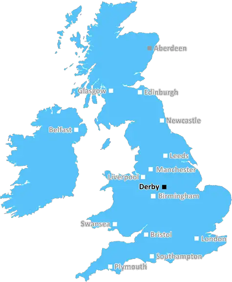
Derby (DE12)
The DE12 postcode area is located in the Derby postcode town region, within the county of Leicestershire, and contains a total of 598 individual postcodes.
There are 53 electoral wards in the DE12 postcode area, including Alfreton, Ashbourne, Bakewell, Belper, Burton-On-Trent, Derby, Heanor, Ilkeston, Matlock, Ripley, Swadlincote which come under the local authority of the North West Leicestershire Council.
Combining the whole postcode region, 22% of people in DE12 are classed as having an AB social grade, (i.e. 'white-collar' middle-upper class), compared to 27% across the UK.
This does not mean that the people of DE12 are poorer than other areas, but it may give an indication that there are areas of deprivation.
The DE12 postcode covers a large area within the South Derbyshire district, ranging from the small villages of Swadlincote, Ashby-de-la-Zouch to the larger towns of Measham and Coalville. It is dominantly rural but includes some residential, industrial and commercial properties.
Swadlincote is the main centre, featuring a large range of independent shops, supermarkets and chain restaurants as well as large retail parks. The town is known for its rich mining heritage and Edwardian architecture. There is an indoor and outdoor market every Tuesday and Saturday as well as a range of pubs and clubs to explore.
In Ashby-de-la-Zouch, a large part of the postcode is committed to rural surroundings. Within the area, there is a range of attractions to visit, including the famous historical ruins of Ashby Castle, Moira Furnace museum and the Battle of Bosworth Visitor Centre.
The area also has connections to the national network through the nearby A42, M42 and M1 motorways giving an easy access to other parts of the country.
Other areas of interest in the postcode include Measham which is home to the largest car boot sale in the Midlands and Thornton's Budgens which is one of the oldest supermarkets in the area. There are also green spaces to explore such as Lower Measham Meadows and Diseworth Nature Reserve. The area is also home to a number of outdoor activities such as mountain biking, climbing and horse riding.
Coalville boasts a large range of shopfronts including the Coalville Indoor Market, antiques shops and the Coalville Heritage Centre. It is located close to the National Forest, offering many forest walks.
Finally, there are a number of small villages within the postcode such as Coleorton, Donisthorpe, Appleby Magna, Packington and Staunton Harold. These villages are steeped in history and offer an insight into life in a rural English village setting.

Demographics

Leicestershire

DE12 is located in the county of Leicestershire, in England.
Leicestershire has a total population of 1,031,300, making it the 21st largest county in the UK.
Leicestershire has a total area of 832 square miles, and a population density of 478 people per square kilometre. For comparison, Greater London has a density of 5,618 people/km2.
| Outward Code | DE12 |
| Postal Town | Derby |
| MSOA Name | North West Leicestershire 008 |
| LSOA Name | North West Leicestershire 008B |
| County | Leicestershire |
| Region | Leicestershire |
| Country | England |
| Local Authority | North West Leicestershire |
| Area Classification | Largely Rural (rural including hub towns 50-79%) |
DE12 Electoral Wards
The postal region of DE12, includes the local towns, villages, electoral wards and stations of:
Dig even deeper into the DE12 postcode by clicking on a postcode below:
Click on an outward postal code below for more information about the area. Each 'outward' postcode give you a comprehensive list of all postcodes within the outward code area (DE) and estimated address.
Click on an 'outward' code for more information. For example, the outward postcode page 'EC2M' will give you an alphabetical list covering all postcodes located in the region, from 'EC2M 1BB' through to 'EC2M 7YA'.
Chris H
Monday, April 8, 2024
We don't have any views of DE12 right now. If you live in DE12 or have visited it, please help us to help others by telling others what you think of this neighbourhood.
Add your view of DE12
People need your local expertise. If you live in DE12 or have first-hand knowledge of the neighbourhood, please consider sharing your views. It's completely anonymous - all we ask is for your initials.
Please tell us what you like about the DE12 postcode area, what you don't like, and what it's like to live or work here.
| LOCAL AMENITIES | |
| FAMILY FRIENDLY | |
| PARKING | |
| GREEN SPACES |
Local News Derbyshire
'Rarely busy' stunning beach just two hours away from Derby voted best in the region
The beach is described as an "unspoilt sandy beach backed by sand dunes"
Derby TelegraphCar tax discount could be offered to drivers over certain age in new VED rule
A new petition is calling for urgent changes to Vehicle Excise Duty (VED) car tax exemptions
Derby TelegraphEuroMillions draw results live: Winning numbers for Friday, April 5, 2024 for 62 million jackpot prize
It could be your lucky day if you are in tonight's huge draw
Derby TelegraphLara Croft voted most iconic video game character
Lara Croft beat old favourites Mario, Sonic and Pac-Man to claim the title, voted for by gamers.
BBC NewsTonnes of soil used to contain chemical spill
The spill - of a chemical which can be an irritant if it gets on skin - was spotted on Wednesday.
BBC NewsAllestree residents livid as 'brutal' bungalow extension allowed
Residents shouted at councillors 'shame on you' and 'disgrace'
Derby TelegraphHuge manor house with formal gardens close to Derby city centre up for sale
Parts of the Old Rectory date back to the 1750s
Derby TelegraphPolice launch appeal after serious assault in Derby
Police would like to speak to two men in connection with the incident
Derby TelegraphFrom the Postcode Area blog

Deciphering Crime Rates - a Deep Dive Into UK Postcode Analysis
Ever wondered about the crime rate in your UK postcode? You're not alone. We've dug deep into the data, uncovering trends and patterns that'll make your head spin.

Death of the High Street?
The BBC reports that despite councils' attempts to kurb them, the UK's high streets have seen a huge growth in fast food outlets. Could this mark the death knell for the Great British high street, and what can we do about it to halt its decline?

Discrimination by Postcode
You really couldn't make it up, could you? Some of the country's most vulnerable people are missing out on their weekly £25 Cold Weather Payment, just because the system that's in operation is discriminating against them because payments are based on postcode, rather than geographic location.

The Redesign is Underway
Well, the current website was absolutely in dire need of a good redesign - from the ground up. So I set out to pull it all apart and get it up and running again to become the most comprehensive guide to every postcode in the UK. And it's been a long, tough job from start to finish - and quite possibly the biggest project I've ever undertaken.
SOCIAL GRADES
According to census records, 22% of people here have a social grade of AB (highest), compared to the national average of 27%.