dartford DA8 Postcodes
Spending a fortune on conveyancing?

Compare instant, low-cost online quotes from trusted conveyancing solicitors.
Backed by experts, our no-obligation service searches through the best conveyancing quotes on the market to save you time and money.
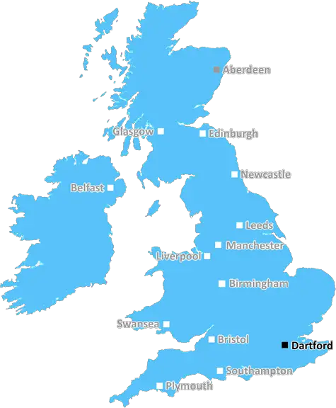
Dartford (DA8)
The DA8 postcode area is located in the Dartford postcode town region, within the county of Greater London, and contains a total of 887 individual postcodes.
There are 5 electoral wards in the DA8 postcode area, including Belvedere, Bexley, Bexleyheath, Dartford, Erith, Gravesend, Greenhithe, Longfield, Sidcup, Swanscombe, Welling which come under the local authority of the Bexley Council.
Combining the whole postcode region, 14% of people in DA8 are classed as having an AB social grade, (i.e. 'white-collar' middle-upper class), compared to 27% across the UK.
This does not mean that the people of DA8 are poorer than other areas, but it may give an indication that there are areas of deprivation.
The DA8 postcode is an area located in the district of Dartford, in the county of Kent in the South East of England. It is located north of the River Thames, and south of Dartford town centre. The area includes areas such as Aberfeldy, Brooklands and Temple Hill, as well as the towns of Slade Green and Erith.
The DA8 postcode covers a wide area and is home to a diverse population. Official statistics from 2011 give the population as 16,754, with 61.3% of the residents being white, and 21.4% being from an Asian or Asian Britain background. The population of the postcode is ethnically diverse, and has a wide range of ages, with the largest groups falling into the 25-44 year old and 45-64 year old age groups.
The area is served by several bus routes, two of which link up the areas of Slade Green, Erith, and Dartford to Bluewater shopping centre. The nearest train service is Erith Station, which has direct connections to central London, and provides easy access to Ebbsfleet and Stratford International Stations.
Erith Town Centre is the main focus of shopping and leisure in the area, with a vibrant and diverse mix of independent shops, high street brands, markers, cafes and restaurants. There are many parks and green spaces to be found in the area, including Slade Green Recreation Ground and Danson Park; both of which are used for sporting activities and host a range of community activities throughout the year. There is also a cinema and several fitness centres.
There are two primary schools located in the postcode area, plus a choice of two secondary academies; all of which rank highly in local education league tables. There are several options for higher and further education too, including Dartford College and The University of Greenwich.
The area has been in the process of regeneration for several years, and new homes are being built in many of the suburbs; this is adding to the vibrancy of the local area, along with a range of cultural activities, and community events.

Demographics

Greater London

DA8 is located in the county of Greater London, in England.
Greater London has a total population of 8,778,500, making it the 1st largest county in the UK.
Greater London has a total area of 606 square miles, and a population density of 5594 people per square kilometre. For comparison, Greater London has a density of 5,618 people/km2.
| Outward Code | DA8 |
| Postal Town | Dartford |
| MSOA Name | Bexley 004 |
| LSOA Name | Bexley 004D |
| County | Greater London |
| Region | Greater London |
| Country | England |
| Local Authority | Bexley |
| Area Classification | Urban with Major Conurbation |
DA8 Electoral Wards
The postal region of DA8, includes the local towns, villages, electoral wards and stations of:
Dig even deeper into the DA8 postcode by clicking on a postcode below:
Click on an outward postal code below for more information about the area. Each 'outward' postcode give you a comprehensive list of all postcodes within the outward code area (DA) and estimated address.
Click on an 'outward' code for more information. For example, the outward postcode page 'EC2M' will give you an alphabetical list covering all postcodes located in the region, from 'EC2M 1BB' through to 'EC2M 7YA'.
Chris H
Sunday, April 7, 2024
We don't have any views of DA8 right now. If you live in DA8 or have visited it, please help us to help others by telling others what you think of this neighbourhood.
Add your view of DA8
People need your local expertise. If you live in DA8 or have first-hand knowledge of the neighbourhood, please consider sharing your views. It's completely anonymous - all we ask is for your initials.
Please tell us what you like about the DA8 postcode area, what you don't like, and what it's like to live or work here.
| LOCAL AMENITIES | |
| FAMILY FRIENDLY | |
| PARKING | |
| GREEN SPACES |
Local News Kent
Edmond de Rothschild REIM acquires Newbury resi scheme for 34m
The affordable housing project has already seen the development of almost 120 new homes.
Property WeekRestaurant loved by rich and famous could take over eyesore' high street site
A neglected high street building once home to Burton and Dorothy Perkins could be transformed into celebrity favourite The Ivy.
Kent OnlineJust because I'm gay and have MS doesn't mean I can't foster'
A foster carer who is gay and has multiple sclerosis (MS) is urging people not to rule out fostering over fears they are not the right fit.
Kent OnlineSellar gets green light for Hertfordshire media facility
The developer has designed the scheme to appeal to the media sector, as well as being appropriate for logistics, warehousing and data centre uses.
Property WeekWhich South East trains will run on strike day?
Train drivers across the South East will walk out on Monday, with very few trains running.
BBC NewsHomes England acquires Worthing site to deliver 250 homes
The acquisition forms part of the body's plans to regenerate challenging brownfield areas.
Property WeekCharlton Athletic 0-0 Stevenage
Stevenage see their League One play-off hopes dented as a 0-0 draw at Charlton extends their winless run to seven matches.
BBC NewsPortsmouth NHS trust takes offices at Lakeside North Harbour
The trust has signed a 10-year lease for space at the business park.
Property WeekFrom the Postcode Area blog

Deciphering Crime Rates - a Deep Dive Into UK Postcode Analysis
Ever wondered about the crime rate in your UK postcode? You're not alone. We've dug deep into the data, uncovering trends and patterns that'll make your head spin.

Death of the High Street?
The BBC reports that despite councils' attempts to kurb them, the UK's high streets have seen a huge growth in fast food outlets. Could this mark the death knell for the Great British high street, and what can we do about it to halt its decline?

Discrimination by Postcode
You really couldn't make it up, could you? Some of the country's most vulnerable people are missing out on their weekly £25 Cold Weather Payment, just because the system that's in operation is discriminating against them because payments are based on postcode, rather than geographic location.

The Redesign is Underway
Well, the current website was absolutely in dire need of a good redesign - from the ground up. So I set out to pull it all apart and get it up and running again to become the most comprehensive guide to every postcode in the UK. And it's been a long, tough job from start to finish - and quite possibly the biggest project I've ever undertaken.
SOCIAL GRADES
According to census records, 14% of people here have a social grade of AB (highest), compared to the national average of 27%.