dartford DA2 Postcodes
Spending a fortune on conveyancing?

Compare instant, low-cost online quotes from trusted conveyancing solicitors.
Backed by experts, our no-obligation service searches through the best conveyancing quotes on the market to save you time and money.
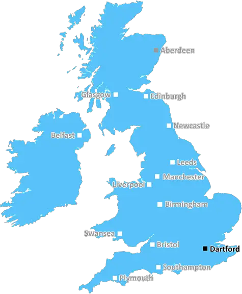
Dartford (DA2)
The DA2 postcode area is located in the Dartford postcode town region, within the county of Kent, and contains a total of 642 individual postcodes.
There are 26 electoral wards in the DA2 postcode area, including Belvedere, Bexley, Bexleyheath, Dartford, Erith, Gravesend, Greenhithe, Longfield, Sidcup, Swanscombe, Welling which come under the local authority of the Dartford Council.
Combining the whole postcode region, 20% of people in DA2 are classed as having an AB social grade, (i.e. 'white-collar' middle-upper class), compared to 27% across the UK.
This does not mean that the people of DA2 are poorer than other areas, but it may give an indication that there are areas of deprivation.
The DA2 postcode is located in the Dartford District of Kent, England. It covers the suburban area of Dartford as well as some of the surrounding villages including Belvedere, Erith and Barnes Cray.
The postcode area starts in the east at the River Thames, then follows along the west side of the A206 and Thames Road before reaching the central part of Dartford. It is then bordered by the A2 until it reaches the B260, which largely makes up the rest of the postcode area. It covers a total area of 57.71 square kilometres and contains a population of around 24,000 people.
The proximity of the DA2 postcode to the River Thames and the A2 means that there are excellent transport links, making the area popular and convenient for commuters. The drive to London from Dartford takes less than 45 minutes and there are two train lines that serve the town, the Southeastern line linking Dartford to London Charing Cross and London Victoria stations; and the Thameslink line which runs from Gravesend to the St Pancras International station. The area is also served by regular bus services and is just a short journey away from the Dartford Crossing which connects to Essex and beyond.
Being part of the Dartford Borough Council area, the DA2 postcode is served by a wide range of facilities and resources including schools, libraries, leisure centres and places of worship. The area also contains a number of parks and open spaces, including Orchard Lake and Parrock recreation grounds, as well as Tilbury Woods Nature Reserve and Footscray Meadows Country Park.
DA2 is also home to a variety of businesses, large and small, from manufacturing to the retail sector. The town hosts a weekly market and is seen as an important economic hub within the wider Kent region. The postcode is also increasingly popular with house-buyers and families due to its central location and relative affordability when compared with other areas.

Demographics

Kent

DA2 is located in the county of Kent, in England.
Kent has a total population of 1,820,400, making it the 6th largest county in the UK.
Kent has a total area of 1443 square miles, and a population density of 486 people per square kilometre. For comparison, Greater London has a density of 5,618 people/km2.
| Outward Code | DA2 |
| Postal Town | Dartford |
| MSOA Name | Dartford 008 |
| LSOA Name | Dartford 008D |
| County | Kent |
| Region | Kent |
| Country | England |
| Local Authority | Dartford |
| Area Classification | Urban with Major Conurbation |
DA2 Electoral Wards
The postal region of DA2, includes the local towns, villages, electoral wards and stations of:
Dig even deeper into the DA2 postcode by clicking on a postcode below:
Click on an outward postal code below for more information about the area. Each 'outward' postcode give you a comprehensive list of all postcodes within the outward code area (DA) and estimated address.
Click on an 'outward' code for more information. For example, the outward postcode page 'EC2M' will give you an alphabetical list covering all postcodes located in the region, from 'EC2M 1BB' through to 'EC2M 7YA'.
Chris H
Monday, April 8, 2024
We don't have any views of DA2 right now. If you live in DA2 or have visited it, please help us to help others by telling others what you think of this neighbourhood.
Add your view of DA2
People need your local expertise. If you live in DA2 or have first-hand knowledge of the neighbourhood, please consider sharing your views. It's completely anonymous - all we ask is for your initials.
Please tell us what you like about the DA2 postcode area, what you don't like, and what it's like to live or work here.
| LOCAL AMENITIES | |
| FAMILY FRIENDLY | |
| PARKING | |
| GREEN SPACES |
Local News Kent
Kent sign Swanepoel after Bartlett deal called off
South African all-rounder Beyers Swanepoel is to join Kent after Xavier Bartlett's deal falls through.
BBC NewsConfusion as one of Kent's most historic areas rebranded the West End'
The rebranding of one of the county's most historic areas as the West End has divided opinion - with some people left baffled.
Kent OnlineMy daughter's nearly six and has never been to school'
A mother has shared her disgust over an ongoing 20-month wait to get her child, who has additional needs, a school place.
Kent OnlineTT Group sells BT's old Southampton offices to consortium
BT's former Friary House office building has permission for residential conversion under permitted development rights.
Property WeekNewFlex opens new Cambridge workspace The Quad
NewFlex said the site isone of the UK's strongest out-of-London business destinations.
Property WeekMixed-use London freehold to lead Allsop's March residential auction
Thefreeholdbuilding in Hampstead is guided at 2.5m-plus.
Property WeekCan Surrey be beaten as County Championship returns?
With the new County Championship season starting on Friday, can anyone prevent Surrey winning a third straight title?
BBC NewsCarter Jonas opens first Kent office
The office will be lead by Steven Drennan, a partner in Carter Jonas's infrastructure team.
Property WeekFrom the Postcode Area blog

Deciphering Crime Rates - a Deep Dive Into UK Postcode Analysis
Ever wondered about the crime rate in your UK postcode? You're not alone. We've dug deep into the data, uncovering trends and patterns that'll make your head spin.

Death of the High Street?
The BBC reports that despite councils' attempts to kurb them, the UK's high streets have seen a huge growth in fast food outlets. Could this mark the death knell for the Great British high street, and what can we do about it to halt its decline?

Discrimination by Postcode
You really couldn't make it up, could you? Some of the country's most vulnerable people are missing out on their weekly £25 Cold Weather Payment, just because the system that's in operation is discriminating against them because payments are based on postcode, rather than geographic location.

The Redesign is Underway
Well, the current website was absolutely in dire need of a good redesign - from the ground up. So I set out to pull it all apart and get it up and running again to become the most comprehensive guide to every postcode in the UK. And it's been a long, tough job from start to finish - and quite possibly the biggest project I've ever undertaken.
SOCIAL GRADES
According to census records, 20% of people here have a social grade of AB (highest), compared to the national average of 27%.