darlington DL7 Postcodes
Spending a fortune on conveyancing?

Compare instant, low-cost online quotes from trusted conveyancing solicitors.
Backed by experts, our no-obligation service searches through the best conveyancing quotes on the market to save you time and money.
Darlington (DL7)
The DL7 postcode area is located in the Darlington postcode town region, within the county of North Yorkshire, and contains a total of 942 individual postcodes.
There are 52 electoral wards in the DL7 postcode area, including Barnard Castle, Bedale, Bishop Auckland, Catterick Garrison, Crook, Darlington, Ferryhill, Hawes, Leyburn, Newton Aycliffe, Northallerton, Richmond, Shildon, Spennymoor which come under the local authority of the Hambleton Council.
Combining the whole postcode region, 25% of people in DL7 are classed as having an AB social grade, (i.e. 'white-collar' middle-upper class), compared to 27% across the UK.
This does not mean that the people of DL7 are poorer than other areas, but it may give an indication that there are areas of deprivation.
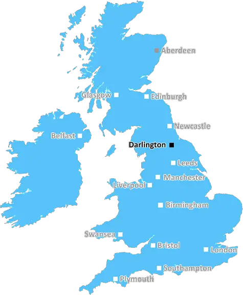
The DL7 postcode is a postcode district for the market town of Darlington in North East England. It covers the southern and eastern parts of the town, stretching from the north of the River Skerne to the south of the A1(M) motorway, from the A66 to the eastern edge of the town.
It was formed in 1993 from the postcode sector DL as part of the Royal Mail's postcode update. It is part of the DL Northallerton postcode area.
The area of the DL7 postcode includes the suburbs of Windlestone, Neasham, Rokeby, Haughton, Morton Park estate, Middlefield Lane estate, and the Coatham Mundeville and Faverdale industrial estates.
The area is mostly residential, with some small businesses and a retail park located close to the A66. It is served by the District Council of Darlington and North East England as well as the Durham County Council.
The primary schools in the DL7 area are Windlestone Primary School, Neasham Primary School, and Haughton Primary School. Neasham Primary Academy and St Joseph's Catholic Primary School also serve the area.
The area is served by public transport with bus routes connecting to the town centre. The DL7 postcode has two railway stations; North Road and Darlington, which provide services to Middlesbrough, Newcastle upon Tyne, Saltburn-by-the-Sea, and other locations.
The area is also home to a number of parks and green spaces such as Whinfield Park, Haughton Dale Park, and Morton Park. There is also St. Andrews Church, which is located on the edge of the Haughton area.

Demographics
North Yorkshire

DL7 is located in the county of North Yorkshire, in England.
North Yorkshire has a total population of 1,145,700, making it the 14th largest county in the UK.
North Yorkshire has a total area of 3341 square miles, and a population density of 132 people per square kilometre. For comparison, Greater London has a density of 5,618 people/km2.
| Outward Code | DL7 |
| Postal Town | Darlington |
| MSOA Name | Hambleton 005 |
| LSOA Name | Hambleton 005B |
| County | North Yorkshire |
| Region | North Yorkshire |
| Country | England |
| Local Authority | Hambleton |
| Area Classification | Mainly Rural (rural including hub towns >=80%) |
DL7 Electoral Wards
The postal region of DL7, includes the local towns, villages, electoral wards and stations of:
Dig even deeper into the DL7 postcode by clicking on a postcode below:
Click on an outward postal code below for more information about the area. Each 'outward' postcode give you a comprehensive list of all postcodes within the outward code area (DL) and estimated address.
Click on an 'outward' code for more information. For example, the outward postcode page 'EC2M' will give you an alphabetical list covering all postcodes located in the region, from 'EC2M 1BB' through to 'EC2M 7YA'.
Chris H
Sunday, April 7, 2024
We don't have any views of DL7 right now. If you live in DL7 or have visited it, please help us to help others by telling others what you think of this neighbourhood.
Add your view of DL7
People need your local expertise. If you live in DL7 or have first-hand knowledge of the neighbourhood, please consider sharing your views. It's completely anonymous - all we ask is for your initials.
Please tell us what you like about the DL7 postcode area, what you don't like, and what it's like to live or work here.
| LOCAL AMENITIES | |
| FAMILY FRIENDLY | |
| PARKING | |
| GREEN SPACES |
Local News North Yorkshire
Scarborough: Suspended sentence for man who threw glass injuring others
Craig Smythe threw a glass at a man who had bitten part of his ear off at a casino in Scarborough.
BBC NewsHS2: Midlands and northern England to get 'reallocated' funds
Labour says the plans are a "reannouncement" of funds from scrapping parts of the high-speed line.
BBC NewsBerwick Kaler: Final curtain for UK's longest-serving panto dame
Berwick Kaler, 78, says he is "bowing out gracefully" after starring in York's pantos since 1977.
BBC NewsYork City 0-1 Eastleigh
Luke Croll scores late on as Eastleigh ease their National League relegation worries by deepening those of nine-man York.
BBC NewsNorth Yorkshire Police: Drivers warned over mobile phone use
Police say it is "disappointing" some drivers continue to put themselves and others at risk.
BBC NewsDiesel stolen from lorries parked near York Racecourse
Police say the thieves struck in a layby on the A64 next to York Racecourse.
BBC NewsWhitby's Duke of York applies to expand with second bar
The Duke of York sits just yards from the famous 199 steps which lead to the abbey.
BBC NewsNorth Yorkshire Police officers attacked while arresting thief
A suspect became aggressive and started kicking two police officers while under arrest.
BBC NewsFrom the Postcode Area blog

Deciphering Crime Rates - a Deep Dive Into UK Postcode Analysis
Ever wondered about the crime rate in your UK postcode? You're not alone. We've dug deep into the data, uncovering trends and patterns that'll make your head spin.

Death of the High Street?
The BBC reports that despite councils' attempts to kurb them, the UK's high streets have seen a huge growth in fast food outlets. Could this mark the death knell for the Great British high street, and what can we do about it to halt its decline?

Discrimination by Postcode
You really couldn't make it up, could you? Some of the country's most vulnerable people are missing out on their weekly £25 Cold Weather Payment, just because the system that's in operation is discriminating against them because payments are based on postcode, rather than geographic location.

The Redesign is Underway
Well, the current website was absolutely in dire need of a good redesign - from the ground up. So I set out to pull it all apart and get it up and running again to become the most comprehensive guide to every postcode in the UK. And it's been a long, tough job from start to finish - and quite possibly the biggest project I've ever undertaken.
SOCIAL GRADES
According to census records, 25% of people here have a social grade of AB (highest), compared to the national average of 27%.