crewe CW9 Postcodes
Spending a fortune on conveyancing?

Compare instant, low-cost online quotes from trusted conveyancing solicitors.
Backed by experts, our no-obligation service searches through the best conveyancing quotes on the market to save you time and money.
Crewe (CW9)
The CW9 postcode area is located in the Crewe postcode town region, within the county of Cheshire, and contains a total of 1549 individual postcodes.
There are 40 electoral wards in the CW9 postcode area, including Congleton, Crewe, Middlewich, Nantwich, Northwich, Sandbach, Tarporley, Winsford which come under the local authority of the Cheshire West and Chester Council.
Combining the whole postcode region, 29% of people in CW9 are classed as having an AB social grade, (i.e. 'white-collar' middle-upper class), compared to 27% across the UK.
This does not mean that the people of CW9 are wealthier - or higher class - than average, but it can be an indication that the area may be prospering and desirable to live in.
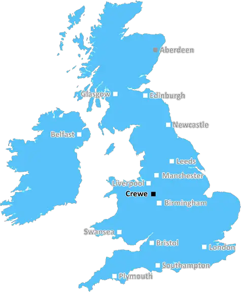
The CW9 postcode is in the Crewe district of Cheshire in North West England, covering a large part of the town. It lies within the Cheshire East local government area and the parliamentary constituency of Crewe and Nantwich and Cheshire Police and Crime Commissioner area.
Part of the postcode includes area of neighbourhood known by the locals as �Under the Moon', which is a large residential area of old mining cottages, a mix of terraced and semi-detached housing, as well as some more modern homes. Its boundaries are the A5189 to the north, the B5077 to the east, the A5020 to the south, and the A5176 to the west.
The education in the area is strong, with a vast variety of primary, secondary and further education providers. This includes a wide range of primary schools such as Oldfields Primary School, Wychwood Primary School and St Mary's Catholic Primary School. Secondary schools include Victoria Community Technology College and Queens Park High School, with the area being well connected by bus to more specialist schools across the county. Further education is provided by South Cheshire College, located close to the town centre.
In terms of leisure and entertainment, there are two main shopping parades on Nantwich Road and Edleston Road, each containing their own range of shops and amenities. Crewe is home to a growing number of pubs, clubs and restaurants, while Leighton Stadium, the Alexandra Stadium, Wychwood Park and the Nantwich Community Centre provide entertainment for both family and sports activities.
The area is also incredibly popular with commuters, being less than 20 minutes by train to Manchester on the West Coast Mainline. The area is also close to the M6, junction 16, giving access to major cities such as Liverpool, Birmingham and the North West.
TheCrewe CW9 postcode is an area that is growing. The fantastic transport links, good schools and attractive environment make it an attractive place to live, work, study, leisure and shop.

Demographics
Cheshire

CW9 is located in the county of Cheshire, in England.
Cheshire has a total population of 1,048,100, making it the 19th largest county in the UK.
Cheshire has a total area of 904 square miles, and a population density of 447 people per square kilometre. For comparison, Greater London has a density of 5,618 people/km2.
| Outward Code | CW9 |
| Postal Town | Crewe |
| MSOA Name | Cheshire West and Chester 018 |
| LSOA Name | Cheshire West and Chester 018B |
| County | Cheshire |
| Region | Cheshire |
| Country | England |
| Local Authority | Cheshire West and Chester |
| Area Classification | Urban with Significant Rural (rural including hub towns 26-49%) |
CW9 Electoral Wards
The postal region of CW9, includes the local towns, villages, electoral wards and stations of:
Dig even deeper into the CW9 postcode by clicking on a postcode below:
Click on an outward postal code below for more information about the area. Each 'outward' postcode give you a comprehensive list of all postcodes within the outward code area (CW) and estimated address.
Click on an 'outward' code for more information. For example, the outward postcode page 'EC2M' will give you an alphabetical list covering all postcodes located in the region, from 'EC2M 1BB' through to 'EC2M 7YA'.
Chris H
Thursday, April 11, 2024
We don't have any views of CW9 right now. If you live in CW9 or have visited it, please help us to help others by telling others what you think of this neighbourhood.
Add your view of CW9
People need your local expertise. If you live in CW9 or have first-hand knowledge of the neighbourhood, please consider sharing your views. It's completely anonymous - all we ask is for your initials.
Please tell us what you like about the CW9 postcode area, what you don't like, and what it's like to live or work here.
| LOCAL AMENITIES | |
| FAMILY FRIENDLY | |
| PARKING | |
| GREEN SPACES |
From the Postcode Area blog

Deciphering Crime Rates - a Deep Dive Into UK Postcode Analysis
Ever wondered about the crime rate in your UK postcode? You're not alone. We've dug deep into the data, uncovering trends and patterns that'll make your head spin.

Death of the High Street?
The BBC reports that despite councils' attempts to kurb them, the UK's high streets have seen a huge growth in fast food outlets. Could this mark the death knell for the Great British high street, and what can we do about it to halt its decline?

Discrimination by Postcode
You really couldn't make it up, could you? Some of the country's most vulnerable people are missing out on their weekly £25 Cold Weather Payment, just because the system that's in operation is discriminating against them because payments are based on postcode, rather than geographic location.

The Redesign is Underway
Well, the current website was absolutely in dire need of a good redesign - from the ground up. So I set out to pull it all apart and get it up and running again to become the most comprehensive guide to every postcode in the UK. And it's been a long, tough job from start to finish - and quite possibly the biggest project I've ever undertaken.
SOCIAL GRADES
According to census records, 29% of people here have a social grade of AB (highest), compared to the national average of 27%.