coventry CV36 Postcodes
Spending a fortune on conveyancing?

Compare instant, low-cost online quotes from trusted conveyancing solicitors.
Backed by experts, our no-obligation service searches through the best conveyancing quotes on the market to save you time and money.
Coventry (CV36)
The CV36 postcode area is located in the Coventry postcode town region, within the county of Warwickshire, and contains a total of 450 individual postcodes.
There are 50 electoral wards in the CV36 postcode area, including Atherstone, Bedworth, Coventry, Kenilworth, Leamington Spa, Nuneaton, Rugby, Shipston-On-Stour, Southam, Stratford-Upon-Avon, Warwick which come under the local authority of the Stratford-on-Avon Council.
Combining the whole postcode region, 31% of people in CV36 are classed as having an AB social grade, (i.e. 'white-collar' middle-upper class), compared to 27% across the UK.
This does not mean that the people of CV36 are wealthier - or higher class - than average, but it can be an indication that the area may be prospering and desirable to live in.
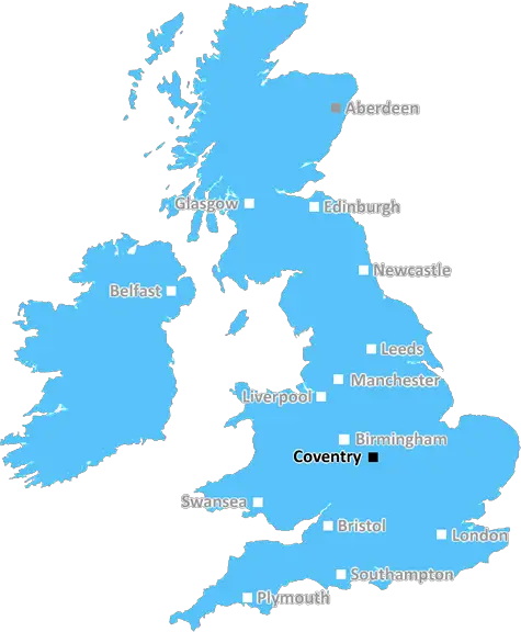
The CV36 postcode is located in the coventry district of the UK. It covers a large area of the city, taking in the northern outskirts of the city to the south-eastern part of Stoneleigh, in Warwickshire. The area contains rural and urban aspects, but the area is mostly comprised of market towns and villages.
Within the CV36 area, there are numerous attractions to visit, including the popular Stoneleigh Abbey Historic House & Gardens, which consists of a 12th Century stone abbot's house and a band of restored gardens. Other leisure facilities include the Warwick Racecourse, Chetwynd Adventure Park and Snitterfield Lake.
In terms of educational establishments, the area is served by both state and independent schools. These include Stoneleigh Infant & Junior Schools, Chetwynd Primary & Nursery School, and Secondary Schools such as Rugby High School & Sports College and Aylesford School & Sports College. Coventry University's Shirley site is just a short distance away.
When it comes to business, the area contains Coventry Cathedral, which is home to a range of interesting shops and places to eat. While it houses the Coventry City FC Football Ground, it also the boasts the Motorcycle Museum, home to the world's oldest motorcycle from 1875.
In terms of essential amenities, a post office, public houses, public transport links and supermarkets are all located within the area. Also, local parks are abundant, including Stoneleigh Park, Grove Common and Black Horse Farm.
For those looking to relocate to the area, it has the advantage of being conveniently located just outside of the local and major cities. Furthermore, the area is known to its strong sense of community, low crime rate and a wide variety of eateries.

Demographics

Warwickshire

CV36 is located in the county of Warwickshire, in England.
Warwickshire has a total population of 556,800, making it the 39th largest county in the UK.
Warwickshire has a total area of 763 square miles, and a population density of 281 people per square kilometre. For comparison, Greater London has a density of 5,618 people/km2.
| Outward Code | CV36 |
| Postal Town | Coventry |
| MSOA Name | Stratford-on-Avon 015 |
| LSOA Name | Stratford-on-Avon 015E |
| County | Warwickshire |
| Region | Warwickshire |
| Country | England |
| Local Authority | Stratford-on-Avon |
| Area Classification | Mainly Rural (rural including hub towns >=80%) |
CV36 Electoral Wards
The postal region of CV36, includes the local towns, villages, electoral wards and stations of:
Dig even deeper into the CV36 postcode by clicking on a postcode below:
Click on an outward postal code below for more information about the area. Each 'outward' postcode give you a comprehensive list of all postcodes within the outward code area (CV) and estimated address.
Click on an 'outward' code for more information. For example, the outward postcode page 'EC2M' will give you an alphabetical list covering all postcodes located in the region, from 'EC2M 1BB' through to 'EC2M 7YA'.
Chris H
Friday, April 12, 2024
We don't have any views of CV36 right now. If you live in CV36 or have visited it, please help us to help others by telling others what you think of this neighbourhood.
Add your view of CV36
People need your local expertise. If you live in CV36 or have first-hand knowledge of the neighbourhood, please consider sharing your views. It's completely anonymous - all we ask is for your initials.
Please tell us what you like about the CV36 postcode area, what you don't like, and what it's like to live or work here.
| LOCAL AMENITIES | |
| FAMILY FRIENDLY | |
| PARKING | |
| GREEN SPACES |
Local News Warwickshire
Radford Road bridge removal
Warwick District Council has received permission from the Environment Agency to proceed with the removal of the existing bridge over the River Leam between Radford Road and Newbold Comyn.
Warwick District CouncilCoventry boost play-off hopes by beating Leeds
Coventry City stay in the mix for a Championship play-off spot with victory over Leeds United, who miss the chance to go top.
BBC NewsNew play area for Bishop's Tachbrook
Just in time for Spring, children and families can now enjoy an exciting new play area at Anchitel Green in Bishop's Tachbrook.
Warwick District CouncilTribute to much-loved grandad killed in M42 crash
Police are appealing for witnesses to the M42 crash in which Tommy Barker died.
BBC NewsLocal groups encouraged to apply for capital grants improvements scheme
Local not-for-profit community organisations are being encouraged to apply for grants of up to 20,000 from Warwick District Council's Rural and Urban Capital Investment Scheme (RUCIS).
Warwick District CouncilRat infestations on the rise in Coventry and Warwickshire
A total of 743 infestations were dealt with every day last year.
BBC NewsFunding awarded for solar panels at Newbold Comyn Leisure Centre
Warwick District Council is pleased to announce that it has received 234,000 from phase two of the Sport England Swimming Pool Support Fund to install solar PV panels at Newbold Comyn Leisure Centre.
Warwick District CouncilCody Fisher killers jailed for life for footballer's murder
Cody Fisher was killed on the dance floor of the Crane club in Birmingham on 26 December 2022.
BBC NewsFrom the Postcode Area blog

Deciphering Crime Rates - a Deep Dive Into UK Postcode Analysis
Ever wondered about the crime rate in your UK postcode? You're not alone. We've dug deep into the data, uncovering trends and patterns that'll make your head spin.

Death of the High Street?
The BBC reports that despite councils' attempts to kurb them, the UK's high streets have seen a huge growth in fast food outlets. Could this mark the death knell for the Great British high street, and what can we do about it to halt its decline?

Discrimination by Postcode
You really couldn't make it up, could you? Some of the country's most vulnerable people are missing out on their weekly £25 Cold Weather Payment, just because the system that's in operation is discriminating against them because payments are based on postcode, rather than geographic location.

The Redesign is Underway
Well, the current website was absolutely in dire need of a good redesign - from the ground up. So I set out to pull it all apart and get it up and running again to become the most comprehensive guide to every postcode in the UK. And it's been a long, tough job from start to finish - and quite possibly the biggest project I've ever undertaken.
SOCIAL GRADES
According to census records, 31% of people here have a social grade of AB (highest), compared to the national average of 27%.