colchester CO11 Postcodes
Spending a fortune on conveyancing?

Compare instant, low-cost online quotes from trusted conveyancing solicitors.
Backed by experts, our no-obligation service searches through the best conveyancing quotes on the market to save you time and money.
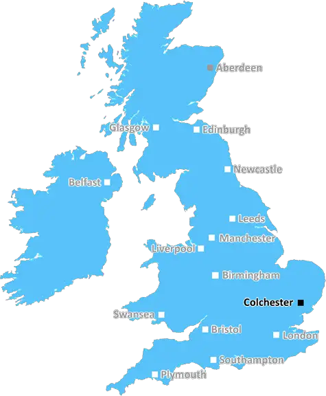
Colchester (CO11)
The CO11 postcode area is located in the Colchester postcode town region, within the county of Essex, and contains a total of 614 individual postcodes.
There are 21 electoral wards in the CO11 postcode area, including Bures, Clacton-On-Sea, Colchester, Frinton-On-Sea, Halstead, Harwich, Manningtree, Sudbury, Walton On The Naze which come under the local authority of the Tendring Council.
Combining the whole postcode region, 26% of people in CO11 are classed as having an AB social grade, (i.e. 'white-collar' middle-upper class), compared to 27% across the UK.
This does not mean that the people of CO11 are poorer than other areas, but it may give an indication that there are areas of deprivation.
CO11 is a postcode in the Colchester district of Essex in United Kingdom. It covers the rural inland areas of the district, including the villages of Ardleigh, Little Bromley, Great Bromley, Great Horkesley, East Mersea, Fox Street, Rowhedge, Langenhoe, Salcott, Wormingford, Virley and parts of Wigborough.
The postcode also covers some parts of the city of Colchester itself, including the towns of Stanway and the recently built Colchester Business Park. The Colchester Institute is also located within this postcode district.
The area is largely a rural, picturesque landscape, with woodlands, rolling hills, meadows and arable land. The area also contains numerous residential developments, adding to the mixture of its environment. The postcode encompasses some of Essex's classic old architecture, as well as stunning locations such as the Fingringhoe Wick and Mersea Island, which are popular with tourists and locals alike.
CO11 is also serviced by the B1029 regional route, linking it to its neighboring districts, with business and leisure facilities across the region. It is served by regional areas, such as Colchester town, Hythe, and brightlingsea and is a popular choice for those from more urbanized areas.
The area also offers good sporting and recreational activities, with abundant natural beauty, including Colchester Zoo, High Woods Country Park, Mersea Country Park, and Dedham Vale.
Several commuter services also travel through the postcode, with commuters being able to access a range of stations within an hour's journey. These destinations are connected to London Liverpool Street and Ipswich as well as East Anglia and Fenchurch street.
Property in the CO11 postcode areas is a popular investment choice for first time buyers, given its varied range of locations as well as its affordability.
Schools in this area are of good quality and kudos for the offer of activities and learning opportunities to the local community. Secondary schools include Colchester Institute, Colchester Royal Grammar School and St. Mary's High school all of which are served by CO11 postcode.
TheCO11 postcode offers various aspects of English heritage and a mix of rural and urban living. Its variety of landscapes, commuter services and recreational activities makes it an ideal setting for locals and tourists alike. This makes it an attractive and investable postcode for those looking for country style living with excellent commutability.

Demographics

Essex

CO11 is located in the county of Essex, in England.
Essex has a total population of 1,802,200, making it the 7th largest county in the UK.
Essex has a total area of 1417 square miles, and a population density of 491 people per square kilometre. For comparison, Greater London has a density of 5,618 people/km2.
| Outward Code | CO11 |
| Postal Town | Colchester |
| MSOA Name | Tendring 003 |
| LSOA Name | Tendring 003F |
| County | Essex |
| Region | Essex |
| Country | England |
| Local Authority | Tendring |
| Area Classification | Largely Rural (rural including hub towns 50-79%) |
CO11 Electoral Wards
The postal region of CO11, includes the local towns, villages, electoral wards and stations of:
Dig even deeper into the CO11 postcode by clicking on a postcode below:
Click on an outward postal code below for more information about the area. Each 'outward' postcode give you a comprehensive list of all postcodes within the outward code area (CO) and estimated address.
Click on an 'outward' code for more information. For example, the outward postcode page 'EC2M' will give you an alphabetical list covering all postcodes located in the region, from 'EC2M 1BB' through to 'EC2M 7YA'.
Chris H
Wednesday, April 17, 2024
We don't have any views of CO11 right now. If you live in CO11 or have visited it, please help us to help others by telling others what you think of this neighbourhood.
Add your view of CO11
People need your local expertise. If you live in CO11 or have first-hand knowledge of the neighbourhood, please consider sharing your views. It's completely anonymous - all we ask is for your initials.
Please tell us what you like about the CO11 postcode area, what you don't like, and what it's like to live or work here.
| LOCAL AMENITIES | |
| FAMILY FRIENDLY | |
| PARKING | |
| GREEN SPACES |
Local News Essex
Essex street with some of most expensive property price tags
The streets with the highest average asking prices this year so far, according to Rightmove, are allin London
The EchoColchester activists target Barclays branch in Clacton
Activists in Essex targeted a bank branch to protest their funding for fossil fuels.
Daily GazetteSavills bolsters Chelmsford office with return of senior development director
Kibblewhite originally joined the agency in 1990 and spent 16 years working there.
Property WeekThirteen Tory election nominations are 'invalid'
Admin errors are blamed for the Tory candidates no longer being eligible for the May election.
BBC NewsNew arts quarter gets planning permission
Planning permission for the project is granted by Harlow Council.
BBC NewsCoggeshall teenager said I've got to deal' before he was stabbed
Andy Wood was killed in February last year when he met with Elijah Clark in Chelmsford to sell him cannabis and cigarettes.
Daily GazetteWestcliff Hotel restaurant re-opened with new head chef
Southend chef, Jessica Sampson, has taken on the role of head chef at the Westcliff Hotel, in Westcliff Parade, and is eager to hit the ground running
The EchoTeenage girl 'hit in the face and had hair pulled' in attack at Tilbury railway station
Police have released an image of a person they wish to speak to
Essex LiveFrom the Postcode Area blog

Deciphering Crime Rates - a Deep Dive Into UK Postcode Analysis
Ever wondered about the crime rate in your UK postcode? You're not alone. We've dug deep into the data, uncovering trends and patterns that'll make your head spin.

Death of the High Street?
The BBC reports that despite councils' attempts to kurb them, the UK's high streets have seen a huge growth in fast food outlets. Could this mark the death knell for the Great British high street, and what can we do about it to halt its decline?

Discrimination by Postcode
You really couldn't make it up, could you? Some of the country's most vulnerable people are missing out on their weekly £25 Cold Weather Payment, just because the system that's in operation is discriminating against them because payments are based on postcode, rather than geographic location.

The Redesign is Underway
Well, the current website was absolutely in dire need of a good redesign - from the ground up. So I set out to pull it all apart and get it up and running again to become the most comprehensive guide to every postcode in the UK. And it's been a long, tough job from start to finish - and quite possibly the biggest project I've ever undertaken.
SOCIAL GRADES
According to census records, 26% of people here have a social grade of AB (highest), compared to the national average of 27%.