bromley BR2 Postcodes
Spending a fortune on conveyancing?

Compare instant, low-cost online quotes from trusted conveyancing solicitors.
Backed by experts, our no-obligation service searches through the best conveyancing quotes on the market to save you time and money.
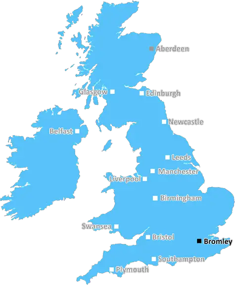
Bromley (BR2)
The BR2 postcode area is located in the Bromley postcode town region, within the county of Greater London, and contains a total of 1395 individual postcodes.
There are 20 electoral wards in the BR2 postcode area, including Beckenham, Bromley, Chislehurst, Keston, Orpington, Swanley, West Wickham which come under the local authority of the Bromley Council.
Combining the whole postcode region, 35% of people in BR2 are classed as having an AB social grade, (i.e. 'white-collar' middle-upper class), compared to 27% across the UK.
This does not mean that the people of BR2 are wealthier - or higher class - than average, but it can be an indication that the area may be prospering and desirable to live in.
The BR2 postcode covers a large area in the Bromley district of South East London, England. It includes the towns and villages of Biggin Hill, Downe, Leaves Green and Knockholt, and borders Orpington, Sevenoaks and Westerham in Kent.
The area is surrounded by woodland, parks and nature reserves, making it an attractive area for outdoor activities and wildlife enthusiasts. It is also home to multiple stately homes, including Biggin Hill Manor House and Leaves Green Manor House, as well as a variety of historic monuments and landmarks.
The BR2 postcode is well-connected, with both Biggin Hill and Downe stations providing direct access to London city centre via Charing Cross, Cannon Street and Victoria. It is also served by a number of bus routes, as well as three motorways within easy reach.
Until the 1930s, the area was largely rural and agricultural, but the arrival of the railway in 1939 led to an increase in housing and population. Since then, it has become increasingly suburbanised, with a number of large residential developments taking place throughout the area in the last decade.
Despite this, the BR2 postcode still retains its rural charm, with plenty of open spaces and scenic views, particularly in the Downe area. The population is close to 30,000, with the majority of residents being white British. There are also a sizable minority of Asian and Black subgroups, and a selection of cafes and restaurants catering to different tastes.
Education-wise, BR2 is home to numerous schools, both state and private, such as Hayes Primary School and Chatterton Primary School. Furthermore, residents of BR2 have access to a good selection of leisure facilities, including swimming pools, sports centres, and community centres. All in all, BR2 postcode has a pleasant, semi-rural atmosphere and excellent transport links, making it highly desirable for both homeowners and renters.

Demographics
Greater London

BR2 is located in the county of Greater London, in England.
Greater London has a total population of 8,778,500, making it the 1st largest county in the UK.
Greater London has a total area of 606 square miles, and a population density of 5594 people per square kilometre. For comparison, Greater London has a density of 5,618 people/km2.
| Outward Code | BR2 |
| Postal Town | Bromley |
| MSOA Name | Bromley 012 |
| LSOA Name | Bromley 012B |
| County | Greater London |
| Region | Greater London |
| Country | England |
| Local Authority | Bromley |
| Area Classification | Urban with Major Conurbation |
BR2 Electoral Wards
The postal region of BR2, includes the local towns, villages, electoral wards and stations of:
Dig even deeper into the BR2 postcode by clicking on a postcode below:
Click on an outward postal code below for more information about the area. Each 'outward' postcode give you a comprehensive list of all postcodes within the outward code area (BR) and estimated address.
Click on an 'outward' code for more information. For example, the outward postcode page 'EC2M' will give you an alphabetical list covering all postcodes located in the region, from 'EC2M 1BB' through to 'EC2M 7YA'.
Chris H
Sunday, April 7, 2024
We don't have any views of BR2 right now. If you live in BR2 or have visited it, please help us to help others by telling others what you think of this neighbourhood.
Add your view of BR2
People need your local expertise. If you live in BR2 or have first-hand knowledge of the neighbourhood, please consider sharing your views. It's completely anonymous - all we ask is for your initials.
Please tell us what you like about the BR2 postcode area, what you don't like, and what it's like to live or work here.
| LOCAL AMENITIES | |
| FAMILY FRIENDLY | |
| PARKING | |
| GREEN SPACES |
Local News Kent
One person injured after car overturns on M2
Delays built on the M2 after a crash near Sittingbourne.
BBC NewsThames Water troubles swell as parent firm defaults
Holding company Kemble has told lenders that it has failed to meet a deadline for interest payments.
BBC NewsHarrogate Town 5-1 Gillingham
Harrogate leave fellow League Two play-off hopefuls Gillingham shell-shocked as a devastating second-half comeback secures a 5-1 home win.
BBC NewsCare home pulls out of Kent asylum-seeker deal
The Sheppey property will no longer open as a temporary home for asylum-seeking children.
BBC NewsSavills bolsters Chelmsford office with return of senior development director
Kibblewhite originally joined the agency in 1990 and spent 16 years working there.
Property WeekCarter Jonas opens first Kent office
The office will be lead by Steven Drennan, a partner in Carter Jonas's infrastructure team.
Property WeekUniversity staff to strike over course closures
Strike action at the University of Kent could come by the end of April, the UCU union said.
BBC NewsOpening date announced for town's first Domino's
The opening date has been announced for a town's first Domino's branch inside a former high street bank.
Kent OnlineFrom the Postcode Area blog

Deciphering Crime Rates - a Deep Dive Into UK Postcode Analysis
Ever wondered about the crime rate in your UK postcode? You're not alone. We've dug deep into the data, uncovering trends and patterns that'll make your head spin.

Death of the High Street?
The BBC reports that despite councils' attempts to kurb them, the UK's high streets have seen a huge growth in fast food outlets. Could this mark the death knell for the Great British high street, and what can we do about it to halt its decline?

Discrimination by Postcode
You really couldn't make it up, could you? Some of the country's most vulnerable people are missing out on their weekly £25 Cold Weather Payment, just because the system that's in operation is discriminating against them because payments are based on postcode, rather than geographic location.

The Redesign is Underway
Well, the current website was absolutely in dire need of a good redesign - from the ground up. So I set out to pull it all apart and get it up and running again to become the most comprehensive guide to every postcode in the UK. And it's been a long, tough job from start to finish - and quite possibly the biggest project I've ever undertaken.
SOCIAL GRADES
According to census records, 35% of people here have a social grade of AB (highest), compared to the national average of 27%.