bath BA14 Postcodes
Spending a fortune on conveyancing?

Compare instant, low-cost online quotes from trusted conveyancing solicitors.
Backed by experts, our no-obligation service searches through the best conveyancing quotes on the market to save you time and money.
Bath (BA14)
The BA14 postcode area is located in the Bath postcode town region, within the county of Wiltshire, and contains a total of 1719 individual postcodes.
There are 63 electoral wards in the BA14 postcode area, including Bath, Bradford-On-Avon, Bruton, Castle Cary, Frome, Glastonbury, Radstock, Shepton Mallet, Street, Templecombe, Trowbridge, Warminster, Wells, Westbury, Wincanton, Yeovil which come under the local authority of the Wiltshire Council.
Combining the whole postcode region, 23% of people in BA14 are classed as having an AB social grade, (i.e. 'white-collar' middle-upper class), compared to 27% across the UK.
This does not mean that the people of BA14 are poorer than other areas, but it may give an indication that there are areas of deprivation.
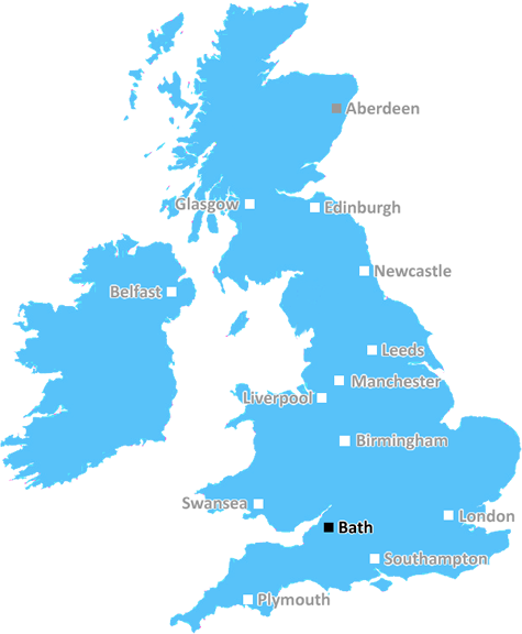
The BA14 postcode covers various towns, villages and districts situated throughout the county of Wiltshire in South West England. The main localities covered by the postcode are the towns of Westbury, Warminster, Trowbridge, Bradford-upon-Avon, Malmesbury and Melksham.
The postcode comprises of four separate sectors made up of the BA1 followed by a single digit. The '4' suffix for the postcode means that the locations which it covers are situated within the surrounding M4, M5 and M3 motorway networks.
While being within the countryside location of Wiltshire, the postcode area offers good access to areas of natural beauty, with numerous parks, open spaces and historic sites. For those seeking activities closer to urban areas, travelling to nearby Bath is made easy due to the access it offers via the M4 motorway.
The postcode is within the local government area of Wiltshire Council, giving it access to all the services and amenities local to the county and its major towns.
The area is served by many buses running from nearby Bath and Bristol as well as the regional service operated by Wilts & Dorset and FirstGroup. The region is also served by a number of railway stations, allowing ease of access to other regions within the UK.
The area within the postcode covers some of the most popular shopping and recreation areas in Wiltshire. Westbury, Warminster and Trowbridge all contain a variety of shops, cafes and pubs as well as other leisure facilities and activities.
The postcode also contains a number of schools such as Leigh Park Primary School, St Martins School, Norton Hill School and Brokerswood Primary School. Shopping centres including Westbury Retail Park, Warminster Retail Park and Shearwater Shopping Centre are also within the postcode.
The region within the postcode is known for its historical sites, such as the Westbury White Horse which has been carved onto the hillside since 1778, as well as Iron Age forts, castles, Neolithic tombs and other artefacts of the past.
BA14 postcode also has many of its own attractions, such as Longleat Centre Parcs, the Longleat Safari Park, the Warminster and Westbury golf clubs, the famous Westbury White Horse, the Stourhead estate, Cheddar Gorge and Glastonbury Tor. This postcode gives tourists, residents and visitors alike easy access to these and the many other places of interest, recreational activities and historic sites.

Demographics
Wiltshire

BA14 is located in the county of Wiltshire, in England.
Wiltshire has a total population of 706,300, making it the 34th largest county in the UK.
Wiltshire has a total area of 1346 square miles, and a population density of 202 people per square kilometre. For comparison, Greater London has a density of 5,618 people/km2.
| Outward Code | BA14 |
| Postal Town | Bath |
| MSOA Name | Wiltshire 036 |
| LSOA Name | Wiltshire 036B |
| County | Wiltshire |
| Region | Wiltshire |
| Country | England |
| Local Authority | Wiltshire |
| Area Classification | Largely Rural (rural including hub towns 50-79%) |
BA14 Electoral Wards
The postal region of BA14, includes the local towns, villages, electoral wards and stations of:
Dig even deeper into the BA14 postcode by clicking on a postcode below:
Click on an outward postal code below for more information about the area. Each 'outward' postcode give you a comprehensive list of all postcodes within the outward code area (BA) and estimated address.
Click on an 'outward' code for more information. For example, the outward postcode page 'EC2M' will give you an alphabetical list covering all postcodes located in the region, from 'EC2M 1BB' through to 'EC2M 7YA'.
NF, bath
Wednesday, November 7, 2018
Love it. Been here 20 years and loved every minute. No shop but it's not too far in any direction to buy some essentials although a car is maybe required. Brilliant thriving village school. The local pub is a great place to visit though.
Add your view of BA14
People need your local expertise. If you live in BA14 or have first-hand knowledge of the neighbourhood, please consider sharing your views. It's completely anonymous - all we ask is for your initials.
Please tell us what you like about the BA14 postcode area, what you don't like, and what it's like to live or work here.
| LOCAL AMENITIES | |
| FAMILY FRIENDLY | |
| PARKING | |
| GREEN SPACES |
Local News Wiltshire
Man charged with rape in town centre
Prinse Kessie was remanded in custody until 3 May when he will appear at Swindon Crown Court.
BBC NewsHistoric door returns to high street
A historic door in Marlborough is restored to its former glory after nearly 100 years.
BBC NewsDriver disqualified after erratic motorway driving
Ion Tintiuc was arrested by police at his home in Swindon after being reported by a member of the public for "swerving all over the road".
BBC NewsCouncil chief executive announces departure
Terence Herbert has accepted a new post with Surrey Council after 13 years at Wiltshire Council.
BBC NewsCounty awarded 375k for walking and cycling schemes
The local authority say the plans will help to improve air quality and decarbonisation in the county.
BBC NewsSutton United 3-1 Swindon Town
Sutton make it four wins in a row by beating Swindon as they move out of the League Two relegation places.
BBC NewsOrganised crime ring jailed for Spice factory
Five individuals were sentenced for producing and supplying a synthetic drug.
BBC NewsSwindon Town 2-1 Notts County
Swindon break a four-match winless streak as they beat Notts County thanks to two pieces of comedic defending.
BBC NewsFrom the Postcode Area blog

Deciphering Crime Rates - a Deep Dive Into UK Postcode Analysis
Ever wondered about the crime rate in your UK postcode? You're not alone. We've dug deep into the data, uncovering trends and patterns that'll make your head spin.

Death of the High Street?
The BBC reports that despite councils' attempts to kurb them, the UK's high streets have seen a huge growth in fast food outlets. Could this mark the death knell for the Great British high street, and what can we do about it to halt its decline?

Discrimination by Postcode
You really couldn't make it up, could you? Some of the country's most vulnerable people are missing out on their weekly £25 Cold Weather Payment, just because the system that's in operation is discriminating against them because payments are based on postcode, rather than geographic location.

The Redesign is Underway
Well, the current website was absolutely in dire need of a good redesign - from the ground up. So I set out to pull it all apart and get it up and running again to become the most comprehensive guide to every postcode in the UK. And it's been a long, tough job from start to finish - and quite possibly the biggest project I've ever undertaken.
SOCIAL GRADES
According to census records, 23% of people here have a social grade of AB (highest), compared to the national average of 27%.