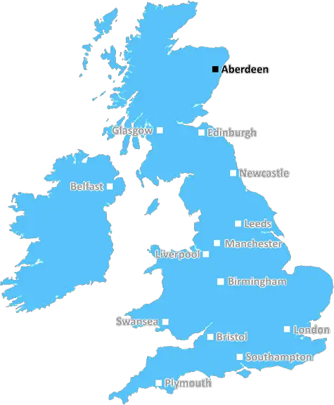
aberdeen AB21 Postcodes
Spending a fortune on conveyancing?

Compare instant, low-cost online quotes from trusted conveyancing solicitors.
Backed by experts, our no-obligation service searches through the best conveyancing quotes on the market to save you time and money.
Aberdeen (AB21)
The AB21 postcode area is located in the Aberdeen postcode town region, within the county of Aberdeenshire, and contains a total of 871 individual postcodes.
There are 22 electoral wards in the AB21 postcode area, including Aberdeen, Aberlour, Aboyne, Alford, Ballater, Ballindalloch, Banchory, Banff, Buckie, Ellon, Fraserburgh, Huntly, Insch, Inverurie, Keith, Laurencekirk, Macduff, Milltimber, Peterculter, Peterhead, Stonehaven, Strathdon, Turriff, Westhill which come under the local authority of the Aberdeenshire Council.
Combining the whole postcode region, 0% of people in AB21 are classed as having an AB social grade, (i.e. 'white-collar' middle-upper class), compared to 27% across the UK.
This does not mean that the people of AB21 are poorer than other areas, but it may give an indication that there are areas of deprivation.
AB21 is a postcode district in the north of Scotland, located in the Aberdeen city council area. It covers a large area of 74 square kilometres and includes a number of small towns and villages. It is the second most populated area in Aberdeen, with over 30,000 people living within its boundaries.
The AB21 postcode district is situated in the northeast of the Aberdeen city council area, bordering the towns of Portlethen, Westhill, Dyce and Bridge of Don. It has a diverse population with a mix of ages, cultures and religions. The area includes areas of natural beauty and is popular with those who appreciate Scotland's rugged outdoors.
The towns and villages within the AB21 postcode area are thriving and offer a range of amenities and services. The area includes a number of reputable schools such as Portlethen Academy and Hazlehead Primary School. There is also an abundance of shopping, entertainment and leisure services available for the local population.
AB21 residents can enjoy easy access to the rest of Aberdeen via public transport services which connect the area to the city centre, airport and other parts of Scotland. Those living in this postcode area also have easy access to the city's parks, urban forests and organised recreational activities.
The AB21 postcode area is a popular destination for tourists and those looking to explore Scotland. Its proximity to the city centre means visitors can easily access attractions such as Aberdeen Art Gallery, His Majesty's Theatre, and The Malt Whisky Trail. Tourists can also enjoy outdoor activities such as fishing, golf, and cycling.
The AB21 postcode district is an attractive area with a lot to offer. It has a vibrant local community, a range of amenities, and easy access to Aberdeen and other parts of Scotland. Those who choose to live here become part of a welcoming and diverse population, with something for everyone to enjoy.

Demographics

Aberdeenshire

AB21 is located in the county of Aberdeenshire, in Scotland.
Aberdeenshire has a total population of 0, making it the largest county in the UK.
Aberdeenshire has a total area of square miles, and a population density of people per square kilometre. For comparison, Greater London has a density of 5,618 people/km2.
| Outward Code | AB21 |
| Postal Town | Aberdeen |
| MSOA Name | Newmachar and Fintray |
| LSOA Name | |
| County | Aberdeenshire |
| Region | Aberdeenshire |
| Country | Scotland |
| Local Authority | Aberdeenshire |
| Area Classification | Unclassified |
AB21 Electoral Wards
The postal region of AB21, includes the local towns, villages, electoral wards and stations of:
Dig even deeper into the AB21 postcode by clicking on a postcode below:
Click on an outward postal code below for more information about the area. Each 'outward' postcode give you a comprehensive list of all postcodes within the outward code area (AB) and estimated address.
Click on an 'outward' code for more information. For example, the outward postcode page 'EC2M' will give you an alphabetical list covering all postcodes located in the region, from 'EC2M 1BB' through to 'EC2M 7YA'.
Chris H
Sunday, April 7, 2024
We don't have any views of AB21 right now. If you live in AB21 or have visited it, please help us to help others by telling others what you think of this neighbourhood.
Add your view of AB21
People need your local expertise. If you live in AB21 or have first-hand knowledge of the neighbourhood, please consider sharing your views. It's completely anonymous - all we ask is for your initials.
Please tell us what you like about the AB21 postcode area, what you don't like, and what it's like to live or work here.
| LOCAL AMENITIES | |
| FAMILY FRIENDLY | |
| PARKING | |
| GREEN SPACES |
From the Postcode Area blog

Deciphering Crime Rates - a Deep Dive Into UK Postcode Analysis
Ever wondered about the crime rate in your UK postcode? You're not alone. We've dug deep into the data, uncovering trends and patterns that'll make your head spin.

Death of the High Street?
The BBC reports that despite councils' attempts to kurb them, the UK's high streets have seen a huge growth in fast food outlets. Could this mark the death knell for the Great British high street, and what can we do about it to halt its decline?

Discrimination by Postcode
You really couldn't make it up, could you? Some of the country's most vulnerable people are missing out on their weekly £25 Cold Weather Payment, just because the system that's in operation is discriminating against them because payments are based on postcode, rather than geographic location.

The Redesign is Underway
Well, the current website was absolutely in dire need of a good redesign - from the ground up. So I set out to pull it all apart and get it up and running again to become the most comprehensive guide to every postcode in the UK. And it's been a long, tough job from start to finish - and quite possibly the biggest project I've ever undertaken.
SOCIAL GRADES
According to census records, 0% of people here have a social grade of AB (highest), compared to the national average of 27%.